Page 12
Searches the whole library — filter by sim & category on the results page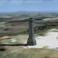
Hardy Monument scenery add-on places the octagonal 22 m stone tower on Black Down, Dorset (50°41′12″N 2°32′57″W), providing a coastal waypoint for GA traffic between Bournemouth, Yeovil and former …
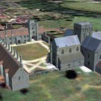
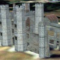
FSX scenery mod brings Winchester’s 12th-century Hospital of St Cross to life beside the Itchen; geo-referenced to Ordnance Survey data and calibrated for Horizon Generation X Volume 1 photoreal te…
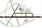
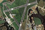
For EGNC, this FSX scenery addon redraws Carlisle Airport, Cumbria, with a stretched 7,500-ft 07/25 runway, dual-end ILS (108.30 MHz), part-length parallel taxiway, six-stand jet apron, upgraded fi…
Clipgate Farm near Canterbury and nearby Pent Farm broaden FSX’s UK GA portfolio with two grass strips modelled at 1-metre terrain resolution, integrated with Just Flight/Horizon VFR photoreal tile…
Historic Titchfield Abbey ruins sit south-west of Fareham in this FSX scenery add-on, built in GMAX with progressive LODs, lean texture mapping and exact coordinates that line up with Horizon Gener…

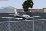
Gate signage is added to the stock EGNH Blackpool Airport, giving FSX pilots clear taxiway pointers and labelled parking stubs for smoother ground handling and stand allocation. The lightweight sce…
Centred on the Isles of Scilly, this EGHT scenery add-on for FSX/P3D places Tresco Heliport and its adjoining private airstrip with corrected helipad geometry, a static AW139, compact passenger lou…
Covering Penzance Heliport (EGHK) in Cornwall, FSX Penzance Scenery V2 refreshes Microsoft Flight Simulator X with refined ground polys, updated AFCAD, bespoke terminal assets and helipad objects, …
Low-level circuits above East Sussex benefit from this Deanland Airfield (EGNY) scenery for FSX, tuned for Horizon GenX Vol.1 photoreal terrain. Animated ground objects, bespoke autogen woodland an…
FSX pilots exploring Welsh airspace may add this freeware EGFE Haverfordwest Airfield scenery, which integrates Horizon GenX orthoimagery and mesh with updated AFD data, CVX flattens, custom hangar…
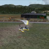
East-Lochlane Farm for FSX positions a short grass runway amid Strathearn farmland just south of Crieff, giving Scottish Highlands VFR pilots a detailed rural GA strip drawn from Bryan Lockyear’s f…
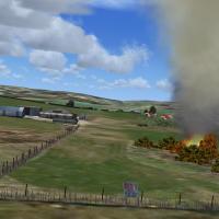
Oxenhope for Neil’s Microlights is a UK airfield scenery add-on for FSX that refreshes the West Yorkshire strip with geo-referenced photoreal ground, bespoke autogen, accurate terrain mesh and the …
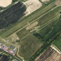
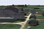
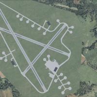
EGNC Carlisle Airport for Microsoft Flight Simulator X places a photoreal rendition of the former RAF Crosby-on-Eden amid Horizon GenX terrain, aligning runways, taxiways and elevation CVX data to …
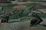
RAF Davidstow Moor (XEGD) brings this Cornish A-Class wartime airfield to FSX with photo-real alignment for Horizon GenX terrain, three long concrete strips, custom AFD, precise drainage grading an…
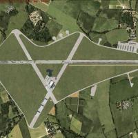
Rebuilt for FSX, this RAF Lasham scenery inserts the 1943 fighter aerodrome into Hampshire with geo-referenced runway alignment, period hangars from Ted Andrews’ library, accurate dispersals and pa…
Built for Microsoft Flight Simulator X, this UK add-on by Tim Dale refines Turweston Aerodrome EGBT with custom Gmax structures, updated AFD, realistic runway 09/27 markings, café-flight-school sta…
Grassthorpe Grange inserts a compact UK general-aviation grass strip into Microsoft Flight Simulator X, adding precise runway coordinates, photoreal ground polys and custom farm outbuildings north-…
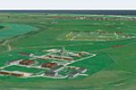
Fictional AAEE Foulness for Microsoft Flight Simulator X positions a post-WWI A&AEE / RAF research airfield on Foulness Island, Essex, UK, offering VFR and stock-mesh variants with runway, hangars,…
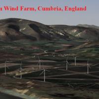
Millom Wind Farm introduces accurately geo-referenced 3-D turbines just north of Barrow Airfield, Cumbria, for Microsoft Flight Simulator X, meshing with Neil Birch’s four-part UK Microlight scener…
London Redhill (EGKR) for Microsoft Flight Simulator X depicts a hypothetical Gatwick satellite, featuring a 6,495-ft asphalt runway, dual parallel taxiways, 26 remote stands and a separate 2,000-f…