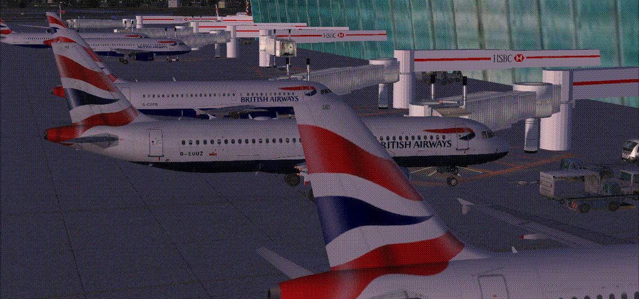
Page 5
Searches the whole library — filter by sim & category on the results page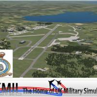
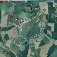
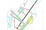
RAF Kinloss for Microsoft Flight Simulator X recreates the Scottish Moray Firth station with updated runways, accurate taxiway layout, custom hangars and ground clutter, giving a noticeable uplift …
RAF Coltishall (EGYC) for FSX + Acceleration recreates the retired Norfolk fighter base with VFR-aligned ground polys, bespoke hangars, dispersal loops, accommodation blocks and static SEPECAT Jagu…
EGAC Belfast George Best City Airport scenery refines the compact city-side aerodrome with additional overspill apron, re-profiled GA stands, corrected terminal and fire-station parking, plus updat…
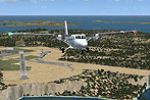
Covering EGHE St Mary’s on the Isles of Scilly, this FSX freeware rebuild adds custom GMAX terminal geometry, animated apron personnel, static GA and BN-2 Islanders, a north-side Skybus operations …
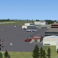
Bristol EGGD for FSX refreshes the default layout with updated passenger terminals, a new freight apron, overflow stands and boosted vehicle traffic; revised AFCAD includes corrected taxiway links,…
Alf Denham’s FSX scenery add-on, UK Airfields Volume 7, re-crafts EGFA Aberporth, EGPR Barra’s tidal beach strip and EGHU Eaglescott with recalibrated runway profiles, updated taxiway links and def…
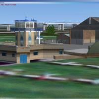
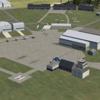
Historic Barton City Airport (EGCB) scenery refreshes Manchester’s grass-strip field with accurately sited 1930s hangars, Europe’s oldest brick control tower, detailed club apron and heli pads, mat…
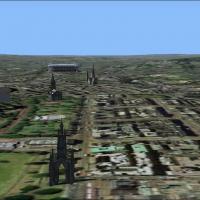
Covering Edinburgh from the Pentland Hills through Musselburgh to EGPH and the Firth of Forth coastline, this FSX photoreal scenery layers high-definition orthoimagery on the default terrain, integ…
Regional flyers looking for fresh UK hops will welcome this FSX add-on: twelve fictional yet location-aware airfields—eight in England, three in Northern Ireland—each reworked with added gates, apr…
Covering England’s south-coast gateway, this FSX Bournemouth International Airport (EGHH) upgrade supplies new terminals, bespoke hangars and AFCAD layout corrections, plus expanded GA and FRA corp…
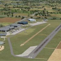
Covering Duxford (EGSU), Earls Colne (EGSR) and Haverfordwest (EGFE), Alf Denham’s fifth UK set reworks default FSX aerodrome data with revised AFCADs and library objects, adding accurate taxiways,…

Updated Glasgow Airport EGPF scenery rebuilds Scotland’s hub with expanded heavy-jet ramp sizes, supplementary taxiways, fresh runway turn-offs and airline-coded jetway stands, easing AI traffic fl…
Covering Belfast Aldergrove (EGAA) for FSX, this scenery add-on refreshes the airport’s gate layout, parking stands and taxiway network while introducing a purpose-built fire station, a correctly p…
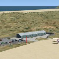
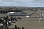
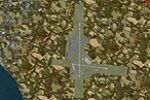
Covering Carlisle Lake District Airport (EGNC) in Cumbria, this Microsoft Flight Simulator X scenery rebuilds the former RAF Crosby-on-Eden with a 2-light PAPI on RWY 07, extra general-aviation sta…
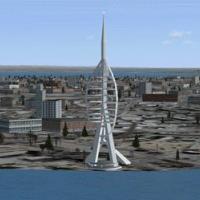
FSX pilots covering United Kingdom legs can insert the Spinnaker Tower landmark in Portsmouth Harbour—170 m (560 ft) of concrete and steel at Gunwharf Quays—featuring reflective glazing, custom nig…
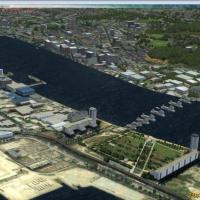
Adding a geo-correct static model of London’s iconic Thames Barrier, this FSX and Prepar3D add-on slots cleanly into ORBX EU England, supplying a precise reference point for VFR river runs, SID dep…
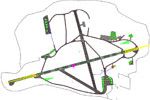
Covering 307 charted sites across England, Wales, Scotland and Northern Ireland, this Microsoft Flight Simulator X scenery add-on positions the CAA-listed En-Route Air Navigation Obstacles—radio ma…
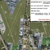
Volume 22 refreshes Rochester Airport (EGTO) for FSX SP2 with hand-built terminal architecture, custom ground polys, optional static GA and taildragger packs, plus a separate photoreal layer coveri…
Focused on EGBB—Birmingham International Airport—this FSX scenery add-on update recalibrates DME offsets on both ILS tracks, adds touchdown-zone lighting to runways 15/33, and integrates with prior…
Alf’s UK Airfields Volume 6 refreshes EGHJ Bembridge, EGTU Dunkeswell and EGBK Sywell for Microsoft Flight Simulator X, supplying freeware VFR scenery that repositions runways, refines taxiways, ad…