Page 3
Searches the whole library — filter by sim & category on the results page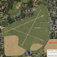
Alf Denham’s free “UK Airfields Volume 20” for FSX SP2 refreshes Priory Farm (X3PF), Walney Island-Barrow (EGNL) and White Waltham (EGLM) with custom 3-D assets, corrected taxiway geometry, landcla…
Detailing EGNH Blackpool Squiresgate on the Lancashire coast, this FSX scenery package integrates with Horizon GenX photo-mesh, delivering terrain flattens, precise three-runway data, apron floodli…
This freeware scenery pack, Alf’s UK Airfields Vol 15, refreshes Eggesford X2EG, Eshott EG18 and Swansea EGFH for Microsoft Flight Simulator X SP2, inserting accurate runway geometry, revised landc…

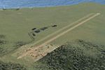
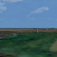
EGHE St Marys Airport scenery for the Isles of Scilly refreshes the default airfield with refined runway geometry, custom ground polys, animated ground crew, static GA aircraft, coastal marine life…

Royal Navy package places County-class guided-missile destroyers and three Leander-class frigates around UK coastal routes in FSX, this warship add-on supplying static and AI variants, wake-optiona…
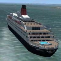
Offering a static Southampton berth and an AI passage along the Solent toward Naples, this FSX scenery drops RMS Queen Elizabeth 2 into Generation X VFR terrain, matching piers and shipping lanes; …

FSX-oriented revision updates John Young’s 1993 RAF Marham scenery, reinstating the omitted North Sea waypoint (AF2_EGZ5.bgl) vital for hose-and-drogue AI Victor tanker patterns, synchronising navi…
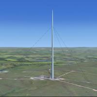
Winter Hill TV mast adds a prominent 309-metre landmark to FSX’s Lancashire skyline, providing an accurate visual reference for VFR legs between Manchester Barton, Blackpool and Liverpool John Lenn…
Telecommunications and utility structures for Flight Simulator X refresh the West Yorkshire–Lancashire airspace: BT Tower southeast of EGNM, Menwith Hill radomes, Ilkley Moor and Cop Hill transmitt…
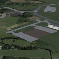
Purpose-built for Microsoft Flight Simulator X, this FSX scenery of RAF Shawbury airbase (EGOS), Shropshire, United Kingdom, refreshes the helicopter station with dense helipad geometry, custom han…
Set in East Sussex, this Microsoft Flight Simulator X add-on recreates RAF Friston’s World War Two grass strips and the adjacent Newhaven harbour floatplane runway, inserting a historically aligned…
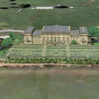
Harewood House scenery adds a Georgian stately home north of Leeds to FSX, aligned with Horizon VFR Generation X Volume 3 photoreal imagery at 2.4 m resolution and 5 m terrain mesh, blending with s…
West Sussex’s shoreline gains two little-known strips in ‘A Day at the Seaside’ for FSX and Horizon VFR Generation X: EGKC Bognor Regis provides an asphalt runway for GA twins, while the grass Brac…
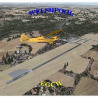
Welshpool Airfield (EGCW) scenery for FSX slots a precisely geo-referenced Mid Wales Airport into Microsoft Flight Simulator X, delivering aligned runway 04/22, Google-Earth-derived taxiways, bespo…
Covering RAF Alconbury in Cambridgeshire, this FSX scenery add-on refreshes the decommissioned USAF air base with custom-modeled hangars, accurate runway/apron markings, photoreal ground polys, rea…
Hatfield EGTH returns to the FSX map as a plausible modern regional hub, featuring a 7,200-ft ILS-equipped 06/24, a separate 3,000-ft GA strip, re-profiled taxiways, ten jet nose-in gates, service …
Virtual Plymouth Airport (EGHD) refresh for Microsoft Flight Simulator X adds a 5,000-ft 13/31 strip with 500-ft displacements, dual-end ILS, a decommissioned 06/24 now serving as primary taxiway, …
Refreshed FSX rendition of Aberdeen Dyce EGPD aligns with current charts: 1 949 m main runway extension, revised touchdown zones, updated heli-runway numerals, plus northern link taxiway and photo-…
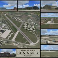
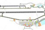
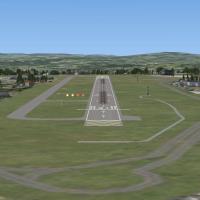
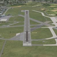
Covering the mid-2010 configuration of RAF Coningsby (EGXC) in Lincolnshire, this Microsoft Flight Simulator X scenery package reproduces every hangar, hardened aircraft shelter and support block w…
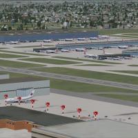
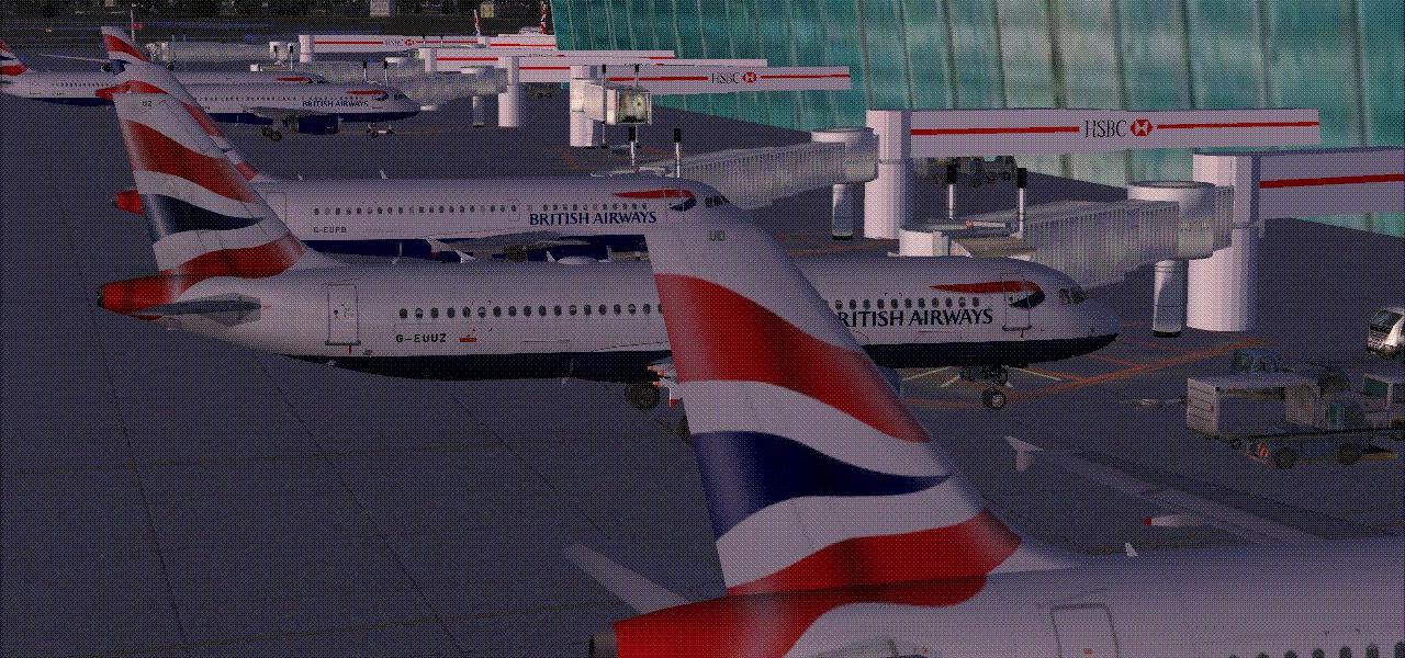
Updated AFCAD for London Heathrow EGLL, tuned for FSX default scenery: Pier 6 integrated, Terminal 2 removed with a rebuilt T1, revised taxiway geometry, signage and parking codes, added A380-capab…