Page 2
Searches the whole library — filter by sim & category on the results page
You can select up to 44 ground and water crash effects, organized by type such as blast objects, craters, dirt/dust, fires, concussion flashes, shockwaves, and smoke. A Min/Max emitter density cont…

A revision delivers 39 weather themes for FS2004, building on two earlier versions and adding 11 winter themes plus 3 miscellaneous variants, with suitability for both VFR and IFR simming. Each the…
Version 1.2 enables slew placement of an aircraft to any coordinate and instant insertion of a 3D asset, a capability credited to Israel Roth and Seev Kahn. It includes 39 libraries with over 1,000…
By Alessandro G. Antonini, the planner presents a moving map drawn with vector layers or bitmapped imagery, offering zoom, pan, rotation. It supports DP-STAR and Airways, imports from Radar Contact…
Courseplanner operates as a stand-alone flight planner, handling over 30,000 SIDs/STARs and more than 60,000 points while you use your own airports and planes from your hangar. It monitors AI traff…
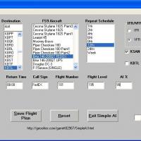
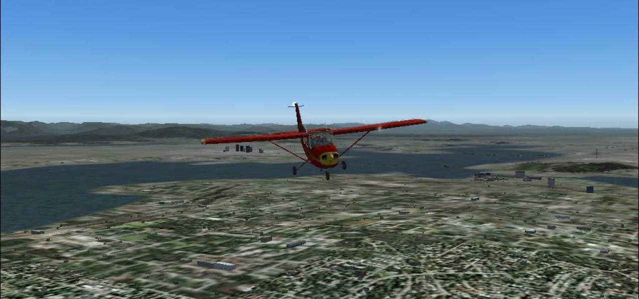
This simple utility generates departure and return flights from default airports and uses any installed aircraft that are configured correctly. It supports generating both outbound and return legs …
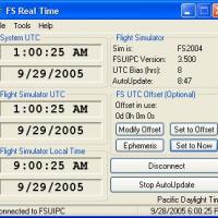
Developed by Joshua Robertson, a UTC time-sync utility keeps time in step with real-world standards, matching the current UTC or applying a +/- offset for varied flight timing. It also incorporates…
 Base Model
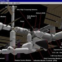
Two flyable aircraft accompany this offering: the Space Shuttle Discovery, enhanced with three loadouts (clean, SRB's, External Tank), a virtual cockpit, and a realistic panel, and a flyable Intern…
By including three-dimensional contrail visuals, this add-on enhances high altitude flight realism, replacing flat trails with depth. It ships backup files containing the original fx_contrail_l.fx,…
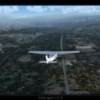
TreeGen reduces tree size by forty percent and increases their numbers, producing a denser canopy while the overall file footprint becomes half of the original. All seasons are included, and there …
An add-on manager assigns cockpit panels and sounds to aircraft and installs from distribution ZIP files, with a ZIP Browser to preview contents. It offers an Option Installer to add variants and a…
 Base Model
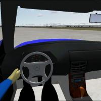
By Jessy Corrales, a late-90s Mercedes-Benz SL600 concept presents a detailed model featuring full DVC data with reflective rims, surfaces, and mirrors. It includes three rim variations and compreh…
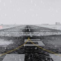
In snowy areas worldwide, the file replaces default winter asphalt and concrete runways with an icy mix to create more realistic surfaces. Runway numbers remain visible, while the rest of the pavem…
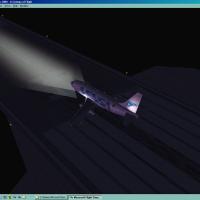
Replacement for the default landing lights relies on about 20 photographs to achieve realism and shows on almost all aircraft sizes. It uses a single bitmap to depict lights across different models…
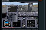
A pictorial guide for beginners presents an FMC tutorial with over 80 color shots, illustrating how to program the Flight Management Computer using the 800 series variant of a 737 family aircraft, …
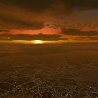
Alternative sunset visuals offer a distinct lighting option for a 2004-era flight simulation environment, enhancing ambient tone. The sunset.gif image has a height of 112 pixels and a width of 150 …

Created by David Dossiere and Mylene Felix, this collection assembles over 800 airline call signs and notes that some ATC callsigns may not work because Microsoft did not include them. It advises u…
By Julien Robert, a grass-improvement option replaces default ground materials with 512x512 image data encoded in DXT3, balancing fidelity and memory use. Alpha blending at edges smooths transition…
An array comprising 110 bitmaps smooths the transition between sky and ground, producing the varied skyscape across scenes. John Cillis receives author credit publicly, and the work may not work wi…
Visitors gain the ability to generate additional weather themes and choose them from the program’s weather menu. The work presents a straightforward, creator-credited tool designed to expand atmosp…