Page 80
Searches the whole library — filter by sim & category on the results page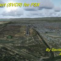
Coro Airport (SVCR) in Venezuela sits in the city of Coro, the capital of Falcon state in western Venezuela. It uses photo-terrain visuals sourced from satellite imagery and shows terminal building…
 Venezuela (Bolivarian Republic of)
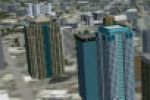
City of Birmingham, AL appears in version 1.0, with the named folder TalonSim Birmingham 1.0. By Dexter Pierre Gray, the work depicts key architectural structures from the Magic City skyline, with …
 United States of America
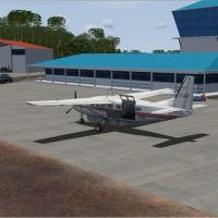
Version 1.0 covers the airport located 6nm east of Georgetown, Guyana. Historical data from 2003 show the facility handling about 50,000 passengers and 1,800 tons of cargo annually, and the new run…
 Guyana
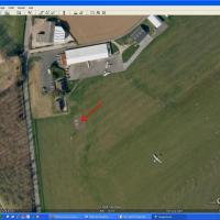
An airfield in Normandy near Le Havre harbor (LFOY) hosts gliding and piston-engine training, reflecting its 1944 American army origins. A simili Pont de Normandie spans the Seine estuary south of …
 France
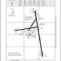
Prince George CYXS in Canada undergoes reconstruction using ADE v1.40 and current airport charts, with runway 15/33 extended from 7,400 to 11,450 feet and ILS added to runway 33. Airport_Buildings_…
 Canada
Japan-based creator Kenichi Ochiai centers a focus on the Ise Shima area, presenting a real-world depiction intended for aerial viewing. The piece is explicitly associated with Japan and credits Oc…
 Japan
Japan
Orland sits beside Brekstad as a Norwegian air base, home to squadron 338 and NATO AWACS, with ENOL as the designation, by Alexandre Mugny. F-16 MLU operates there, and NIGHTWAY campaigns deploy 8–…
 Norway
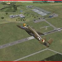
An airfield in the Vendée region of western France carries the code LFRI and supports GA, gliding, ULM, parachuting, aerobatics and model flying. Two folders exist, including LFIR xclud, and it is …
France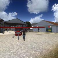
By Jean-Philippe Pierard and Emmanuel Pierard, Buzet airfield sits near Nivelles in Belgium and serves ultralight operations. Photoreal visuals adorn hangars and buildings, with road traffic presen…
 Belgium
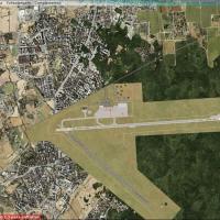
Cristobal Laje recreates a Cordoba, Argentina airfield identified by SACO, showcasing a compact field with surrounding infrastructure. The ASR9 radar is attached, and the rest relies on default obj…
 Argentina
Stefan Liebe crafts a Bremen Airport enhancement near the Weser River, reflecting January 2013 taxiway changes and designators at EDDW. Jetways now appear at terminal gates and runway-apron marking…
 Germany
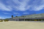
NL2000 V4 EHBK Maastricht Aachen Airport is the v4.01 variant within the NL2000 v4 lineup. It requires the NL2000 v4.0.20 installer and expands modular, free geographic coverage across the Netherla…
 Netherlands
Version 1.0 upgrade expands Italy with two airfields, LIPM Modena Marzaglia and LIDR Ravenna, each hosting a hangar and a clubhouse. A grass area forms near the LIDR tower, by Francesco Cerra, impr…
 Italy
Italy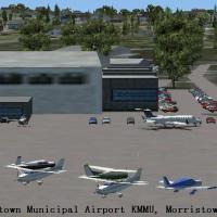
The Town of Morristown owns the airport, located roughly 3 miles from Morristown, NJ, at an elevation of 187 feet, with a paved longest runway of 5,999 feet. Sidney Schwartz archives a single file …
United States of America
By Dominique M. L. Donzelot, La Baule-Escoublac LFRE situates an attached airfield on the Atlantic coast of western France beside a 12 km beach and busy light-aircraft activity. Two folders, LFRE E…
France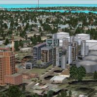
Ryan Brown offers a Galveston, Texas layout featuring an oil company HQ, a hospital, a wreck site with flipped tankers and cars, and five offshore rigs. The entry includes a .BGL file with coordina…
United States of America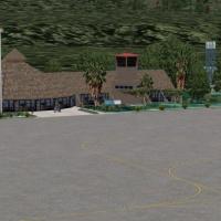
By Frits Beyer and Jacques Botha, a photoreal add-on near Sun City in South Africa showcases custom-built visuals and a named variant folder called Pilanesberg Airport(FAPN), alongside the AFX_FAPN…
 South Africa
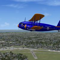
Two .bgl files depict Roosevelt Field and Curtiss Field on Long Island, capturing the eastern and western halves once separated by a bluff near Old Country Road. Nearby New York history informs the…
United States of America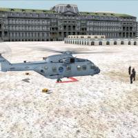
Washington, DC hosts a heliport layout identified by ICAO code KWH, situating a dedicated pad within the capital area. Version 1.0 marks the release, reflecting an approach that aligns with common …
United States of America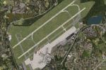
By Thomas Ruth, this complete rework of the default airport adds custom buildings and new animated jetways. ADE files reside in the root of the D drive, and source materials are provided for furthe…
Germany