Page 8
Searches the whole library — filter by sim & category on the results page
Four-page tutorial outlines steps to optimize and accelerate any PC, drawing on free software and revised operating system settings. It adds guidance on preventing the blue screen of death and carr…
Bruce.Fitzgerald updates an older Peleliu to Koror bombing run, reworking the sequence to affect flour bombs differently. The change makes flour bombs explode in all such uses and leaves a crater w…
By Thomas Murr, the guide shows how to swap the tow plane in the simulator so any desired aircraft can haul a glider aloft, with a Falke tow plane pictured. A hotkey sequence—hold CTRL and SHIFT an…
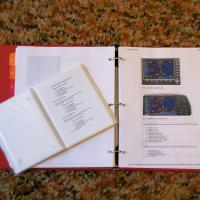
By Noel Sivertson, the checklist provides a quick reference for the default GPS 500 and comes in PDF format, making printing and carrying easy. A companion image shows the sheets printed and bound …
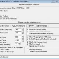
Arrestor cables accompany a version labeled 2.6 for ArrCab, and a bottleneck from FSUIPC Simconnect disrupts ArrCab's behavior, a scenario described as daunting at first. Nevertheless, ArrCab remai…
Tom Knudsen offers a lighting tweak that alters how runway and taxiway illumination appears. The approach centers on the spotlight.bmp file, and users back up the existing version before replacing …
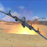
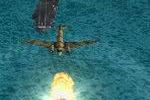
Original model by V. Zhyhulskiy, enhanced by Greg Schneider, delivers nuclear bomb effects. A screenshot illustrates a nuclear bomb drop, and the array centers on large visual effects that appear i…
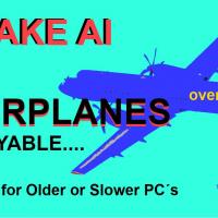
AI aircraft remain unavailable as regular flyable airplanes, and some pilots face FPS problems on slower or older PCs, making the setup feel heavy. The guide shows how to render AI planes flyable i…
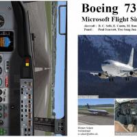
Presented as a PDF booklet, the guide traces the full cycle from cold start through securing for a Boeing 737-200, based on the panel by B.C. Selb, E. Cantu, M. Baumann, H. William, Paul Scarratt, …
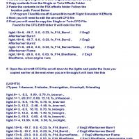
A practical tutorial on adding and editing afterburner effects for a single or twin-engine jet project, featuring a step-by-step approach and clear illustrations. The author, Mark Rooks of RSDG, gu…
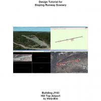
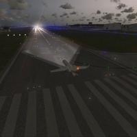
Walter Roberts presents a design approach to sloping runways by building a sloping flatten polygon and turning it into a hardened surface, then locating it accurately within the world. The text not…

Werner Schott compiles a freeware PDF manual for the DeHavilland DHC-2 Beaver wheel variant, guiding from dark and cold startup to shutdown with cockpit checks and engine management. Manifold press…

The driver enables GoFlight hardware to interface with the PMDG B737 NGX, authored by Stephen Munn. Running setup.exe starts the process, and an enclosed PDF accompanies the package with installati…
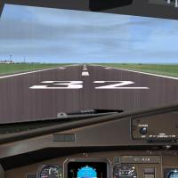
Image assets arrive in 8x8-bit, DXT3 format with alpha channels for transparency and no mip maps, ensuring streamlined rendering. The original assets accompany this work, and Claus V. Holmberg appe…
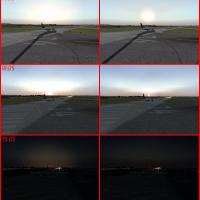
By Dave Bolger, this sun glow tweak makes the sun appear more radiant and its glow lasts longer after sunset. It uses the suneffect.cfg file placed in the main directory, with a backup included, an…
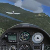
Thomas Murr presents a banked-turn tow-plane technique for glider towing, detailing how to maneuver the tow plane instead of flying straight ahead. It notes a method to summon the tow aircraft with…

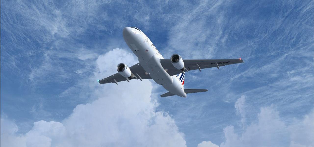
Emirates operates 21 A380s, and current flight plans are published from the airline's website by Kevin R. Wynn. Based in Dubai, the operator serves routes to KJFK, EGLL, ZBAA, ZSPD, CYYZ, and EDDM,…
 Patch
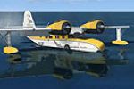
PatchA fix adjusts water contact points for a Grumman Goose, enabling the float system to engage earlier and allowing the hull to sit deeper in the water. It offers two variants, with Variant 1 aiming f…
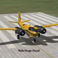
An illustrated tutorial addresses propeller display issues that occur when older aircraft are used with a newer simulator environment, outlining step-by-step corrections. David 'Opa' Marshall compi…
Self-explaining and step-by-step, this concise guide by Riccardo Milan covers all 737 NGX checklist events in the FS2Crew Voice Edition, delivering a compact, focused walkthrough of the entire sequ…