Page 63
Searches the whole library — filter by sim & category on the results page
An EKVA-based Danish base add-on at Vandel corrects aprons, adds taxiways and objects, providing a background that mirrors real-world layouts. It centers on the EKVA site and expands the airfield's…
 Denmark
The Rhode Island airport KPVD near Providence receives updated gates and parking, with jetways visible and operable. Jetways can be called to the jet by pressing CNTRL-J, and several extras are inc…
 United States of America
Ray Smith presents an enhanced Albany-area airport layout with a lengthened Runway 1/19, revised taxiways, and expanded parking to improve traffic flow for both user and AI aircraft. Crosswind oper…
United States of America
Ioannina Airport, LGIO, Greece, receives an add-on by Moraitis Vaggelis (SAOxt) placed in the LGIO_SAOxt folder; two photos show daytime and nighttime views, reflecting the project’s use of publicl…
 Greece
Two BGL options for Barajas International at LEMD arrive as LEMD_ADE_RS.BGL and LEMD_ADE_CW_RS.BGL, with crosswind runways activated in the CW_RS version and standard two-runway operation in the RS…
 Spain
Spain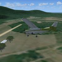
A compilation of 146 airfields spans Calabria, Basilicata, Puglia, Abruzzo, Molise, Campania, Lazio, and Umbria, with runway coordinates drawn from Google Earth. It requires RWY12 and EZ libraries,…
 Italy
Italy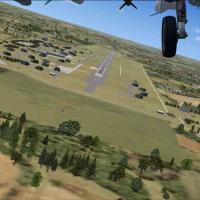
Near Neuburg, Bavaria on the Danube, a version 1 rework reworks the ETSP layout using ADE X 1.50 and stock objects. By Uwe Steenweg, it adds abundant parking and light poles credited to Jim Dhaenen…
 Germany
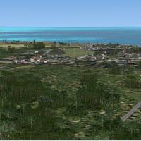
By Chris Thompson and Alf B. Meier, the Belize airfields compilation adds 12 regional airfields, including Belmopan, Kanantik, and Hidden Valley. Eight Alf Meier entries are reworked for AI traffic…
 Belize
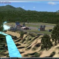
Dominica Island restoration reworks coastlines and land class, and includes the Canfield and Melville Hall airports along with Roseau, Portsmouth, Marigot, Delices, and Scott-head1. Roads and traff…
 Dominica
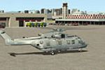
An enhanced naval facility for KNZY sits at Coronado’s tip near San Diego, anchoring the base by KNZY. It adds a fire station with firefighting vehicles and repositioned control towers, and provide…
United States of America
Greensboro's KGSO facility in North Carolina requires an accelerator pack for many items and parking areas, and GAPLANE1.ZIP is needed for some aircraft, with Jimmy R. Martin credited. If terrain e…
United States of America
Located at KGRR in Grand Rapids, Michigan, the project adds a new terminal and tower, updates gates and parking, and makes all jetways visible and operable. By Rob Touchtone and using ADE, it enabl…
United States of America
An LXGB file by James Parkes upgrades the Gibraltar area with changed gates, added buildings around the airport, a fire station, taxiway signs, and a tarmacked surface. This identifier marks the mo…
 Gibraltar
Old Warden, identified by ICAO code EGTH after relocation from EGTZ, receives updated placement and added objects created with Instant Object Maker v1.2; the project, by Alf Denham, offers multiple…
 United Kingdom
By Matthew Hollcraft, KGJT in Colorado updates the airport using the latest charts and Google satellite imagery. Two BGL files named KGJT_ADEX_MH and KGJT_ADEX_MH_CVX accompany Jim Dhaenen's T-hang…
United States of America
NZNS hosts a freeware add-on for Nelson Regional Airport, intended for personal use. It includes minor updates to night lighting and relies on Flight1 Software tools and Airport Facilitator X to pl…
 New Zealand
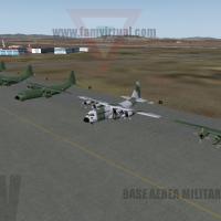
The Mexican Air Force operates the base at Santa Lucia in Mexico State (MMSM). The vX.5 version includes Gmax objects, strengthening its geographic representation and usability for regional operati…
 Mexico
Dean Mountford/FS Dreamscapes guides a beta add-on that renders Monument Valley with 5-meter IFSAR elevation data and 1-meter ortho imagery, plus a high-fidelity mesh that resolves the buttes and m…
United States of America
Jose Vicente Andretta presents a Venezuelan airfields collection featuring twelve sites such as SVSE Santa Elena de Uairen, SVMP Metropolitano, SVCL Calabozo, SVVP Valle de la Pascua, SVPU La Parag…
 Venezuela (Bolivarian Republic of)
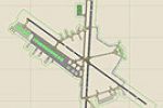
KDOV, located in Delaware, gains an improved layout with parking spaces, two fire stations with trucks, and a water tower, by Jim Cook. The modification adds Military_Combat and Military_Cargo spac…
United States of America