Page 67
Searches the whole library — filter by sim & category on the results page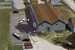
LFSE airfield in Epinal-Dogneville, France, receives a complete landclass redesign of Epinal city, with a ground that shows seasonal and night variants. Animated windsock, static planes, cars, and …
 France
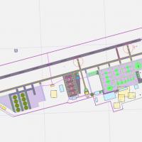
Aden in Yemen (OYAA) uses satellite imagery to guide a stock-airport-based upgrade, adjusting aprons and taxiways and adding parking spots plus vehicle paths. A single .bgl file, released into the …
 Yemen
Yemen
Whistler area adds a float-plane base named Whistler-Green Lake Water Aerodrome (CAE5) and two heliports, Whistler Health Care Centre Heliport CAW4 in town and Whistler Municipal Heliport CBE9 just…
 Canada
In the Western Cape, South Africa, Ysterplaat Airport (FAYP) carries version 1.00 with credits to Lourens Basson, Johan van Wyk, and Aeroworx. It features photo realistic ground surfaces with hanga…
 South Africa
An add-on near KLGA replaces the default park layout with photoreal surroundings and introduces Unisphere plus the 1964-45 World’s Fair Pavilion and Towers. Citi Field, Yankee Stadium, and the Quee…
 United States of America
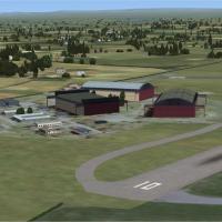
Alf Denham creates a freeware edition for three UK airfields, Currock Hill X5CH, Kirkbride EG86, and Lands End/St. Just EGHC, refining coastlines and structures via landclass updates. He uses Googl…
 United Kingdom
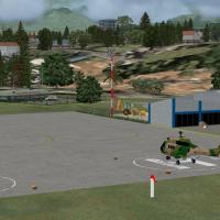
In Venezuela, El Vigia Airport (SVVG) depicts a terminal building, control tower, and military base hangar alongside heliports, taxiway signs, parking, and vehicles, while adding ILS for runway 09 …
 Venezuela (Bolivarian Republic of)
This is one of two files for medium-sized airports, focusing on central California coast coverage from Monterey Bay south to Van Nuys, with nine airports and some extras. J. D. Starseed is the crea…
United States of America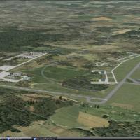
Hoedspruit AFB in South Africa functions as a fighter base and is fixed and updated to its current layout. Hoedspruit AFB.zip archive includes the FAHS_hoedspruit folder and the AFX_FVHS_ALT.bgl, w…
South Africa
Credits go to Al Wheeler for a build that aligns KSBA and KIZA with Gottfried Razek’s hi-res photo imagery, using custom 3D objects and adjusted runways. SBAFSXPH.ZIP contains 24 BGL files, 46 BMP …
United States of America
The airfield LFSV near Nancy has four runways, the southern pair remains closed and two runways open to the north. A photoreal ground with seasonal and night variants, plus a landclass that adds Ne…
France
In the Venezuelan Andes, SVSA uses satellite-terrain data derived from imagery to present its topography. The representation covers the terminal building, the control tower, a fire station, and mul…
Venezuela (Bolivarian Republic of)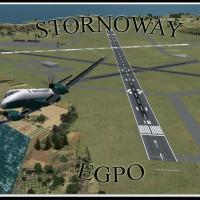
Stornoway, identified by IATA SYY and ICAO EGPO, sits two nautical miles east of the town on the Isle of Lewis in Scotland, with operations dating back to 1937 when the site also hosted a Royal Air…
United Kingdom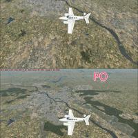
Beta 2 presents replacement graphics for Warsaw and towns around, drawing on assets from the default library and landclass data for Warsaw's regional context. An image reference appears at /userima…
 Poland
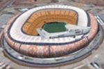
Freeware project presents a stadium model for the 2010 FIFA World Cup in South Africa, fashioned as a custom-designed object with a photoreal base by Philip Schall, PSDS. It is the landmark formerl…
South Africa
KFHR in Washington sees ramps, taxiways, and buildings moved, with some default structures removed and replaced by stock hangers; the modification adds static aircraft and expands parking for Kenmo…
United States of America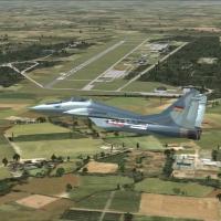
Holzdorf AB lies in eastern Germany and is depicted as a Luftwaffe site with an updated stock representation; ADE X 1.50 handles placement with stock objects, while German shelters and a hangar by …
 Germany
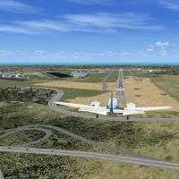
Revision 1 adds Daytona International Speedway to the KDAB area in Florida, expanding the airport vicinity with the renowned venue. The update elevates the track and infield to reduce distance-base…
United States of America
The archive contains all models compiled in the KCAE_ADEX_AP.BGL file, with the Models folder housing the related assets. Taxiway signs are placed per certification-manual exhibits, taxiway designa…
United States of America
Sunay Kilic presents LTBG Bandirma, a VFR-focused project detailing the base and its surroundings, including the coast, Bandirma city, and the Kapidag peninsula. Models include C-130, B-412 by Jean…
 Turkey