Page 76
Searches the whole library — filter by sim & category on the results page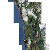
Three .bgl files deliver naval traffic around Alaska, featuring Ark Royal, Clemenceau, and USS Nimitz v2. The trio relies on these carriers being present and stays compatible with UTX Alaska, with …
 United States of America
DominicaX, created by Zev C. Richards and Jean Louis Valladier, delivers over 750 square kilometers of photoreal coverage with hand-placed autogen, objects, and traffic. Airport representations are…
 Dominica
The second edition covers important VFR waypoints in South Africa and highlights the Northgate dome and the Silver Ball in greater Johannesburg. It remains freeware and is built from a custom desig…
 South Africa
Victor Pinto provides a Panama FS-X adjustment that corrects two issues, addressing water rendering and MPMG crash boxes. The note credits Pinto as creator and identifies Panama FS-X as the focus, …
 Panama
P. Tsekouras delivers improvements to Eleusis Airport (LGEL) west of Athens, Greece, with corrected taxiways, an unchanged main runway, and added buildings and parking based on Google Earth imagery…
 Greece
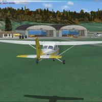
Besancon covers two airfields, LFSA Thise and LFQM La Veze, in eastern France along the Doubs river near Switzerland. The project uses traditional terrain-building tools, including SbuilderX and a …
 France
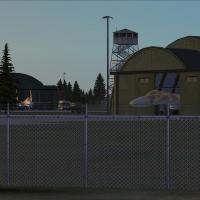
Chkalovsk airbase in western Russia hosts civilian and military traffic and remains largely fictional. Static aircraft include Su-27 Flankers, gliders, and an AN-225, while the layout targets Alpha…
 Russian Federation
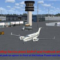
Kim Dahl contributes a KML file that refines grass visuals on AFX, with Jens Peter Bruun-Hansen credited for the work. Requires EKRK2.ZIP and seeks to sustain solid FPS on an average system, while …
 Denmark
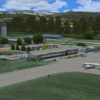
Custom-designed models and a photoreal base change with the seasons at Matsapha Airport (FDMS) in Swaziland, a busy hub with regular flights to South Africa, by Frits Beyer and Jacques Botha; the A…
 Eswatini
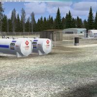
Located at KNFJ in Milton, Florida, this project supports the T-6B Texan II and features working IFLOLS trailers with a meatball for carrier-landing practice. by Brandon Thetford, it acknowledges S…
United States of America
Plymouth Airport receives a makeover with a new terminal, redeveloped parking gates and ramps, static aircraft, a Plymouth flying school, and a car park with 3D cars, by Harry Patten. A single bgl …
 United Kingdom
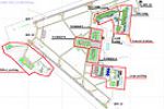
Two variants place real airlines at the correct gates and renumber gates for Jacksonville International Airport (KJAX), Florida. Two files carry the names KJAX_real_park data for AI-traffic add-ons…
United States of America
By Felix Romero Jr., this Honduras airfield work covers airfields such as Nuevo Ocotepeque, Archaga, Amapala and Utila, each tied to codes MHNV, MHAC, MHAM and MHUT, with Trujillo, Puerto Lempira a…
 Honduras
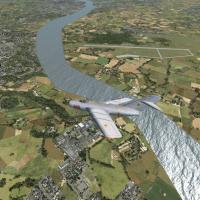
Tokol airfield (LHTL) near Budapest, once military, now serves general aviation; Paul Strogen adds fighter ramps, hardened shelters, and landclass improvements, enabling MiG-15, MiG-17, MiG-19, and…
 Hungary
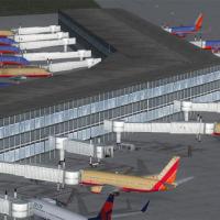
At KHOU, a new terminal replaces the old Houston Hobby facility, with adjacent taxiways placed and adjusted using current satellite imagery, by Carlyle Sharpe. The layout file relies on Planner wit…
United States of America
At the Camp Pendleton field KNFG near Oceanside, Jim Cook provides an updated layout with added Military_Cargo and Military_Combat parking spaces, and a fire station with trucks. Two files, AFX_KNF…
United States of America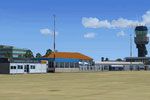
EHGG sits southeast of Groningen and integrates with the NL2000 framework, relying on v4.0.20 to function properly, with jetways, runways, taxiways, and aprons rendered in high-resolution imagery a…
 Netherlands
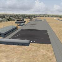
Lee Marrow delivers an FCBB-focused addon for Maya Maya Brazzaville in the Republic of Congo, using mainly stock FSX objects and including the lights enhancement FSX_LTS.ZIP by Jim Dhaenens. The wo…
 Congo
Congo
The airfield near Lake Erie in Cleveland, Ohio, ships with an installer program and KBKLinstaller.exe, ensuring a straightforward setup for users. It adds static aircraft on the ramp and includes a…
United States of America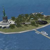
A fictional makeover reshapes the flat Liberty Island within the simulation, now featuring the Statue of Libery and a variety of other objects for visual interest. By Alan D. Griswold, the work nam…
United States of America