Page 88
Searches the whole library — filter by sim & category on the results page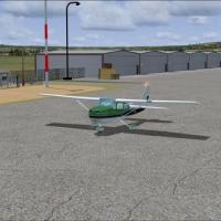
SNPD in Brazil presents a v1.0 project authored by Saulo Ferreira Leite and adapted by Cesar Marinho, with credit also extended to Luis Sá for Sbuider and RWY12 authors. It includes an NDB PAT 385.…
 Brazil
The wind farm near Rhyl sands sits about 8 km off the North Wales coast in the United Kingdom, a coastal installation. Neil Birch credits the project as its creator, linking the offshore site to No…
 United Kingdom
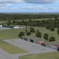
Custom designed buildings shape the Buluwayo airport complex in Zimbabwe, equipped with a newly included terminal and taxiways correctly marked, while the field maintains two runways; FVBU_Buluwayo…
 Zimbabwe
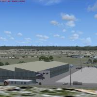
Overberg Air Force Base near Bredasdorp in South Africa appears as freeware, built from custom hangars and default libraries, with three additional libraries from Jaxan Prier, Guy Diotte, Michael C…
 South Africa
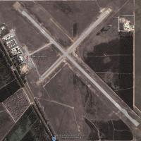
An airport enhancement reworks Albany Airport (YABA) in Western Australia, repositioning hangars, refining taxiway edges, and removing encroaching vegetation around runway approaches before replaci…
 Australia
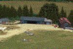
Terlet Airfield (EHTL) is modeled with a precise layout of runways and grass strips, featuring authentic glider hangars and clubhouses that mirror real-world references. It resides within the NL200…
 Netherlands
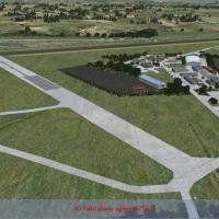
Two separate fields form Enstone Aerodrome, EGTN and UK03. The ICAO code EGTN has marked the site since 2008, and the 08-26 layout features an asphalt main runway and a grass South Side strip for GA.
United Kingdom
Epinal Mirecourt Airport (LFSG) in France exists in version 1.0, by Alexandre Remy. Credits include Pierre Chevallier for photos, DR400 model by FranceVFR, BMP2000 and DXT BMP by Martin Wright, and…
 France
Rochester, positioned along Lake Ontario in upstate NY, links to Eastman Kodak and credits Dick Kittredge for the work. RochesterNY.bgl accompanies the project, adding landscape features and suppor…
 United States of America
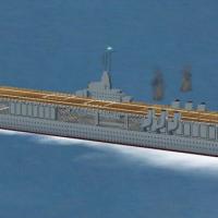
Led by Paul Clawson, the model presents a static Ranger CV-4 hull with a precise hard deck, rotating radar dish, twin smoke effects, and a wake effect. It includes a night texture in DDS format and…
United States of America
Severin Afari presents DGAA in Accra for use with ACCRASCENERY.ZIP. The video does not show the military side, which includes parked helicopters, F-22s, F-16s, and military fuel trucks, while other…
 Ghana
Ghana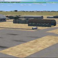
At Hamilton NZHN in New Zealand, taxiways receive an update with CTC Aviation aprons and both Runways 25R and 25L are now included. The file Hamilton NZHN.bgl is public domain, with buildings drawn…
 New Zealand
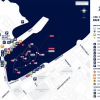
Created by Siscot Yves and Carlos Santos, this freeware add-on reconstructs the pylons and racetrack along the Abu Dhabi Corniche, mirroring the 2010 layout and its checkpoints. Three-dimensional o…
 United Arab Emirates
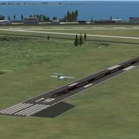
Ontario-based Kingston carries identifier CYGK and uses default objects to display semi-accurate visuals, by Connor Donaldson. The freeware offering centers on CYGK.bgl and notes non-operational ha…
 Canada
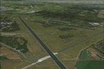
The NL2000 v4 ecosystem enables a freeware recreation of Enschede Airport Twente (EHTW) with taxi routes and runway data aligned to published figures and night lighting for dusk operations. High-re…
Netherlands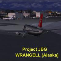
An Alaska PAWG airport receives a Project JBG upgrade, with Joe Garcia credited for the compilation and Jean-Pierre Fillion supplying static aircraft. ADE 9x version 1.47 guides the work and Runway…
United States of America
Shahin Najafi presents an Iranian airport compilation featuring Bojnourd (OIMN), Sanandaj (OICS), and Shahre-Kord (OIFS) with three variants, and notes the distinct airfield codes for each location…
 Iran (Islamic Republic of)
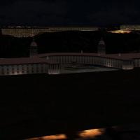
By Frits Beyer, this freeware Union Building feature presents a custom-designed structure for a South African setting. It arrives as a zip containing a project folder and directs start points such …
South Africa
Royan Medis Airport, registration LFCY, lies in western France and is presented by Alexandre Remy. It features a DR400 model by FranceVFR, the AFX_LFCY_ALT.bgl file for placement, and building work…
France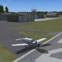
By Mark Bradshaw, the project adds buildings, taxiways and aprons to Cumbernauld EGPG airport, while relying entirely on default objects. It uses photos and satellite images as reference to guide t…
United Kingdom