Page 91
Searches the whole library — filter by sim & category on the results page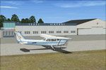
Texel Airport, located on Texel island in the Wadden Sea region, receives an NL2000 v4.0-compatible enhancement by The Netherlands 2000 Design Team. It adds photoreal ground imagery, a precise airf…
 Netherlands
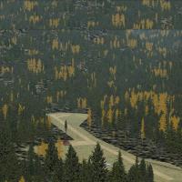
An I08 variant by Erik van Onselen sits at Cabin Creek USFS in Idaho, updating the layout with runways, aprons, buildings, roads and parking areas. Shape polygons replace standard surfaces for the …
 United States of America
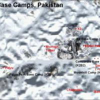
Four camps line the Baltoro Glacier near K2 in Pakistan, named B1 to B4. B1 features a temporary small gravel runway with stone marks at about 3400 m; B2 is the largest camp at roughly 4600 m and h…
 Pakistan
An enhanced version of the Newport News/Williamsburg airport replaces and expands ground layout with added aprons, taxiways, roads, and jetways, moves the control tower to the correct location, and…
United States of America
Public air facility near Caldwell in northwestern Essex County carries IATA code CDW, ICAO designation KCDW, and FAA LID CDW, while the Essex County Improvement Authority owns it. It features two a…
United States of America
MMIM, Mexico, centers on Isla Mujeres with a photorealistic portrayal by Fernando Rodriguez and the MMIM code used to identify the locale. The MMIM designation identifies the locale, while the crea…
 Mexico
KSPB Scappoose, Oregon Industrial Airpark, by Robert Lacy, sits along the Sauvie Island corridor between Portland and St. Helens. A photoreal, high-resolution ground image is included, plus a 55 Fo…
United States of America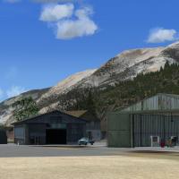
An addon for Alaska's Stewart and Hyder area reworks river shorelines and the airfield, adds the towns and port dock, and uses default objects with autogen to mirror satellite imagery. It includes …
 Global (World)
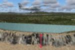
The collection fixes elevation for 137 lakes across Madagascar, replacing prior tyre-like walls and crater-like depressions. An conversion tool reworks older SCA flats into flatten polygons, while …
 Madagascar
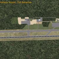
Marsh Harbour, Bahamas (MYAM) features a 6,100 ft asphalt runway designated 09/27 at 6 ft elevation, serving Nassau and several Florida cities. The update moves the runway, lengthens it, converts t…
 Bahamas
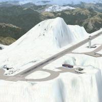
A fictional high-altitude airport sits at the summit of Glacier Peak in Washington (WA). The work is by Andy Johnston, and the concept locates aviation at that peak within the state, emphasizing it…
United States of America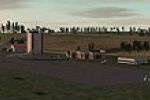
Jacques Botha creates Wallblake in The Valley, Anguilla (TQPF) and relies on default FSX libraries, ensuring compatibility only with that simulator. The release references Wallblake.zip and a subfo…
 Anguilla
KHXD in South Carolina gains a new main terminal and corrected airline codes for ramps, GA hangar, and FBO, enhancing real-world alignment at the airport. ADE guides development, EZ_1.ZIP and RWY12…
United States of AmericaBy Willem Noordhuizen, the northern Marquesas project reworks Nuku Hiva, Ua Huka, and Ua Pou airports, with coastlines and landclass adjusted and villages added. It uses Oceania-Asia SRTM Terrain b…
 French Polynesia
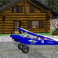
Two animated GA hangars and a log cabin stand at Joe's Outpost on Bean Island, southern Alaska, USA, version 1.0. It is designed for NAV1 and NAV2, and ships with a PDF document and an installer by…
United States of AmericaJoshua Keaton creates the project around Dobbins Air Reserve Base (KMGE) near Marietta, Georgia, using Airport Design Editor. Two folders include a Dobbins AFB layout and a C130 library, linking KM…
United States of America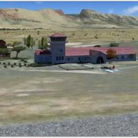
Beaufort West Airfield (FABW) in South Africa functions as a refueling stop between Cape and the Northern Provinces, with Aeroworx credited to Hannes Steyn and Martin du Preez. It aligns elevations…
 South Africa
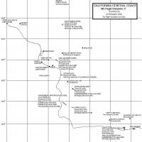
Al Wheeler presents CCCFSXC, a California Central Coast collection spanning Paso Robles to Santa Barbara with about 22 points of interest. It includes 105 BGL files and 105 BMP or DDS image files a…
United States of America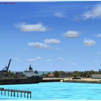
By Dominique M. L. Donzelot, this Gulf of Aden base near Socotra centers on a main airfield labeled LHC1 Kilmia, featuring a long runway for heavies and a shorter fighter strip, plus an Ulm field a…
 Yemen
Yemen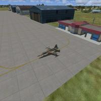
An enhancement to a northern Taiwan air base repositions taxiways, expands aprons, and adds civilian gates and space for military aircraft. Since 2007 the site serves ROC Navy fixed-wing ASW duties…
 Taiwan, Province of China