Page 96
Searches the whole library — filter by sim & category on the results page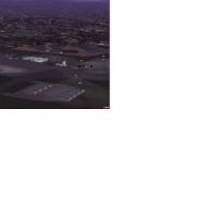
In Limpopo province, near the city of Polokwane in South Africa, the facility carries IATA PTG and ICAO FAPP designations and has operated since 1996 on a former air force base. It handles about 50…
 South Africa
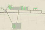
Registration KHRT in Florida receives an enhanced version by Jim Cook, adding parking for Military_Cargo and Military_Combat, a fire station with trucks, and helipads with static support vehicles. …
 United States of America
Steven Dean creates a PHHI-area modification for Hawaii that adds military objects and buildings for the airfield, using wheelerraf.bgl. Not a real representation of PHHI, this freeware work relies…
United States of America
Two adjustment files for Harrisburg International Airport (KMDT) by Jim Cook adjust aprons and taxiways, assign gates, and add cargo, GA, and Military_Cargo parking at the National Guard apron, plu…
United States of America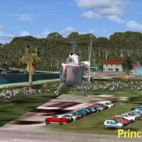
A CJCR compilation by Jimmy R. Martin reworks CJCR, MYZ2, and MYER across south Eleutheria Island, Bahamas, covering Rock Sound, Freetown, Greencastle, and Princess Cays. With acceleration features…
 Bahamas
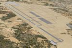
A Spanish airport project serving Ciudad Real by Jesus Ramirez de Arellano includes several files with gates, parking areas, and navigation aids, along with roads carrying traffic, and a designed s…
 Spain
Spain
Alexander Sievert releases version 2 for the Okanagan landclass, spanning the valley from the U.S. border north to Grindrod, BC, and reworking vegetation while adding numerous minor towns and major…
 Global (World)
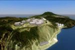
Harald Sandvik provides a mesh for St-Eustatius, located in the Caribbean and centered on the F.D. Roosevelt TNCE airfield, with a base photo-based representation and an optional ADITIONAL_TANKS2_O…
 Bonaire, Sint Eustatius and Saba
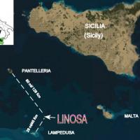
Fulvio Mazzokan delivers Linosa Island imagery near Sicily, Italy, rendered at photoreal 1.2 meter per pixel resolution. Nearby airfields LICD on Lampedusa and LICG on Pantelleria provide reference…
 Italy
Italy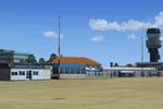
Ground updates focus on Groningen Airport Eelde (EHGG) within the NL2000 v4 framework, designed by The Netherlands 2000 Design Team, featuring precise taxiways and an accurately modeled terminal an…
 Netherlands
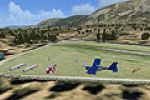
At Feshiebridge near Aviemore in Scotland, the gliding club layout sits amid the Cairngorms with the 111-meter Sgoran Dubh Mor rising directly east of the field. Neil Birch authors the project and …
 United Kingdom
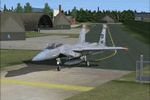
This eighties-era recreation of Soesterberg Air Base faithfully mirrors the main apron, taxiways, and period structures, while preserving the historical runway alignment and foliage boundaries arou…
Netherlands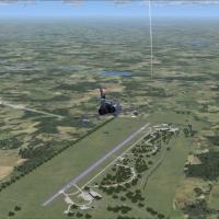
Located in northwestern Germany near Rheine, Hopsten AB presents a historical layout linked to JaboG 36 W and JG 72 W operations, with the F-4F Phantom II retirement noted on 20 December 2006. It u…
 Germany
Rework expands Hiva Oa coverage by adjusting Atuona airport to Jaques Brel Airport and remapping coastlines across Tahuata, Mohotani, Fatu Hiva, and Fatu Huku in the Marquesas. The archive NTMN_ADE…
 French Polynesia
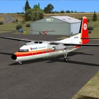
Two NZCI variants present Tuuta Airport near Waitangi, with a separate Pitt Island Airstrip (NZCT) included in each version, by Lawrie Roache and Ian Thatcher. One uses default visuals with a custo…
 New Zealand
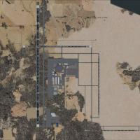
By Raymond Mills, this KGFK add-on for North Dakota’s airport refines the original KGFK10, adding a newly constructed runway and improves instrument approaches for currency, while keeping a clean a…
United States of America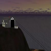
Version 2.0 introduces smoother gondola animation along the mountain incline, updating Cape Town's cable-car route with more fluid movement. Compatibility relies on Aeroworx or NMG Trading terrain …
South AfricaTerrace CYXT airport gains extended runways and updated taxi networks through a thorough ADE v1.39 Beta revision aligned with a 2009 chart date, removing the 254 kHz NDB and repositioning VASIS on …
 Canada
By Tim, four updated airfields across Nevada and California appear: L23 Pahute Mesa Army Test Facility Nevada; BYS Fort Irwin AAF Armory California; 0CL8 Tera bone yard California; TNX Tonopah Miss…
United States of America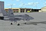
An updated KNCA layout at MCAS New River in Jacksonville, NC adds parking, a fire station with trucks, and relocated control tower, while taxiways and aprons are adjusted and several buildings repl…
United States of America