Page 115
Searches the whole library — filter by sim & category on the results page
Robert Parson presents a scenario off the east coast of Africa with coordinates S4°9.46' and E46°48.36' near Mogadishu, Somalia, where pirates stalk a cargo ship. A file named Pirates.BGL is refere…
 Somalia
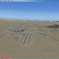
Jean 0L7 in the Las Vegas area receives two .bgl files to improve the airport, with an .ade file included for use only with Airport Design Editor. A Civil Air Patrol L-23 Blanik operates here to su…
 United States of America
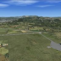
La Morgal Airport in Asurias (Spain) receives GA traffic placement at LEMR, with a dedicated apron and a helipad added. Félix Fernández de Castro provides three .bgls—AstEmKit_LEMR_AFX.bgl, AstEmKi…
 Spain
Spain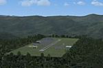
A fifth installment in the Pro Hop lineup focuses on small mountain airfields in the Virginia and North Carolina Smokey Mountains. Created by J. D. Starseed and distributed for Red Eye Guys Inc, th…
United States of America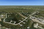
NL2000 v4.0 Volkel facility segment presents a runway modeled to match the real-world EHVK layout. It includes custom hangars and ATC facilities positioned to official references and aligns with NL…
 Netherlands
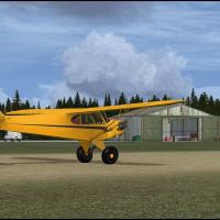
Ian Pearson creates a fictional airfield near Lewisporte, Newfoundland, designed for A2A Piper Cub with AccuSim but accessible to any small STOL with a single grass runway and a single water runway…
 Canada
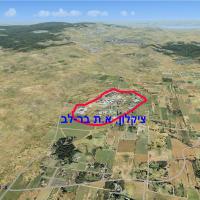
By Muli Ivanir, this airstrip sits in Bar Lev Park, Israel, about a mile north of Achihud junction, and serves GA and ultralight pilots in coordination with Cyclone Aviation Products Ltd. Designed …
 Israel
The EDTF Beta variant centers on the Freiburg region near the Basel/Freiburg-Mulhouse airport complex, with additional areas around the Black Forest. It features sheep, birds, a balloon, a theme pa…
 Germany
By Mark Bradshaw, this BGUK enhancement adds an apron, a short taxiway and gates to the basic runway at a Greenland airfield, along with a few default objects, and considerably visually brightens t…
 Greenland
Alex Ferguson creates a freeware extension for PAEN in Alaska, credits himself as the author, and notes it is not for commercial use. The project sits off PAEN and ties the Alaska location to the c…
United States of AmericaLocated in the Town of Glenville, Schenectady County, KSCH hosts the Stratton Air National Guard base and the 109th Airlift Wing. The edition modifies the stock airfield with added taxiways, aprons…
United States of America
Eleven ranch landing strips lie across broad La Pampa and Cordoba, and each location has terrain objects and landclass. Jimmy R. Martin and Federico Malfu Sanchez author the work, and SA62_EA_ANDAL…
 Argentina
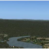
Camopi Airport (SOOC) lies in southeastern French Guiana near the Brazil border, serving the Camopi Amerindian village on the river, with a challenging jungle dirt airstrip and nearby villages and …
 French Guiana
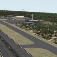
Designed as a 64-bit compatible option for dual or quad core systems, CJCR_W7 uses objects from the flight library and places them into a single area; roads stay drivable and heli traffic offers sc…
 Global (World)
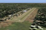
The area near Cole Landling centers on a private Newcastle, Oklahoma airstrip coded 2OK7, offering residential aircraft parking for residents and a couple of small businesses. It requires Rwy12 and…
United States of AmericaUK-focused v2 release, labeled EGHK, mirrors the prior version and offers an auto install option, with Harry Patten as creator. Manual installation remains possible by placing the bgl file(s) into …
 United Kingdom
Greymouth airfield on the rugged west coast of New Zealand's South Island gains accurate taxiway alignments based on real-world references and a relocated fuel area. Windsocks reposition to reflect…
 New Zealand
Rob Touchtone creates a KPNE installation in Pennsylvania, with hand-placed buildings guided by Google Earth data and a few facilities omitted to keep frame rates steady. The ADE-based project uses…
United States of America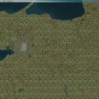
An adjustment to landclass for the Kaliningrad region in Russia is authored by Lukasz Kubacki and is built with Sbuilder X by Louis Sa. It introduces forests, small towns, and crops, and centers on…
 Russian Federation
Chris Carel, credited as MoCat, presents Dinner Key as a fictional Florida-based extension for Caribbean Seaplane Tours, requiring Caribbean SeaPlane Tours Florida Operations, Caribbe West, Bahamas…
United States of America