Page 122
Searches the whole library — filter by sim & category on the results page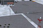
KPVC on Cape Cod gains additional GA parking and a dedicated area for Cape Air, which services the airport, enhancing support for general aviation. ADE v 1.37 guides the design and a Race Point lig…
 United States of America
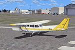
Located at KEVB in Florida, the project updates aprons and taxiways, replaces several buildings, and adds roads, light poles, static vehicles and aircraft, along with numerous trees. It provides tw…
United States of America
Bill Dick and Phil Cayton create Bushflight Northwest with documentation by Chris Brisland, centering on the northwest corner of Washington state and adding airports, villages, ship wrecks, seaplan…
United States of America
In New Zealand's NZHR area, Hanmer Springs Airfield lies two nautical miles south of Hanmer Springs Village on the South Island's Northern Canterbury region. Vector Landclass, a payware library, is…
 New Zealand
Located in the Bahamas as Sampson Cay (MYXH), this item presents a resort island with rentals and charters. It comprises two folders and animates gulls and dolphins when a Gold Acceleration compone…
 Bahamas
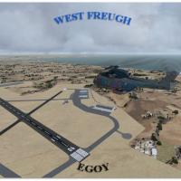
RAF West Freugh, designated EGOY, lies in Wigtownshire, UK, five miles southeast of Stranraer, and serves as an armaments training site. The author, Gordon Barnes, uses two BGL files named EGOY_ADE…
 United Kingdom
At KSLK in New York, a two-file modification adds GA parking, replaces some buildings, and places static aircraft and vehicles as aprons and taxiways are adjusted. Two files carry the changes, KSLK…
United States of America
As part of the NL2000 v4 project, Aerodrome Drachten (EHDR) integrates photoreal imagery and custom 3D structures to reproduce hangars, terminal buildings, and other facilities. It requires NL2000 …
 Netherlands
Robert Pearson presents an update that includes Pocatello, Idaho, and WW2 B-29 training bases Fairmont, Bruning, and Walker, plus several others, with RWY12 objects. This expansion follows earlier …
United States of America
Situated at CYCZ in British Columbia, Canada, the facility spans 6,000 feet and welcomes private and charter aircraft up to Boeing 737s. It adds a main terminal, a control tower and parking, with e…
 Canada
Riaan van Vuren presents an Inanda Dam depiction near Durban, South Africa, recognized as a landmark for aircraft en route to Durban International (FADN). This addition focuses on the dam's geograp…
 South Africa
Bob Caparoula creates a satellite-based rendition of the Moriarty 0E0 airfield in New Mexico, crafted from US Geological Survey imagery. Freeware by Bob Caparoula, the archive Lillooet_CAR3.zip del…
United States of AmericaKYNG in Youngstown, Ohio receives an adjustment that places Allegiant parking correctly and makes jetways work, while all gates stay consistently accurate to the period. Jetways connect to aircraft…
United States of AmericaIn Texas, Amarillo International bears the code KAMA and depicts the front portion of the terminal under construction, illustrating ongoing work at the facility. Two heliports exist at Bell Heilcop…
United States of AmericaWatertown's KART receives an improved rendition featuring replaced default buildings, expanded aprons and taxiways, paved and gravel parking, and static vehicles. Gates are assigned to Cape Air, li…
United States of America
At KHTO on Long Island, Jim Cook delivers an enhanced layout that reshapes aprons and tightens taxiway alignment to reflect current diagrams. The work relies on AirNav data and recent Google Earth …
United States of America
Arbois airfield (LFGD) in the Jura region of France receives a modest add-on that equips the site with facilities for light airplanes and gliders. Dominique M. L. Donzelot is listed as the author, …
 France
Northampton, Massachusetts sits along the Connecticut River and features a small airport. Dick Kittredge authors NorthamptonMA.bgl, created for use with a terrain-enhancing companion program and vi…
United States of America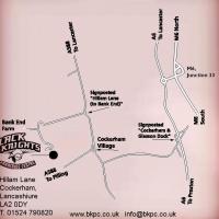
Neil Birch delivers a ten-field extension, including Egton and Fishburn, aligned with VFR materials. It requires ADOTF.ZIP, ADOTF-UP.ZIP, ADFARM-2.ZIP, WDYEZSRP.ZIP, plus Rwy12 and UK VFR add-ons, …
United Kingdom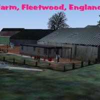
Near Fleetwood in Lancashire, UK, Tarn Farm is intended for Neil's Microlights users, with Neil Birch credited as the author. It remains compatible with default visuals, though some elements stay h…
United Kingdom