FSX Scenery

Page 35

Sort
Reset
Preview screenshot

Charlestown Naval Auxiliary Station

KALF in Rhode Island serves as a satellite to Quonset NAS and trains night fighter squadrons on F6F Hellcat and TBM Avenger. The model, by Fred Highland, reproduces the site circa 1945 from aerial and satellite photos using Airport Design Editor, with KALF_ADE_FDH.BGL and KALF_ADE_FDH_CVX.BGL.

Country
United States of America
File Size
5.14 MB
Total Downloads
269
Star Rating
4/5
Screenshots
23
Preview screenshot

Argentina Ranches Scenery Pack 1 Fix

By Jimmy R. Martin and Federico Malfu Sanchez, the correction addresses a floating runway on SA62 Ea Andalen and targets ARGENTINA_RANCHES_PACK_1.ZIP, noting that the related installation contains 11 ranch landing strips. No other changes are described.

Country
Argentina
File Size
493.68 KB
Total Downloads
268
Star Rating
2/5
Screenshots
1
Preview screenshot

RAF Barkston Heath AB

Defence Elementary Flying Training School operates the Slingsby T67M260 Firefly two-seat trainer at the airfield. Two files, EGYE_ADEX_GB.BGL and EGYE_ADEX_GB_CVX.bgl, accompany it and support its use as a Relief Landing Ground for Cranwell, detailing integration with DEFTS operations.

Country
United Kingdom
File Size
354.69 KB
Total Downloads
267
Screenshots
1
Preview screenshot

Rougham Airfield

By Trevor Clark, this Rougham airfield rendition targets Volume 2 compatibility and features an optional airshow when the Acceleration Pack is present. It requires several freeware object libraries, including rafbldV2.zip and ukvfr.zip, and allocates a multicom frequency of 133.60.

Country
United Kingdom
File Size
1.13 MB
Total Downloads
263
Star Rating
2/5
Screenshots
2
No image available.

New River Gorge Bridge

Harold Crowell offers a freeware 3D model of the long span near Fayetteville, West Virginia, built with Abacus FSDS V3.5 and positioned with ADE by Scruffy Duck. A single .bgl file in a zip archive accompanies the work and dates to a 1977 opening when the span was the highest vehicular bridge until 2004.

Country
United States of America
File Size
36.84 KB
Total Downloads
262
Star Rating
5/5
Preview screenshot

Mitchel AFB Scenery Update 3

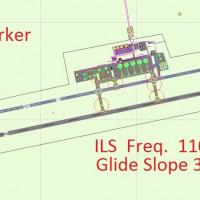
KMCH gains an ILS with MALSR approach lights and a VASI on Runway 30, and a working control tower is established on Mitchel AFB in New York. An NDB sits on the final approach at Babylon, BBN, frequency 275; tower and ground frequencies are 119.9 and 121.8, and a taxiway lighting glitch is fixed.

Country
United States of America
File Size
793.31 KB
Total Downloads
262
Star Rating
5/5
Screenshots
3
No image available.

Aeropuerto Almirante Padilla

By Anwar Gonzalez, the public airport near Riohacha, Colombia, carries the designation SKRH with IATA RCH and ICAO SKRH, operated by Aerocivil. It sits at 13 m elevation (43 ft) and at coordinates 11°31'34" N, 72°55'33" W, featuring a 1,760 m asphalt runway labeled 10/26 and supporting Avianca and Líneas Aéreas Suramericanas operations.

Country
Colombia
File Size
6.46 KB
Total Downloads
260
Preview screenshot

EGRA Cardington NAS Update

Two BMP files accompany this modification, R101.BMP and R101_LM.BMP, for the static R101 airship, alongside three BGLs—EGRA_ADEX_JM.BGL, EGRA_ADEX_JM_OBJ.BGL, and EGRA_ADEX_JM_CVX.BGL—for airfield layout data and objects. Hangar 2 doors are adapted for automatic opening and closing, and a future upgrade adds an elevated runway for mast-head docking, by John McKeon.

Country
United Kingdom
File Size
300.2 KB
Total Downloads
259
Star Rating
4/5
Screenshots
2
Preview screenshot

Simmons Army Air Field

An improved KFBG facility at Fort Bragg, NC, adjusts roads, aprons, and taxiways, adds military parking, replaces buildings, and includes static vehicles. Jim Cook provides alignment with the MAIW Simmons AAF AI package, uses two stock BGL files KFBG_AFX_JC.bgl and KFBG_JC.bgl, and relies on AirNav diagrams and mapping tools for accuracy.

Country
United States of America
File Size
15.74 KB
Total Downloads
258
Preview screenshot

VEPT Patna

VEPT Patna in India receives minor airfield improvements with hand-placed touchdown zones via the Lance Tucker library, featuring 500 ft bars and 1000 ft TDZ marks at each end, and PAPI relocated on both runways. It is designed for a base representation and relies on the rwy_mark.zip file for full TDZ realism.

Country
India
File Size
248.14 KB
Total Downloads
257
Preview screenshot

Pease AFB

Steve Hess changes the parking configuration at Pease International Tradeport (KPSM) in New Hampshire to mirror Pease AFB days, restoring a layout associated with the former base. The description notes the site in the region with the Pease heritage and its airport designation.

Country
United States of America
File Size
1.14 MB
Total Downloads
257
Preview screenshot

NL2000 V4.2 Heliports

By The Netherlands 2000 Design Team, this heliport expansion integrates with v4.2 modules, aligning heliport models to precise coordinates near hospitals, corporate facilities, and offshore sites across the Netherlands. Polygons and localized objects capture ground markings and boundaries, while approach lighting guides night operations.

Country
Netherlands
File Size
22.69 MB
Total Downloads
253
Preview screenshot

Oradea Airport

Oradea’s airfield in Romania (LROD) refines the stock layout by rebuilding buildings and adding paths that connect them to resemble the real site. It extends the field, adds traces of a former runway, and introduces a small second apron for very small GA parking, by Ana Gana.

Country
Romania
File Size
22.96 KB
Total Downloads
252
No image available.

RAF Halton

Located south of Aylesbury, Buckinghamshire, UK, RAF Halton hosts the RAFGSA Chilterns Gliding Centre along with the Halton AeroClub and Halton Microlight Club. The Virtual Flying Club team delivers this portrayal, credited to Jon Davidson, and captures the facility and its aviation activities.

Country
United Kingdom
File Size
3.82 KB
Total Downloads
245
Preview screenshot

Atlangatepec Air Force Base #19

MMTA auxiliary air base in the Mexican Air Force chain sits about 15 kilometers from Tlaxcala and carries TXA registration. It includes GMAX objects and photo-terrain, with modeling work by Omar Herrera G. and Omar Eduardo Herrera Galindo under SEMARV design.

Country
Mexico
File Size
10.85 MB
Total Downloads
244
Star Rating
1/5
Screenshots
3
Preview screenshot

BollingAFB/Anacostia NAS

This Washington-area add-on revisits Bolling AFB and Anacostia NAS after fixed-wing traffic ends in 1962 as Navy and Air Force operations shift to Andrews AFB. A file named AFX_KBOF_ALT.bgl is described as a Flatten file, and credits go to John Hawranick, Jr.

Country
United States of America
File Size
438.66 KB
Total Downloads
244
Screenshots
1
Preview screenshot

Scenery Fix For FVHA Harare Airport

Lee Marrow provides a fix for Harare International Airport, revising the FVHA1.ZIP file to restore missing buildings that were excluded by error. Within Zimbabwe, the adjustment corrects an inadvertent omission that left terminal and apron buildings absent in the prior configuration, and the revision is attributed to Lee Marrow.

Country
Zimbabwe
File Size
11.93 KB
Total Downloads
242
No image available.

Manitoba Floatplane Bases

A Manitoba floatplane network encompasses 55 bases, including 36 floatplane bases, 6 heliports, 13 airports or airstrips, plus 12 unlisted floatplane bases and outposts and 3 unlisted airstrips, spanning 649,950 sq km (250,900 sq mi) and hosting over 110,000 lakes, with 15 flights starting from unlisted bases by Mike Mann, based on internet data.

Country
Canada
File Size
4.39 MB
Total Downloads
240
Preview screenshot

Monterey Peninsula Airport Scenery V2 Update

KMRY, the airport in California, receives a v2 revision tied to MONTEREYAIRPORTKMRYVERSION2.ZIP, addressing two missing hangars and windsock animation issues. The fix responds to reports that the windsock appears oversized or the pole rests on the ground.

Country
United States of America
File Size
306.57 KB
Total Downloads
237
Preview screenshot

Dyess AAF Scenery V2

Version 2 adds aprons, parking spaces, taxiways, and other objects, while correcting runway markings at the site. Freeflight International Airport, previously Dyess Army Airfield, sits on Roi-Namur, Kwajalein Atoll in the Marshall Islands, secured an FAA ROI code and operates a 04/22 asphalt runway measuring 4,499 by 150 feet with an elevation of 10 feet.

Country
Marshall Islands
File Size
83.25 KB
Total Downloads
236
Screenshots
2