Page 69
Searches the whole library — filter by sim & category on the results page
KLIT Little Rock, Arkansas, is developed for SP2 compatibility using ADE, featuring gates aligned to current airline parking and jetways that are visible and functional. Cargo buildings with correc…
 United States of America
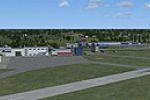
The ICAO designates the Netherlands site with the code EHKD, linking the location to official aviation identifiers. A graphic labeled dekooy3.gif accompanies the entry, providing a visual reference…
 Netherlands
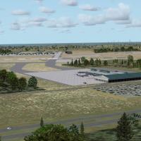
A freeware update by Art Poole retools KVPS in Florida to support mixed civilian and military operations with a newly modeled terminal, functioning jetways, dedicated gate parking, and realigned ta…
United States of America
Two BGL files, KIND_ADEX_CJH.BGL and KIND_ADEX_CJH_CVX.BGL, are designed with ADEX v1.47.07. They depict Indianapolis International Airport in Indiana as of 2010 and carry credit to Chris Homko, of…
United States of America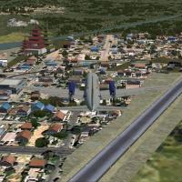
Gera Godoy Canova presents a Tibet layout that adds three real airports plus five non-existent ones, totaling eight airfields with the authentic sites placed roughly where they exist. A PLN file na…
 China
ChinaAnimated people and extra effects accompany the proper runway setup, while blast fences frame the approach and a new car park completes the field, all presented under the authorship of Harry Patten…
 United Kingdom
Nordholz Navy Airfield in Germany uses code ETMN, with civil EDMN nearby, and hosts a nearby glider field EDXN Spieka for gliders and small aircraft. The project is built with Airport Design Editor…
 Germany
An enhanced urban view of Taichung, Taiwan presents accurate 3D models of landmark structures, including Evergreen Laurel Hotel and Ren Yen Building at Feng Chia University. By Mike Huang and with …
 Taiwan, Province of China
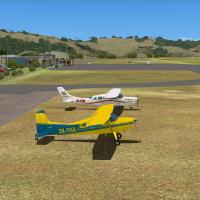
NZWR, the Whangarei-area airport in the Northland region, gains a custom addon designed to fit the photoreal base included with the VLC North Islands Airfields v1.2 from VectorLandClass. The projec…
 New Zealand
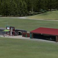
Located in the Bavarian Alps, Bad Endorf-Jolling (EDPC) in Germany presents Glider Objects by Wolfgang Piper and a rotating Windsock from FSDevelopers. The archive directs copying folders into the …
Germany
The 2011 edition for Fairbanks International Airport by Wilson Malone of AKFS Design revises runway numbers, GPS and ILS approaches, and adds new taxiways, floatpond visuals, and refined markings a…
United States of America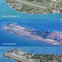
By Oliver Imperial, the work depicts the base and naval station with an accurate shoreline at SANGLEY POINT and the Cavite naval yard across Canacao Bay, while roads reflect actual traffic. It uses…
 Philippines
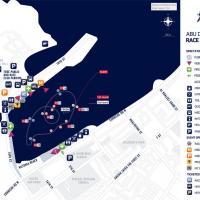
Creators Syscot Yves and Carlos Santos present a freeware enhancement that replicates the 2010 Abu Dhabi air race circuit near OMAD, with pylons, race gates, and other custom objects aligned to rea…
 United Arab Emirates
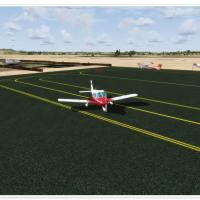
By Daniel Louvet, LFMA in southern France gains enhanced infrastructure with all buildings, precise taxiway markings, a glider area, and a heliport with a medical facility, while the control tower …
 France
By J. D. Starseed, this Bahamas region enhancement expands to ten airfields and introduces a new airport with ILS approaches, while maintaining stable frame rates. Individual BGL files appear, with…
 Bahamas
EGPN Dundee (Riverside) in Scotland receives a fictional expansion, updating the airfield with a 6000-foot runway 09/27 featuring ILS at both ends and enhanced surrounding landclass and coastlines.…
United Kingdom
An airfield identified by the code OAZI is created from scratch using an Afghan airfield diagram and photos. The layout includes helicopter parkings rendered as steel mats, reflecting the operation…
 Afghanistan
Five carriers with support sit about 80 nm north of McMurdo Station, awaiting arrival with rescuees on board. A refuel point exists at McMurdo, but pilots must locate it themselves, and three evacu…
 Antarctica
Anthony Lynch documents five airfields in and around the Snowy Mountains, including Cooma-Snowy Mountains YCOM, Polo Flat YPFT, Tumut YTMU, Khancoban YKHA, and Geehi, which has no ICAO. Most sites …
 Australia
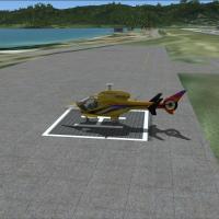
For the TNCM airport in the Netherlands Antilles, the add-on includes an ILS for runway 9, two helipads, an FBO building, and an enlarged turning point for runway 27. A single bgl file supports the…
 Sint Maarten (Dutch part)