Included in this category are all of the freeware-released scenery add-on files available on Fly Away Simulation that are compatible with the brand-new Microsoft Flight Simulator (MSFS) 2024 and 2020 release.
The image shows a Cessna 152 flying over Meteora Valley in MSFS.
This section is proving to be most abundant in terms of quantity of mods released so far, mainly due to the fact that scenery generation is a lot easier to work with than designing something such as an aircraft model. The SDK for MSFS is easy to work with and the creation process is very similar to previous versions of Microsoft's simulator packages. Also, there is an abundance of stock 3D buildings, objects, textures, and items that can be used around airfields, airports, and regions.
Some of the files covered in this section;
The add-ons are listed in order of date with the newest at the top of the page - however, you may change the order displayed by using the "Sort by" options below.
The file library is growing daily as new releases are announced for this brand-new simulator. Stay up to date by visiting this page often - it's updated regularly so it would be wise to bookmark it.
All of the files covered in this section are completely free to download and use.

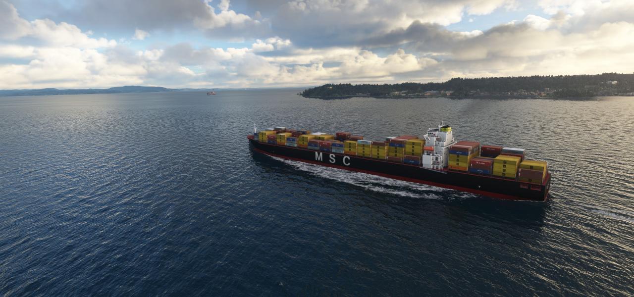
GAIST Ultra Version 6 broadens global maritime traffic with around 1,000 unique ship models and nearly 2,000 appearances, and expands routes to raise density across coastal and intercontinental lan…
 Global (World)
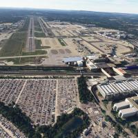
An add-on for flight simulation transforms Gatwick Airport (EGKK) by remodeling North and South Terminals and Pier 1, with high-resolution detailing and dynamic lighting, while adding enhanced grou…
 United Kingdom
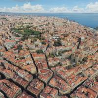
High-fidelity photogrammetry renders Lisbon’s architecture and riverfront with precise 3D detail, anchored by geographic coordinates 38°43'30.96"N, 9°9'0.07"W. The work relies on Lisboa Megapack v2…
 Portugal
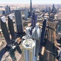
Risuali presents a freeware content enhancement that reworks Dubai and Jebel Ali Port, replacing more than 250 buildings and landmarks such as Burj Khalifa, Burj Al Arab, Dubai Frame, Stargate, and…
 United Arab Emirates
A faithful recreation captures the seven-building historic complex over Manhattan, with the Twin Towers and their plaza meticulously modeled. It uses COMP maps to control shine and reflectivity, de…
 United States of America
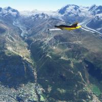
Haydn94 (Haydn Jones) delivers a Swiss-focused enhancement covering Bern, Geneva, Lausanne, Lucerne, Sion, and Zermatt, with new 3D building shapes and upgraded ground surfaces across these cities;…
 Switzerland
Captainfrag reworks NTTE atoll and continues upgrades since March 2021 to enhance realism and preserve local details. The arrangement is rearranged with an upgraded runway and resort, while The Bra…
 French Polynesia
Three folders named thalixte-malmo1, thalixte-malmo2, and thalixte-malmo3 contain the photogrammetry project for Malmö’s cityscape, using Google Maps imagery to render accurate 3D buildings and lan…
 Sweden
The 20-meter resolution DEM upgrade covers the entire country of Italy, including Sicily and Sardinia, with the ItalyDEM folder serving as the deployment container. Credits include DEM10 by TINITAL…
 Italy
Italy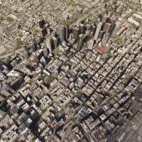
The add-on reintroduces Wilshire Grand Center and Metropolis Towers, restoring prominent downtown skyline elements. It adds authentic night lighting and introduces multiple helipads at the Ritz Car…
United States of America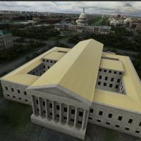
DC-area landmark compilation comprises more than 30 custom 3D landmarks, built with Blender and a Blender-based toolkit, using PBR shading for realistic rendering. Included sites span National Mall…
United States of America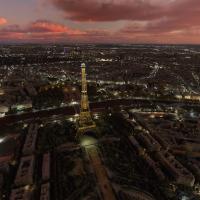
Thalixte includes five directories named thalixte-paris1 through thalixte-paris5, containing Paris area data from Google Maps and 3D elements credited to Google, generated via the Google Earth Deco…
 France
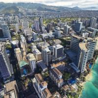
By steveli, this freeware area enhancement replaces the base representation for Honolulu and its surroundings with six parts, all included in one download, labeled Part 1 through Part 6. Honolulu a…
United States of America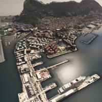
A photogrammetry-based representation of Gibraltar uses high-resolution imagery from Google Maps to create precise 3D models with GPS coordinates 36° 8? 24? N, 5° 21? 0? W. Version 1.1 addresses el…
 Gibraltar
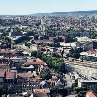
Version 3.0 by AndrianLScenery reshapes the Dijon, France area for the 2020 edition, using 19 cm per tile HD textures and revised terraforming data, and adds CHU Hospital Heliport while preserving …
France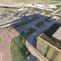
Two dedicated builds cover Inverness EGPE for the simulator’s 2020 and 2024 generations, featuring hand-crafted terminal and control tower, plus cargo structures such as Co-op and UPS. Landside con…
United Kingdom
Created as a freeware, in-progress scenery refresh for Microsoft Flight Simulator, this RAF Mildenhall (EGUN) package focuses on bringing the ramp and airfield layout closer to the character of the…
United Kingdom
JayFlySim delivers an extensive overhaul of Paris–Le Bourget (LFPB), updating terminals, taxiways, and signage to reflect Feb 2021 charts. It adds over 100 static clutter objects and aircraft, incl…
France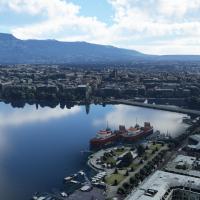
AdrianLscenery combines all parts of a Geneva area enhancement into a single archive, including the airport and Annemasse, plus northeast, southeast, and west sections. It uses photogrammetric grou…
Switzerland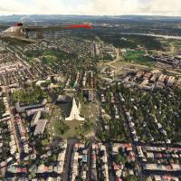
Two folders named thalixte-reykjavik1 and thalixte-reykjavik2 provide detailed Reykjavik urban imaging through high‑resolution photogrammetry, reconstructing 3D spaces from photographic data and de…
 Iceland