Page 86
Searches the whole library — filter by sim & category on the results page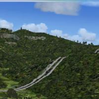
A file named CVX_SwissTunnels.BGL hides highways by placing them in tunnels, preventing streets from crossing mountains and altering how the terrain is perceived. Martin Rothenmund authors the work…
 Switzerland
The two-island focus, Tubuai and Raivavae, lie at the southernmost fringe of French Polynesia near the Cookie Islands. A 1m per-pixel resolution with LOD 15 defines its detail, and a simple runway …
 French Polynesia
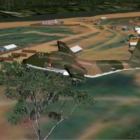
By Xavier Carré and Jacques Godfrin, this Gia Nghia location for a Vietnam War project combines photoreal ground texture with custom objects; the dirt airstrip measures 650 m by 25 m and supports F…
 Viet Nam
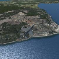
Located at LTBH in Turkey, the airfield and surroundings deliver VFR coverage with realistic autogen, landclass improvements, and photoreal components. By Sunay Kilic, it relies on grcoastlines.zip…
 Turkey
Coverage spans Pitcairn, Henderson, and the Ducie and Oeno atolls, with four fictional airports mapped as Ducie NJDC, Henderson NJHN, Oeno NJOE, and Pitcairn NJPI. Image detail is 1m per pixel, wit…
 Pitcairn
KTRI in Kingsport/Bristol, Tennessee receives a dedicated enhancement by Rob Touchtone, aligning gates and parking for Delta, US Airways, American and Allegiant, and adding a cargo ramp for civilia…
 United States of America
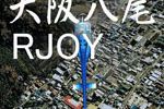
Kenichi Ochiai creates version 2.0 of the work bearing the RJOY Yao prefix, a two-part identifier that appears in the original designation. This second iteration strengthens the link between the li…
 Japan
Japan
KAUS in Austin, Texas, receives a refined arrangement of gates and parking that updates the overall layout while jetways remain visible and operable for seamless connections. Gates align with curre…
United States of America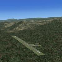
A northern and northeastern South Africa addition includes the Lowveld and regions near Kruger National Park, with terrain aligned to a 1m resolution for authentic placement. Creators Martin du Pre…
 South Africa
By Cesar Marinho, the freeware terrain refinement targets SBCJ and improves altitude accuracy by using SBCJ_FLATTEN.BGL to smooth surface inconsistencies and APX34340.BGL to synchronize airport dat…
 Brazil
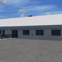
The MYER airport overhaul overhauls runway, taxiways, aprons and parking, adding custom objects and library placements with landclass changes near MYER. It relies on Google Earth imagery and Harrin…
 Bahamas
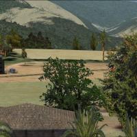
Lamidada airfield in Nepal, VNLD, receives an add-on that corrects aprons and adds taxiways and objects, improving the background to resemble real-world conditions. The older Magdeburg version (EDB…
 Nepal
Nepal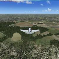
Chateau Thierry, identified as LFFH in France, presents photorealistic imagery and autogen, credited to Ludovic Benoit. Image assets include fsx1.jpg and fsx2_large.jpg, illustrating multiple views…
 France
Ray Smith delivers Kahului Airport enhancements, offering two variants that activate a crosswind runway alongside the primary one or retain a single-runway layout; files PHOG_ADE_CW_RS.BGL, PHOG_AD…
United States of America
An improved regional airport revision at White Plains, New York, adjusts aprons and relocates the terminal to avoid highways, and adds two moving jetways. Replaces most default buildings and adds p…
United States of America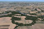
The Salem, Oregon depiction spans 163 square miles with night lighting, water features, and extensive autogen, and includes Independence State Airport as a residential airpark with houses beside ro…
United States of AmericaA rebuilt layout at the KDAY airport presents corrected gate assignments and parking codes, with movable jetways and terminal revisions aligned to operations, created with ADE9X. American Airlines …
United States of America
In the Lehigh Valley, Allentown/Bethlehem Airport, code KABE, receives an ADE-based layout with accurate parking for carriers and cargo operators. Jetways remain fully functional and respond to CTR…
United States of America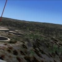
The Ota AB entry records BA2’s 1992 CFMTFA designation and notes that the aerodrome remains closed to air activity, with the 1940 inauguration part of its history, as documented in historical notes…
 Portugal
An island group in the Bay of Bengal receives enhancements with four new airfields and landclass updates across main towns; a naval base allows helicopter landings on a destroyer by the bay. Six fl…
 India
India