Page 105
Searches the whole library — filter by sim & category on the results page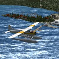
Ganges Harbour on Saltspring Island in British Columbia is recreated with default objects, featuring the Ganges Harbour Water Aerodrome (CAX6) and the Lady Minto hospital heliport (CAL7) with layou…
 Canada
VEPT Patna in India receives minor airfield improvements with hand-placed touchdown zones via the Lance Tucker library, featuring 500 ft bars and 1000 ft TDZ marks at each end, and PAPI relocated o…
 India
India
The ACLT airfield sits two minutes from the town center on land reclaimed from surrounding swamps along the western Atlantic coast of France. By Dominique M. L. Donzelot, it uses only existing elem…
 France
By Alan Blencowe, Shedman's object libraries supply 90 freeware models and include YPLP, Perth, and Langley Park in Western Australia, with BGL files provided for integration into existing layouts …
 Australia
KGON in Connecticut gains GA parking, two fuel trucks, and a RI National Guard area with static aircraft. Taxiways and signage undergo reconfiguration. Two BGL files support the changes, by Kyle Co…
 United States of America
A small airstrip lies in l'Enclave des Papes, in the south of France, nestled between a vineyard and olive trees along a quiet rural landscape. Jean-Pierre Kozerawski creates the LFNV designation, …
France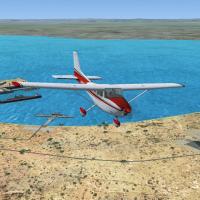
By Roger Leupold, the Garden Island project sits off the Western Australian coast near Rockingham, dating to April 2012. Aerial references align runways, helipads, and landmarks, while surrounding …
AustraliaIn Norway, the Kjeller area around the airport shows photoreal ground at 25 cm per pixel and requires KjellerX by Ulf H. Aass to operate correctly, with autogen density best set to Very dense or Ex…
 Norway
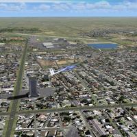
Brian Carlin creates version 4.2 for KMFE in McAllen, Texas, using two BGL components named KMFE_ADE_BCCRWe4_CVX and KMFE_ADE_BCCRWe4. This enhancement works with a terrain add-on and relies on ADE…
United States of America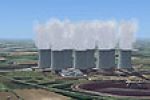
Lighting assets by Jim Dhaenens are built with GMAX and the SP-2/Acceleration SDK for a power-station setting, with STEAM.ZIP referenced. Lights wash the ground with a lit appearance from dusk to d…
 United Kingdom
Enhanced Lebanon Municipal Airport at KLEB updates taxiways and aprons, corrects building positions, relocates the tower, and adds static aircraft, parking with cars and light poles, plus a termina…
United States of AmericaKasama Airport, FLKS, sits 15 km west of Kasama, the provincial capital of Northern Province, Zambia, and Proflight Zambia uses it alongside private planes. Only runway 13/31 is in use, the surface…
 Zambia
Harold Crowell offers a freeware 3D model of the long span near Fayetteville, West Virginia, built with Abacus FSDS V3.5 and positioned with ADE by Scruffy Duck. A single .bgl file in a zip archive…
United States of America
By Hannes Steyn of Aeroworx, a set of dam walls across southern Africa provides reference points for VFR flying and improves regional visuals. It aligns with the Aeroworx mesh for Southern Africa, …
 Global (World)
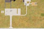
Oradea’s airfield in Romania (LROD) refines the stock layout by rebuilding buildings and adding paths that connect them to resemble the real site. It extends the field, adds traces of a former runw…
 Romania
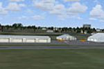
The terminal at Avon Park, designated KAVO, sits in central Florida as a SketchUp-built building. By Frank Watson, it serves as a temporary base for attendees of the 12 Hours of Sebring Gran Prix a…
United States of America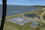
By The Netherlands 2000 Design Team, this heliport expansion integrates with v4.2 modules, aligning heliport models to precise coordinates near hospitals, corporate facilities, and offshore sites a…
 Netherlands
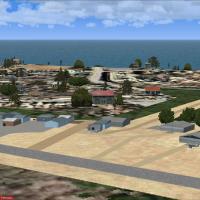
Paradise Beach in the Eastern Cape, South Africa hosts the Jeffreys Bay location used for airfield operations, produced from custom models and textures and credited to Jacques Botha. It includes a …
 South Africa
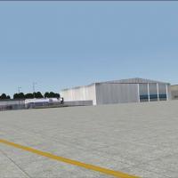
An update to Amenab Slade's 2004 project for the KPNE airfield adds four ramp lights named Quad, Dual, Single Floodlights, and a small Street Light, each illuminating at 180°, 90°, 45°, and 34°. Th…
United States of America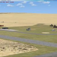
Namibia’s Luderitz Airport (FYLZ) presents a layout built with custom designed hangars and standard libraries. On final approach to runway 4, Kolmanskop ghost town sits to the left, a desert landma…
 Namibia