Page 49
Searches the whole library — filter by sim & category on the results page
Three ASR-9 radar configurations drive this lineup, including platforms with obstruction lights, a standalone unit, and a tower variant, plus two doppler radars differing by tower type. Maui, Hawai…
 United States of America
Seven Puerto Rico airports are covered, with two refreshed and five added, including TJIG Isla Grande, ABO Antonio Gery Juarbe Pol, Adjuntas PR20, Vieques TJVQ, Culebra CPX, Patillas X64, and Fajar…
 Puerto Rico
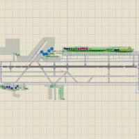
Ontario airport update by Mike Lyons adds gates and jetways to align with the real terminal, and modifies cargo ramps to reflect closer operations, while the core file, KONT_fsx_ml.bgl, remains req…
United States of America
KCLT in Charlotte, North Carolina gains an ADE-built modification that makes jetways visible and operable, revises gate assignments and parking, and adds a new control tower with a cargo terminal a…
United States of America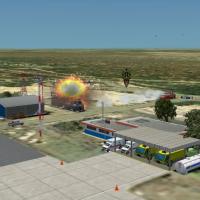
By David Maldonado, SVJC near Punto Fijo in Venezuela centers on Josefa Camejo International Airport and the Amuay refinery complex, the largest, with hourly transformer explosions and refinery smo…
 Venezuela (Bolivarian Republic of)
Philip Schall (PSDS) creates a freeware stadium model from a custom designed object and bases it on a photoreal base in Johannesburg. The representation relates to soccer events connected to the 20…
 South Africa
The setup runs on SP2 without Acceleration and targets NSFA in Samoa, while including a bonus upgrade for NSFI Fagali Airport. Credits go to Lawrie Roache, Godfrey Tier, and Robin Corn, while Fligh…
 Samoa
Samoa
Victor Pinto presents a PanamaFS-X complement that refines the Panama Canal area and adds the MPMG airport. A causewayfiller.bgl accompanies the PanamaFS-X complement and aligns with its structure,…
 Panama
Orly LFPO near Paris gains two BGL variants, one with a crosswind runway activated and one without. The changes renumber gates, animate jetbridges, assign parking with extra spaces, and rebuild sup…
 France
In and around Vancouver, several landable helipads appear, including three atop highrise buildings and others on waterfront docks, while ships and marinas populate waters mostly north of the city. …
 Canada
Kish Island, registered as OIBK in Iran, advances to version two, addressing a taxiway disappearing bug and developing approach lights and taxiway lights. The work is credited to Usof Kalantari, co…
 Iran (Islamic Republic of)
At EDDF in Germany, the EDDF_V3 version adds Terminal A Plus and pins ILS Z and ILS Y to RWY 07L-25R, reflecting up-to-date runways and taxiways as of January 2013, with gate signage indicating num…
 Germany
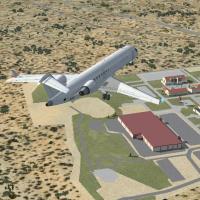
NAS Sigonella Mil centers Sicily, maps NAS I and NAS 2 areas, and moves runways 550 feet north to align headings. Google Sketchup models convert to .mdl from .dae, and the folder NASSigonella conta…
 Italy
Italy
By Shanard Letang, this upgrade of Rafael Nunez International Airport (SKCG) in Cartagena, Colombia uses mapping software to ensure correct parking and adds GA parking. It focuses on the Cartagena …
 Colombia
Majuro on PKMJ, Marshall Islands, features a runway and apron rebuilt in 1971 with upgrades completed by 2009. Two fire tenders join the existing fleet as part of 2007 improvements, and Chris Pesch…
 Marshall Islands
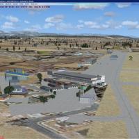
Payerne functions as Switzerland’s principal air base and hosts 10 to 16 F/A 18 C - D. Flight operations run daily except weekends, with hours 08h00 with 12h00 and 13h30 with 17h00 year-round for a…
 Switzerland
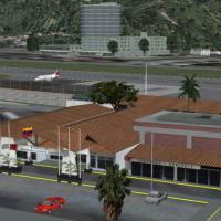
By David Maldonado, Merida's SVMD facility in Venezuela is modeled with a single 1640-meter runway measuring 60 meters in width, including security zones. It adds a terminal building, a control tow…
Venezuela (Bolivarian Republic of)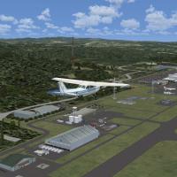
Ian W. delivers a freeware upgrade for Hiroshima (RJOA) near Mihara, about 50 kilometers east of Hiroshima, adding refined aprons, signage, and additional hangar clusters, with accurately positione…
 Japan
Japan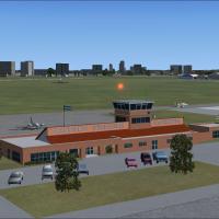
An airfield in Buenos Aires Province presents 1800-meter runways and 28 parking positions including refueling. Three hangars feature animated doors, and the project uses Gmax-built structures with …
 Argentina
UK location updates the Scillonian Islands airport at St Marys with animated people, a realistic terminal building, static aircraft, aircraft in repair on the appropriate side of the airfield, plus…
 United Kingdom