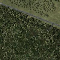
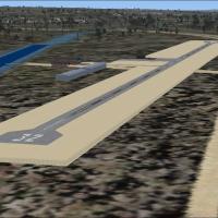
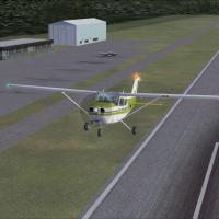
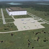
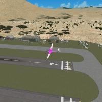
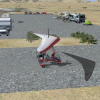
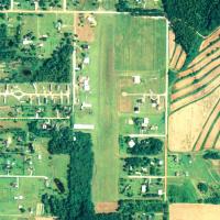
United States of America

Page 54

Sort
Reset
No image available.

Springfield

Springfield, Massachusetts receives a freeware FSX cityscape overhaul from Richard Kittredge, introducing precisely geo-referenced landmarks, autogen structures and tweaked landclass synced with Ultimate Terrain X data along the Connecticut River corridor. The package upgrades night lighting, road vectors and rooftop textures, delivering more believable VFR navigation across New England while maintaining default-like performance.

File Size
2.09 KB
Total Downloads
78
Preview screenshot

Bolivar Municipal Airport

Focused on M17 Bolivar Municipal Airport in Polk County, Missouri, this Flight Simulator X scenery pack adds bespoke GMAX buildings, static aircraft, apron clutter, accurate runway and taxiway markings, working ATIS, calibrated PAPI and field lighting, plus MyTraffic-compatible AI schedules, refining GA circuit training across mid-American skies.

File Size
386.37 KB
Total Downloads
77
Screenshots
7
Preview screenshot

Merritt Field

FSX Merritt Field (4PN7) overhauls the Eagles Mere, Pennsylvania grass strip into a paved 3,100-ft general-aviation runway, adding an apron, hangars, fuel pumps, static vehicles and aircraft, plus custom road vectors that align with default or UTX data while relying solely on stock object libraries for smooth integration.

File Size
3.96 KB
Total Downloads
77
Star Rating
1/5
Preview screenshot

Roy E. Gray Airport

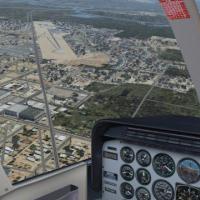
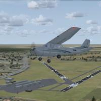
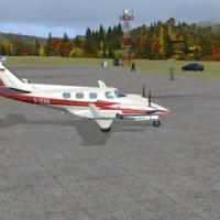
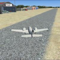
Roy E. Gray Airport (5R7) brings Bayou La Batre, Alabama, into FSX with a private airpark layout, hangar-homes, a resident Stearman, optional AI helicopter sortie paths via Heli Traffic, and blended ground polys tuned for Ultimate Terrain USA X, GEX, REX, MyTraffic X, and DirectX 11 rendering.

File Size
1.98 MB
Total Downloads
76
Screenshots
3
Preview screenshot

Fairgrounds Airpark Airport

Positioned in Big Horn County, Fairgrounds Airpark (F02) for FSX receives a scenery upgrade featuring full runway lighting arrays, published ILS, marked parking bays, service vehicles, and heli pads, delivering accurate AFCAD tweaks and realistic ground textures for general aviation pilots conducting VFR or IFR training circuits.

File Size
336.99 KB
Total Downloads
76
Screenshots
4
Preview screenshot

Willows-Glenn County Airport

FSX pilots browsing the United States scenery list will find this Willows-Glenn County Airport (KWLW) redevelopment handy: Northern California runways, taxiways and aprons shifted to true coordinates, ADE-crafted BGLs, default-library hangars, static ramp vehicles and refreshed landclass supply an accurate GA stop without taxing frame rates.

File Size
262.1 KB
Total Downloads
73
Screenshots
1
No image available.

Ohio Regional Airport

Covering Ohio Regional Airport (KORA) at Orrville, this FSX scenery add-on injects accurate runway profiles, updated taxiway layout, custom hangars, photoreal ground polys, dynamic night lighting, and optimised autogen blending with surrounding Wayne County farmland; designed for Microsoft Flight Simulator X users seeking precise GA operations and smooth AI traffic flow.

File Size
286.31 KB
Total Downloads
72
Preview screenshot

Martin Campbell Field Airport

Covering Martin Campbell Field Airport (1A3) in Copperhill, Tennessee, this FSX add-on scenery refreshes the GA strip with corrected runway 3/21 length, revised taxi linkage, updated lighting and local landclass aligning with Ocoee River valley terrain; built in Airport Design Editor for seamless pairing with Ultimate Terrain X, Active Sky, and high-resolution mesh—ideal for VFR approaches and short-field practice.

File Size
407.06 KB
Total Downloads
71
Screenshots
4
Preview screenshot

Farmington Regional Airport

Covering KFAM – Farmington Regional Airport in Missouri – this FSX scenery layer refines aprons, adds basic autogen structures, custom ramp lighting, and accurate runway markings that replace stock assets, giving GA pilots realistic pattern work conditions without heavy frame-rate impact; compatible with default mesh.

File Size
352.44 KB
Total Downloads
70
Star Rating
2/5
Screenshots
3
Preview screenshot

Alpine Airfield

FSX Alpine Airfield scenery refines this California back-country strip with corrected elevation data, sharper photoreal ground polygons, custom vegetation libraries, and precise runway geometry suited to STOL drills and VFR mountain circuits; Aaron Bennett’s freeware add-on enhances building textures, obstacle placement, and lighting, enabling realistic bush flying practice amid rugged Sierra terrain.

File Size
181.63 KB
Total Downloads
69
Screenshots
1
Preview screenshot

Tappahannock Airport

Pilots flying U.S. domestic GA hops can add KXSA Tappahannock-Essex County Airport to Microsoft Flight Simulator X with this lightweight scenery, which introduces an updated AFCAD, terminal model shaped from limited photo references, correct runway 10/28 geometry, VASI placement, aprons, taxiway lighting, and regional autogen blending.

File Size
125.29 KB
Total Downloads
69
Preview screenshot

Newton Airport

Newton Airport 3N5 scenery for FSX portrays the modest Sussex County airfield south of Newton, New Jersey, with geo-referenced asphalt, summer-only tree lines and a dusk-dark field suited to VFR circuits. Aligned to MegaSceneryEarth NY 005 imagery and leveraging EZ, RWY12 and OZx libraries, the package preserves terrain continuity, shows the lighted wind indicator and leaves the ramp fuel-empty by design.

File Size
6.28 MB
Total Downloads
68
Star Rating
5/5
Screenshots
21
Preview screenshot

Elbert County-Patz Field

FSX Elbert County-Patz Field (27A) brings Elberton, Georgia’s GA strip into sharper relief with corrected AFCAD data, detailed taxiways, photoreal ground polys, accurate runway edge lighting and environment cues tuned to Ultimate Terrain X, Ground Environment X and REX, ensuring smooth VFR patterns and AI traffic compatibility within the United States regional scenery library.

File Size
88.18 KB
Total Downloads
67
Star Rating
1/5
Screenshots
2
No image available.

Marlboro Airport (2N8)

This FSX add-on recreates the decommissioned Marlboro Airport 2N8 in Matawan, New Jersey, mirroring its 2002 closure with crossed-runway markings, stripped taxiways and open satellite-photo turf matched to MegaSceneryEarth NJ/DE 001. Suitable for low-level circuit drills on an abandoned strip, using only default assets to keep VAS overhead modest.

File Size
197.58 KB
Total Downloads
67
Preview screenshot

Riverside Airport

Riverside Airport (4B2) for Microsoft Flight Simulator X and FSX:Steam Edition recreates the long-gone general-aviation strip wedged between I-90 and the Erie Canal near Rome–Utica, New York, restoring its 3,500-ft asphalt runway, 10,000-ft seaplane lane, mechanic-school ramps and surrounding topography via custom AFCAD, flatten data and targeted library calls.

File Size
330.81 KB
Total Downloads
67
Screenshots
1
Preview screenshot

Salton Sea Airport

Created for Microsoft Flight Simulator X, Salton Sea Soaring Club (SSC1) drops a fictional glider strip into the arid basin between Borrego Springs and the Salton Sea, California, delivering custom airfield objects, accurate desert landclass, thermal-friendly weather data and optimized AFCAD for VFR sailplane training and sightseeing hops.

File Size
477.96 KB
Total Downloads
65
Screenshots
5
Preview screenshot

HE Production Facility

Maine’s fictional KHEP HE Production Facility add-on for Microsoft Flight Simulator X (FSX) installs a 50-storey aircraft manufacturing complex, 8 million ft³ in volume, 20 nm northwest of Bangor, USA, complete with illuminated single-runway layout, signed taxiways, ILS, ATC frequencies, plus companion KHES “HE Supply” airstrip 30 nm south for virtual aviation pilots.

File Size
4.56 MB
Total Downloads
64
Screenshots
11
No image available.

Trinca Airport

Trinca Airport 13N scenery for Microsoft Flight Simulator X (FSX) depicts the 2,636-ft grass runway southwest of Andover, New Jersey, featuring bespoke hangar models, geo-referenced with Google orthoimagery and tuned to align with MegaSceneryEarth NY 007. Day-VFR only, no fuel, windsock on field—suited to light GA training and bush flying.

File Size
863.89 KB
Total Downloads
63
No image available.

El Mirage Field

El Mirage Field (99CL) scenery refreshes the Mojave Desert airstrip with photo-real ground imagery, adjusted elevation mesh, custom dirt runway markings and matching autogen for compatible FSX SP1/Acceleration setups, aligning smoothly with MegaSceneryX Southern California; ideal for short-field practice, glider tows and low-level VFR hops across the High Desert.

File Size
14.17 KB
Total Downloads
63
Preview screenshot

Steve's Airpark X

FSX rendition of Steve’s Airpark X (3AZ4) brings Quartzsite, Arizona’s private desert strip into Microsoft Flight Simulator X with tailored ground polys, photoreal terrain, corrected elevation, custom hangars and sparse-desert vegetation, offering an authentic VFR entry point for backcountry sorties across the American Southwest; supports AI traffic, night lighting and ADE-corrected parking.

File Size
1.04 MB
Total Downloads
63
Screenshots
4