Page 51
Searches the whole library — filter by sim & category on the results page
KMSV Sullivan County International for Microsoft Flight Simulator X overhauls this upstate New York field with repositioned aprons, accurate taxiway geometry from AirNav data, rebuilt hangars and t…
 6.73 KB
 100Nov 2011
 1/5
1/5
Upstate New York gets fuller treatment with this freeware FSX add-on, rebuilding Geneva on Seneca Lake’s north shore with photoreal shoreline vectors, custom autogen, marinas and small-airfield obj…
2.37 MB100Nov 2011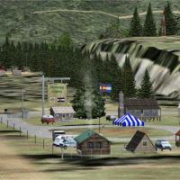
Targeted at bush flyers running Microsoft Flight Simulator X or FSX: Steam Edition, the Nutmeg Cabins Update introduces a corrected .bgl file that properly tags the rustic lodge scenery as Colorado…
134.03 KB100Nov 2011 1
1
Napa County Airport KAPC in northern California receives a reworked AFCAD, built with Airport Design Editor, mapping real-world taxiway geometry, runway offsets, apron edge lines and coded parking …
10.42 KB99Jun 2012Truckee–Tahoe Airport KTRK in California gains a new AFCAD by Clear Sky Simulations, adjusting runway profiles, taxiway vectors, stand coding and localizer alignment for Microsoft Flight Simulator …
16.17 KB99Jun 2012Updated ADE for KSNA John Wayne–Orange County Airport refines the default FSX layout with accurate ramp assignments, reinstated Gate 4, animated jet-bridge logic, rebuilt ground service routes, ext…
18.12 KB99Jun 2012
Covering KMYV Yuba County Airport in Marysville, this FSX scenery add-on realigns runway 5/23, revised taxiways and GA parking with high-resolution satellite references, inserts ADE-compiled BGL te…
300.73 KB99Nov 20112/51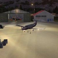
Morgan County Airport (42U) for FSX refreshes this Utah GA strip with photoreal ground textures, precise apron geometry, static Cessnas, ground-service vehicles, and calibrated night lighting that …
358.37 KB98Feb 20123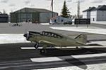
Marlboro Airport (9B1) for FSX refreshes this Massachusetts general-aviation strip with re-profiled aprons, corrected taxiway geometry, custom hangars, roadside scenery, plus regionally accurate ba…
6.6 KB98Dec 20111/5Slidell Airport (KASD) drop-in BGL scenery update for Microsoft Flight Simulator X deletes two fictitious ramp structures and adds the post-2007 1,000-ft runway extension, aligning pavement geometr…
4.85 KB97Jul 2012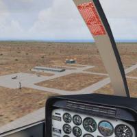
FSX Benson Municipal Airport (E95) brings this Cochise County desert GA field to life with updated runway edge lighting, positioned hangars, custom objects, animated people and accurately placed bu…
306.89 KB97Feb 20122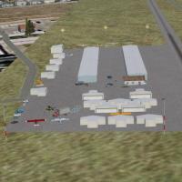
FSX add-on scenery for La Cholla Airpark 57AZ, a private GA field northwest of Tucson, refreshes the desert strip with EZ/RWY12 library assets, aligned runway/taxiway data, re-positioned hangars, a…
193.87 KB97Feb 20121/52Rotorcraft crews over New York’s Hudson Valley can drop into Haverstraw Heliport (H43) with this scenery upgrade for Microsoft Flight Simulator X, crafted from high-resolution satellite data and ou…
1.83 MB97Feb 2012Covering the 3,594-ft asphalt runway at Old Bridge Airport 3N6 in central New Jersey, this Microsoft Flight Simulator X scenery enhancement aligns precisely with MegaSceneryEarth NJ/DE photoreal te…
1.61 MB95Feb 2012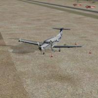
Hay Fever Farm CO59 brings FSX users a small Galeton, Colorado high-plains strip with custom library objects, matching the real farmstead layout against Ultimate Terrain USA landclass and FS Genesi…
308.71 KB95Feb 20126Covering 75 acres near Berlin, New Jersey, this FSX rendition of Camden County Airport (19N) aligns with MegaSceneryEarth NJ textures, presenting grass and asphalt tiedowns, lit wind indicators, se…
943.91 KB95Feb 2012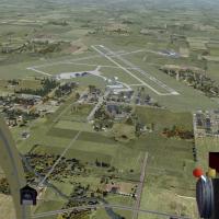
Marion Municipal Airport (KMNN) scenery for FSX restores the real-world dual-runway configuration by reopening 07/25, aligns hangars and terminal buildings with stock library assets, and adds PAPI …
747.3 KB95Dec 20118FSX rendition of Cobb County–McCollum Field KRYY refreshes the default airport with a post-renovation 6,305 ft concrete runway widened to 100 ft, realigned localizer, expanded GA parking on north a…
9.18 KB95Dec 2011
Fictional KJOU Journey International brings a brick-paved ramp layout, 111 gate positions plus dedicated cargo stands to your FSX United States region, complete with calibrated ILS beams, default A…
316.36 KB93Feb 20131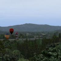
Covering Martin Campbell Field (1A3) near Copperhill, Tennessee, this FSX add-on introduces custom ground polys, accurate runway 2/20 lighting, functional ILS and ATIS frequencies, plus surrounding…
329.48 KB93Jan 20125