Page 50
Searches the whole library — filter by sim & category on the results page
Supplement KHOB Lea County Regional Airport in FSX with a practical cargo apron and hangar footprint tailored for freight ops at Hobbs, New Mexico; this scenery add-on supplies custom building geom…
FSX / Microsoft Flight Simulator X scenery add-on for Skyhaven Airport KDAW in Rochester, New Hampshire delivers redrawn aprons, corrected taxiway geometry and access roads, plus hand-placed GA han…
Katie's Lagoon is a fictional floatplane base (MTKL) on Flathead Lake, Montana, for FSX seaplane and bush pilots; this scenery add-on provides cabins, marina, helipad, visible water runway starts, …
This FSX add-on plants a detailed Fantasy Island recreation along Pennsylvania’s Susquehanna River, complementing Selinsgrove scenery with a compact GA strip, dockside water operations, photoreal g…

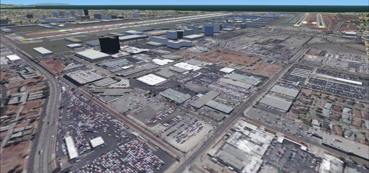
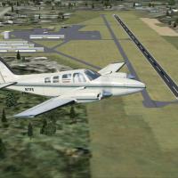
This revised AFCAD file for Austin–Bergstrom International Airport (KAUS), Texas, refreshes the default FSX/P3D layout with aligned jetways to present charts, additional GA parking, a dedicated car…
KUWL New Castle-Henry County Municipal Airport scenery updates Microsoft Flight Simulator X with a faithful runway 9/27 profile, calibrated taxiway geometry, GA ramp spots and Midwest VFR reference…
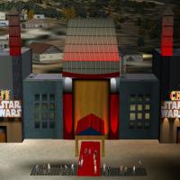
Hollywood Boulevard’s iconic Grauman’s / Mann’s Chinese Theatre is replicated in this FSX landmark add-on, supplying high-resolution textures, custom 3-D geometry, animated night lighting and accur…
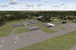
FSX Desert Military Base extends the United States desert portfolio with a compact tactical airfield at Conner (14CL), introducing a baked-sand runway, revetments and helipads suited to STOL props,…
Sunrise Beach Airport (2KL) scenery for FSX injects a grass-strip airfield on Lake LBJ into Microsoft Flight Simulator’s default Central Texas terrain, adding hangars, nearby tree lines, approach o…
This FSX freeware scenery refreshes Skypark Airport KBTF in Bountiful, Utah with custom 3-D vehicles, static GA aircraft, apron personnel, photoreal ground textures and updated ramp lighting, match…
In northwestern Pennsylvania, this FSX freeware brings back Splane Memorial KOIL, a long-closed Oil City airfield, with ADE-built layout, 2,000-ft paved strip, vintage taxiways and ground polygons …
Blairstown Airport 1N7 for FSX recreates this 151-acre private field southwest of Blairstown, New Jersey with precise GA parking, turf glider staging south of runway 07/25, operational 100LL pump, …
Illinois GA flyers get a practical upgrade with Kevin Burns’ Bolingbrook Clow Airport scenery mod for Microsoft Flight Simulator X; hand-placed hangars, helipads, static GA traffic, georeferenced f…
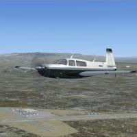
Reworking University Airport (KEDU/0O5) on the edge of Davis, California, this Microsoft Flight Simulator X add-on corrects runway 17/35 geometry, resizes aprons, retouches taxi-edge lines and inse…
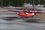
Bush pilots looking for a tight strip in Alaska will find Grizz's Cabin—a short dirt runway east of Talkeetna—ideal for STOL practice in Microsoft Flight Simulator X (FSX). This freeware scenery do…
Council Bluffs Municipal Airport (KCBF) gains an updated ADE profile for FSX that re-numbers runways 14-32 and 18-36, extends the 5500-ft asphalt strip, refines taxiway geometry with edge lighting,…
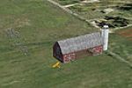
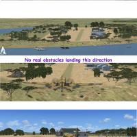
This U.S. scenery add-on for FSX positions a classic barnstorming obstacle just southeast of Whidbey Island NAS (KNUW), supplying a pass-through barn, static spectator crowds, and an improvised air…
Covering KWVI Watsonville Municipal Airport, this freeware FSX scenery by Phillip Coyle redraws taxiways, parking stands and runway thresholds from recent satellite surveys, compiled in ADE and pac…
KMSV Sullivan County International for Microsoft Flight Simulator X overhauls this upstate New York field with repositioned aprons, accurate taxiway geometry from AirNav data, rebuilt hangars and t…
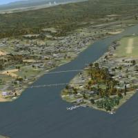
Upstate New York gets fuller treatment with this freeware FSX add-on, rebuilding Geneva on Seneca Lake’s north shore with photoreal shoreline vectors, custom autogen, marinas and small-airfield obj…