Page 33
Searches the whole library — filter by sim & category on the results page
KBKL Burke Lakefront Airport for FSX adds Cleveland’s shoreline airfield to U.S. Midwest scenery with hand-built SketchUp structures, photo-real facades, ramp clutter, static GA traffic, helipad, a…
FSX freeware rendition of Everglades Airpark (X01) in Collier County, Florida delivers custom hangars and terminal models blended with stock library objects, placing the 29-acre general aviation st…
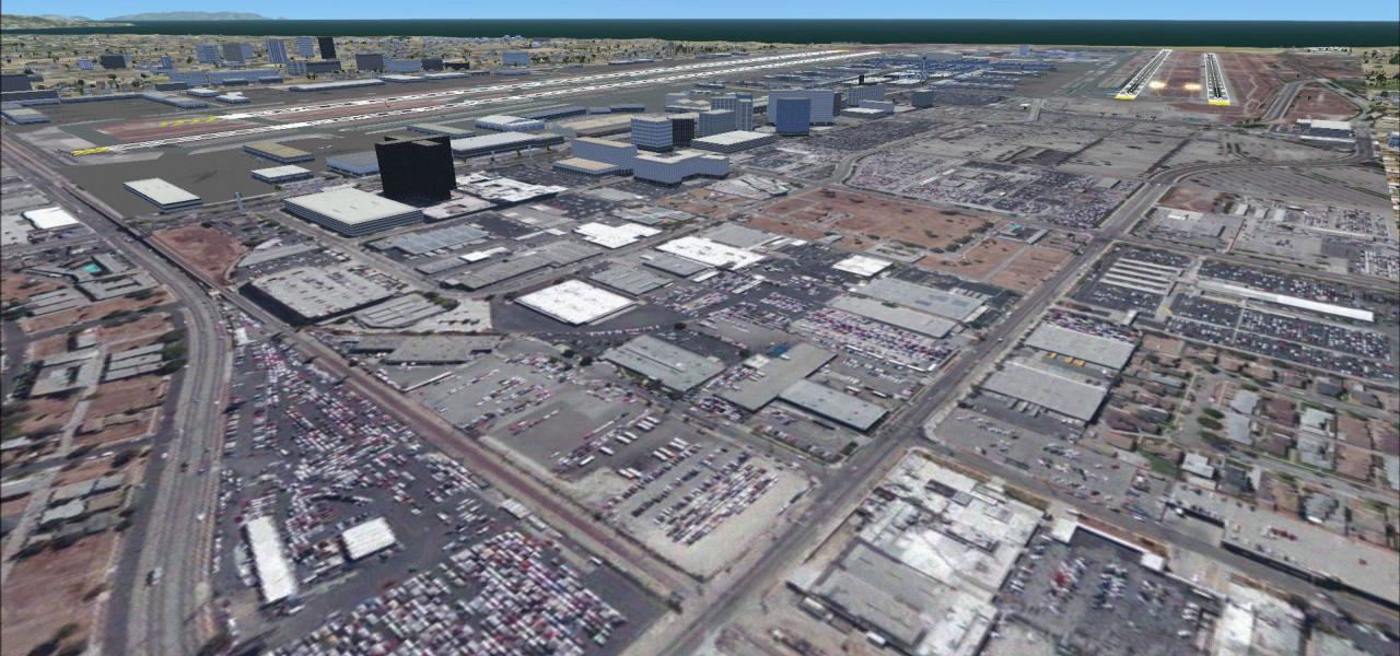
Specialised update for Microsoft Flight Simulator X models Seattle–Tacoma International Airport (KSEA), adding the post-construction third runway, revised plateau earthworks, accurate AFCAD taxiway…
Sulphur Creek Ranch Airstrip brings a remote Idaho backcountry STOL strip to FSX, adding tailored autogen, a 4,400-foot turf runway profile, refined landclass placement and precise default-mesh ali…

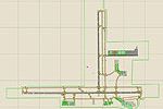
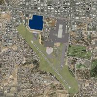
Rochester International Airport KRST for FSX refines the AFCAD with correct gate numbering, updated airline codes, aligned parking stands and accurate ATC designations, bringing Minnesota’s primary…
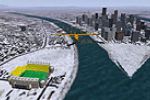
Heinz Field, PNC Park and the now-vanished Mellon Arena anchor this Pittsburgh stadium pack for FSX; each landmark has been re-geolocated for Ultimate Terrain X, giving VFR flyers accurate Alleghen…
Danbury Municipal Airport (KDXR) for FSX receives an updated AFCAD, aligning taxiway geometry to satellite data, refining signage, adding GA stands, helipads, LOC runway holds, and a bespoke segmen…
Clearwater Airpark (KCLW) for Microsoft Flight Simulator X gains a useful overhaul with corrected taxiway alignment, refined apron edges and custom hangar stock drawn from Airport_Buildings_AP, plu…
Focused on the United States Pacific Northwest, this scenery enhancement expands Orbx PNW around Jefferson County International (0S9) for Microsoft Flight Simulator X by injecting fresh BGL layers:…
Placing a fictional Nimitz-class deck a few miles off KLAX, this FSX BGL scenery crafted with Instant Scenery positions a static carrier group and Blue Angels 1–3, offering VATSIM or offline flyers…
Pilots seeking reliable naval ops in the Pensacola sector will appreciate this FSX carrier scenery fix, replacing legacy CV-71 assets with a streamlined CV-69 task-group placement 20 NM south of KN…
FSX Project Lubbock 2008 refreshes Lubbock Preston Smith International Airport (KLBB) in West Texas with updated AFCAD gate coding, corrected runway 17R/35L dimensions, revised taxiway signage, imp…

Covering Westover Air Reserve Base / Metropolitan Airport (KCEF), Springfield–Chicopee, Massachusetts, this freeware Microsoft Flight Simulator X scenery update refines the default United States ai…
Otis ANGB (KFMH) scenery for Flight Simulator X provides a revised layout of this Cape Cod, Massachusetts military airport: corrected runway thresholds, realistic taxiway fillets, new fire-station …
Covering tree-lined Tieton State Airport (4S6) in Washington’s Cascade foothills, FSX Birds Vol. 6 adds animated birds, refreshed photoreal textures by Adam Mills, moored boats, a lighthouse and an…

Wilkes-Barre/Scranton International (KAVP) airport enhancement for Microsoft Flight Simulator X SP2 refreshes the stock airfield with updated AFCAD data, precise stand numbering, animated CTRL-J je…
KCOS City of Colorado Springs Airport scenery for Microsoft Flight Simulator X (FSX) integrates a fresh AFCAD layout, populating every terminal position with real-world gate numbers and airline cod…

Old Rhinebeck Aerodrome NY94 scenery for FSX and FSX:SE refreshes the upstate New York turf field with period hangars, dirt access roads, vintage static vehicles, perimeter fencing and corrected ru…
Released February 2007, this FSX-native v1.0.2 scenery models the West Concourse at Dallas Love Field (KDAL), Texas, reproducing Southwest’s gate layout, jetways, apron lighting and precise taxiway…
FSX users seeking a South Texas hub will find this ADE-compiled v3.2 upgrade of McAllen Miller International (KMFE) delivers satellite-aligned geometry, corrected taxiway routing, refined ground po…