Page 35
Searches the whole library — filter by sim & category on the results page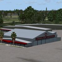
Covering Jacksonville’s Craig Municipal Airport (KCRG), this FSX scenery refines the airfield layout, recreates the Craig Air Center FBO and service apron, aligns runways, taxiways and approach lig…

Spanning Barbers Point Harbor to the Electric Beach power station on Oahu’s leeward coast, this FSX autogen layer for MegaSceneryX Honolulu populates PHJR with static US Navy airframes, helicopters…
Ghost Airports Collection – Pennsylvania for FSX revives 46 long-closed Keystone State airfields—among them the freshly modeled Clarion Rhea strip—with new fuel pads, corrected road vectors, and re…
Adding Middletown, Connecticut to an FSX library injects New England’s Connecticut River corridor with photoreal ground textures, precise shoreline vectors, hand-placed autogen, and custom objects …

FSX rendition of Greater Binghamton Regional Airport (KBGM, New York) refreshes the default field with revised aprons, realigned taxiways, updated service roads, a scratch-built terminal sporting a…
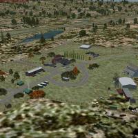
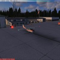
FSX rendition of Kistler Ranch (08CL) places a 2,000-ft dirt strip and summer-camp outbuildings west of Jamestown, California, at 981 ft MSL, with custom ground polys, regional autogen and accurate…
Sky Harbor Airport KDYT scenery for Microsoft Flight Simulator X revises this Duluth, Minnesota shoreline strip with updated aprons, realistic taxiway routing, replacement stock structures, enlarge…
Refines Ocala International / Jim Taylor Field (KOCF) in Florida by enlarging general-aviation parking, realigning AFCAD positions, adding the northern hangar complex, perimeter roads, lighting, st…
China Lake’s KNID Naval Air Weapons Station in California receives a revised AFCAD layout for FSX, adding accurate ramp geometry, military parking stands, and optimized taxi routing for Military AI…
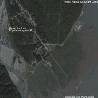
Targeted scenery update for Microsoft Flight Simulator X refines Hyder Seabase 4Z7 in Alaska, adding default-library dock assets, a usable parking gate for floatplane starts, and an optional set of…

Offshore scenery add-on introduces three Gulf of Mexico oil rigs—Lafayette (KLFO, NDB 477 kHz), Galveston (KGLO, 396 kHz) and Corpus Christi (KNGO, 391 kHz)—registered as GPS-capable heliports in F…
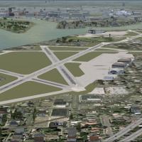
Portland International Jetport KPWM in Maine receives a pragmatic overhaul with this Microsoft Flight Simulator X AFX upgrade, introducing properly aligned jetways, authentic gate and cargo stand a…
Long Island MacArthur (KISP) AFCAD revision for FSX default scenery refines apron geometry, enables crosswind runway operation, aligns taxiways to current Jeppesen charts, adds coded airline gates,…
This Microsoft Flight Simulator X scenery for Aspen–Pitkin County/Sardy Field KASE applies Google-Earth-matched geometry across runways 15/33, taxiways, and GA parking, injects stock library assets…
FSX users focusing on U.S. Pacific Northwest hops will find this Bremerton National Airport (KPWT) scenery handy, adding custom GMAX structures, detailed hangars, updated AFCAD parking, accurate ta…

Covering Illinois’ Aurora Municipal (KARR) and Greater Kankakee (KIKK), this FSX freeware add-on drops custom EZ-Scenery objects, photoreal surfaces and tailored AI traffic onto 6,500-ft and 5,979-…

Built for Microsoft Flight Simulator X, this KBMI Bloomington–Normal scenery addon refreshes the Central Illinois Regional Airport with an updated AFCAD file, precise airline gate allocations, oper…
FSX pilots will find Washington DC’s riverfront Bolling Air Force Base and adjacent Anacostia Naval Air Station reopened in this Microsoft Flight Simulator X scenery add-on by John Hawranick Jr., f…
Positioned at 6,752 ft in the San Bernardino Mountains, this Microsoft Flight Simulator X scenery add-on brings Big Bear Airport (L35) alive with photoreal ground imagery, refined terrain mesh, cus…

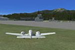
Truckee–Tahoe Airport (KTRK) for FSX refreshes this Sierra Nevada plateau airfield with Google-Earth-aligned taxiways, corrected thresholds, stock-library hangars, weathered apron detail and ADE-co…