Page 49
Searches the whole library — filter by sim & category on the results page
Auburn Municipal Airport (KAUN) for FSX recreates this Sierra Foothills GA hub with corrected runway geometry, revised taxiway links, accurately sized aprons and default object placement keyed to G…

Practical AFCAD update for KMHT–Manchester-Boston Regional Airport brings revised taxiway geometry, corrected gate assignments and enhanced apron detailing for FSX users exploring New Hampshire air…
Covering rural Wadesboro in North Carolina, this FSX-ready Anson County Airport (KAFP) package places the 2008 configuration in the sim, showing the 5,500-ft 16/34 asphalt runway, full-length paral…
Low-key and precise, this AFCAD update for Kenneth Copeland Airport (4TA2) in Fort Worth, Texas, USA refines default FSX scenery with corrected runway geometry, fresh aprons, discrete parking stand…
Subtle taxiway and apron revisions bring Charles M. Schulz–Sonoma County Airport (KSTS) up to date in FSX through an AFCAD rebuilt with Airport Design Editor; corrected hold-short nodes, re-sequenc…
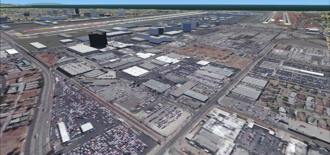
Las Vegas’ KLAS gains a pragmatic facelift for Microsoft Flight Simulator X: optional BGL sets unlock crosswind runway ops, extend vehicle roads to GA ramps, add Southwest gates, refine taxiway lin…
FSX J-B Golf Scenery situates a short grass strip behind a public golf course in Farmington, California, east of Stockton in the San Joaquin Valley. This U.S. add-on delivers accurately georeferenc…

Covering Penn Valley Airport (KSEG) near Selinsgrove, Pennsylvania, this FSX add-on updates runway and taxiway geometry, corrects lighting, syncs the AFCAD with current FAA data, and layers in Susq…
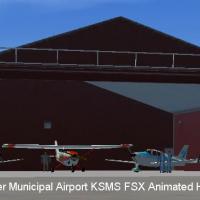
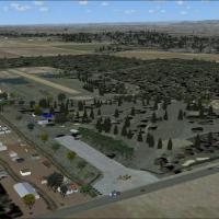
South Carolina’s KSMS Sumter Municipal arrives in Microsoft Flight Simulator X with Instant Scenery-placed hangars, custom signage, corrected navaids, a 5,500-foot asphalt primary runway, refined t…
Quakertown Airport (KUKT) scenery add-on for Microsoft Flight Simulator X refreshes the Bucks County GA field with realigned aprons, extended taxiways, revised hangars, service roads and scattered …
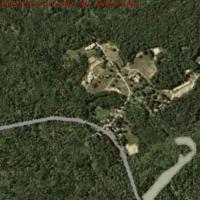
This FSX 4-Seasons Photo Texture scenery add-on for North Branch, Antrim, New Hampshire, United States slots a .bgl photoreal layer over the disused Hawthorne College grounds, carving a realistic c…
Flying W Airport (N14) scenery plants Lumberton, New Jersey’s 3,500-ft hard-surface runway and pool-shaped apron into Microsoft Flight Simulator X, matching parking pads, tie-downs and dual 100LL/J…
This freeware patch realigns Airglades Airport (2IS) inside the MegasceneryEarth Florida-014 photoreal tile, removing the duplicate runway anomaly and restoring proper coordinates near Clewiston. B…
FSX rendition of Saratoga County Airport (5B2) in Saratoga Springs, New York brings revised aprons, corrected runway markings, extra GA stands, custom parking lots, stock-library buildings and stat…
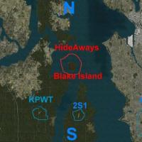
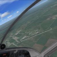
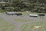
Targeted at MSFS X pilots touring the Pacific Northwest, this Blake Island, Washington scenery patch removes the invisible tree wall obscuring runway 15, inserts sharper landclass, hand-placed coni…
KUUU Newport State Airport scenery for FSX enhances this non-towered Rhode Island strip with an upgraded AFCAD, accurate taxiway geometry, wind tee, fuel bowser, extended GA ramp spots, updated bus…
FSX pilots exploring South Dakota can slot this Madison Municipal Airport (KMDS) enhancement into their scenery stack for a detailed GA hub featuring custom structures, illuminated grass strip edge…
Mountain View Airport KMNF, set amid the Ozarks foothills of Missouri, brings Microsoft Flight Simulator X (FSX) pilots a refined general-aviation strip with hand-placed hangars, people models, PAP…

FSX flyer traffic into KHTO benefits from this East Hampton, Long Island upgrade: revised taxiway geometry via current satellite data, updated general-aviation stands, operational fuel trucks, four…
Springfield–Lebanon Airport 6I2 scenery for Microsoft Flight Simulator X refreshes this Kentucky general-aviation field with redesigned aprons, correct taxiway centerlines, updated AFCAD stands, a …