Page 32
Searches the whole library — filter by sim & category on the results page
FSX pilots browsing the United States directory will find KGGB, a fictional Golden Gate Bridge Airport for California, placing twin Runway 27 thresholds (water and concrete) beside San Francisco Ba…

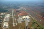
Covering KELP—El Paso International Airport in Texas—this Microsoft Flight Simulator X airport scenery AFCAD add-on supplies accurate airline-specific gates, updated parking codes, and corrected ta…
Ported from the FS2004 build, KBTR Beta for Microsoft Flight Simulator X installs Baton Rouge landmarks—State Capitol tower, Cortana Mall, Exxon petro-chemical plant—and animated Mississippi River …
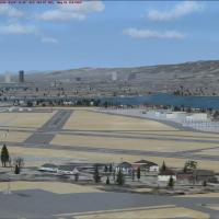
Mojave Spaceport for Microsoft Flight Simulator X adds the California desert test hub with static fire engines, parked bizjets, derelict airframes in the famous bone-yard, animated ground staff and…
Author Dusty Bizub revises New York’s Westchester County Airport (KHPN) for FSX with a refreshed AFCAD: real-world gate numbers, updated terminal lettering, aligned stands, adjusted ramp profiles a…
Nevada’s Tonopah Test Range (TNX) scenery for Microsoft Flight Simulator X refines the desert airfield with proper MIL-spec ramp parking, custom landclass, added perimeter roads, accurate elevation…
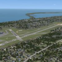
FSX scenery update for Erie International Airport / Tom Ridge Field (KERI) in Pennsylvania lengthens runway 6-24 to about 8,350 ft, tweaks edge lighting, portrays the offset parallel taxiway and co…
KPWT Bremerton National Airport refreshes a Washington State airfield for Microsoft Flight Simulator X; this download ports Mark Smith’s noted FS2004 scenery, incorporates an ADE-generated AFCAD, r…
FSX scenery add-on refines California’s Central Coast corridor, updating Santa Barbara (KSBA), San Luis Obispo (KSBP), Vandenberg (KVBG) and five other fields with revised AFCADs, animated night-li…
Hagerstown Regional Airport KHGR scenery for FSX offers a thorough revamp: reshaped aprons, corrected taxiway geometry, a 6 000-ft runway extension, relocated control tower, dedicated Allegiant Air…
Naval Air Station Brunswick (KNHZ) gains extended aprons, cargo- and combat-coded stands, upgraded tower, and native-asset buildings in this FSX add-on for the United States scenery collection. Sta…
Hunter Army Airfield (KSVN) at Fort Stewart, Savannah, Georgia gains a thorough FSX overhaul with expanded MIL_COMBAT stands, twin firehouses, revised taxiway geometry, relocated tower, fresh hanga…

Extensive AFCAD overhaul for Des Moines International Airport KDSM in Iowa adjusts runway dimensions and overruns, activates DME on ILS 13, assigns real-world airline codes to jetway gates, expands…
Revision 2 of the California Central Coast FSX scenery refines terrain mesh and airfield geometry across eight coastal airports, adds repaired AFCAD layouts, resolves texture flicker, and layers 99…
Covering Maryland Airport (2W5) at Indian Head, this FSX-native enhancement places a detailed 3,740-ft asphalt runway, real-world taxiways and custom aprons just 15 miles south of Washington, D.C.;…
KHSV Huntsville International–Jones Airport, Alabama, gains an ADE-generated AFCAD upgrade mirroring the July 2008 FAA charts, featuring a 228-foot replacement control tower, new taxiway L for heav…
Covering 22 general-aviation strips across eastern Kansas, this FSX add-on for Microsoft Flight Simulator X refines runways, taxiways and NDB data for sites such as Clay Center (KCYW), Beech Factor…
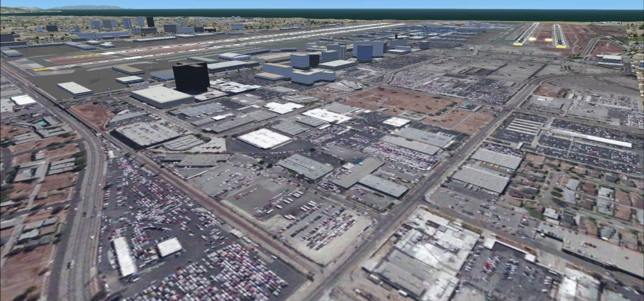
Covering KOAK in California’s Bay Area, this FSX-specific scenery installs rebuilt terminal geometry, aligned jetways, dedicated cargo aprons, GA T-hangars, accurate gate coding and night lighting …
FSX rendition of Flying Cloud Municipal Airport (KFCM) near Minneapolis delivers a 5,000-ft extended runway, updated taxiway geometry, south ramp build-out and correctly scaled hangars, supplying G…
Bolton Field (KTZR) for FSX refines this Scioto Valley GA reliever with ADE-crafted AFCAD data that aligns taxiway geometry, FAA charts and recent satellite imagery; the scenery adds a relocated te…