Page 28
Searches the whole library — filter by sim & category on the results page
FSX scenery add-on positions the Battlestar Galactica Rag-Tag Fleet just off Honolulu International PHNL, supplying static yet landable meshes of support vessels including Flattop, Colonial Defende…

For FSX pilots charting the United States Hawaii region, this freeware rework of Hana Airport PHHN refines runway/taxiway footprints to FAA data, injects geo-referenced default objects, adjusts CVX…
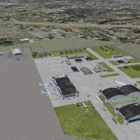
Enhances the stock FSX layout of Naval Air Station Mayport, Florida (KNRB) by adding expanded Military_Combat stands, updated aprons and taxiway links checked against AirNav charts and Google Earth…
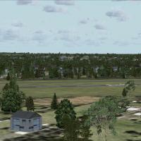
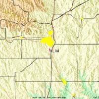
FSX Landclass for Santa Barbara replaces default Flight Simulator X terrain with refined land-class data and autogen, positioning UCSB, Goleta, Montecito and KSBA structures per sectional charts; h…
A deliberate FSX refresh for Tweed New Haven Regional (KHVN), Connecticut, introduces a custom .bgl AFCAD with true-to-chart gate layout (1-3, 2a/5, Part 135 stand), revised terminal geometry, func…
Palm Springs International Airport KPSP for Microsoft Flight Simulator X receives Version 2 AFCAD tuning: refreshed RNAV‐RNP charts, STARs, departure procedures, an optional curved “pseudo-ILS” pat…
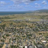
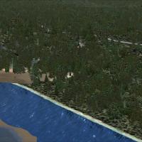
Covering Rochester, New York’s Lake Ontario shoreline, downtown skyline and KROC approach corridors, this FSX add-on inserts custom autogen, updated landclass and accurately placed POIs such as the…
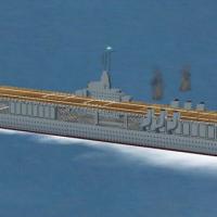
This FSX SP2-native static rendition of pre-war aircraft carrier USS Ranger (CV-4) anchors just south of Long Beach Harbor, California, presenting an exact-scale hard deck, animated radar, rotating…
KFAT Fresno Yosemite International AFCAD for Microsoft Flight Simulator X updates the stock airport layout with accurately positioned cargo bays, extra general-aviation tie-downs, defined helicopte…
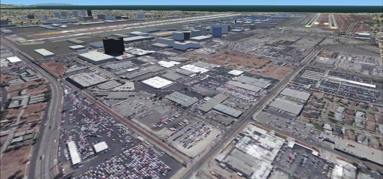
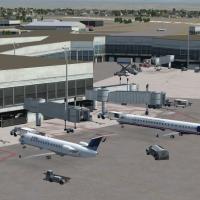
KSNA AFCAD v1.1 refines John Wayne Airport, Orange County for FSX, incorporating 2010 terminal allocations, corrected taxiway geometry, TUSTI LDA transition on 19R, refreshed SID/STAR nav-data, car…
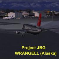
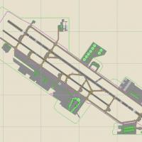
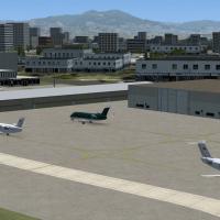
Wrangell Airport PAWG Alaska for Microsoft Flight Simulator X refreshes the default airfield with revised aprons, realistic terminal buildings, ramp vehicles, people libraries and static aircraft, …
KGNV Gainesville Regional for FSX refreshes Florida flying with custom terminal geometry, corrected AFCAD data, photoreal textures, revised landclass, and a local object library that integrates wit…
Flight Simulator X users gain a precise visual refresh of Lawton–Fort Sill Regional Airport, ICAO KLAW, Oklahoma, through this freeware scenery add-on; Rwy12 and EZ-Scenery libraries introduce tail…
Mobile Downtown Airport KBFM for Microsoft Flight Simulator X modernises this United States Gulf Coast hub with revised AFCAD geometry, photoreal ground polys, balanced night lighting, custom termi…

KSAC Sacramento Executive Airport v2 refines the default FSX airfield with corrected taxiway geometry, accurate GA ramp spots, and removal of the stray beacon at the south fuel farm; compiled via A…
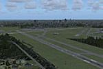
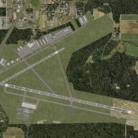
This FSX flight-simulator scenery for Piedmont Triad International (KGSO), North Carolina updates the AFCAD with realigned taxiways, accurate links to freight-dedicated Runway 5L, repositioned taxi…

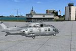
FSX “Updated Carrier Group Oceana v2” plants a double-carrier task force 12 nm northeast of NAS Oceana, Virginia, complete with functional arrestor wires, deck-parked SH-60s, dual LOC/DME beacons (…
This FSX AFCAD update for Fort Lauderdale–Hollywood International Airport (KFLL) revises runway designations to current FAA magnetic headings, improving ILS capture, SID/STAR conformity, ATC phrase…

Realigns Wilson Lake, Big Goat Lake and the adjoining Wilson River to proper geo-coordinates in Flight Simulator X, widens the channel and applies legacy waterclass, giving floatplane pilots a prac…
Copalis State Airport S16 for FSX renders the United States’ only ocean-beach airfield, providing a 4,500-ft tidal sand runway on Washington’s Pacific shore from the Copalis River to basalt rocks n…