Page 17
Searches the whole library — filter by sim & category on the results page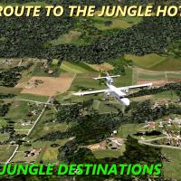
Pilots use a Trislander to fly to lodgings in Guatemala: Three Owls Jungle Inn for two nights and El Tesoro lodge for one, priced at 2500 Euros from a European capital. A route map file HOTLES.JPG …

Flight plans spanning the Odyssey Dawn period cover 18–30 March 2011, with the broader operation lasting 19–31 March 2011. Created with Tim Arnot's Plan G and designed for multiplayer use, two .bgl…
By Gera Godoy Canova, the EXPEDITION TO PIT-01 variant centers on transporting a scientist team to Canaima, Venezuela, referencing a 1934 gold mine discovery and the mine entrance near a lagoon. It…

An ARNZ X option centers on the default Cessna 208B and includes ATC and pilot/copilot voices. It requires specific skins to function, such as Lifeflight for King Air 350, Air New Zealand for Boein…
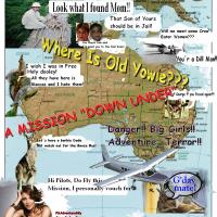
From Melbourne, the expedition unfolds across Australia with an episode sequence of three, of which the first two, AdventureSky-Australia Yowie-Start and Episode1-To the Mountains, are available no…
Ed Olander presents a scenario starting at Burwash and ending at Yakutat Airport, using the AugustaWestland EH101 helicopter, with four to five goals depending on choices, including timely engine s…
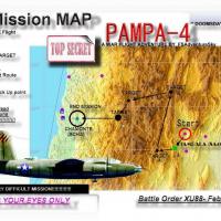
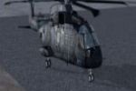
By Gera Godoy C, the PAMPA-4 operation centers on a Martin B-26, dated February 1944, and includes a hhiker.zip download along with a .bgl file for the project. Flight instructions stress map-based…
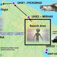
Three new airports in Russia, designated UHX1, UHX2, and UHX33, appear in the scenario, created by Gera Godoy C. The .bgl files are used, referencing Siberian radar activity and ground ozone observ…
Beijing marks the starting point as you pilot for Dr. Laura Berlotti, Prime Atomic Scentist, to inspect several hot atomic plants. A tiny camera arrives with a note urging photographs, and the rout…
Set in Naples, Italy, the Ala Littoria service traces the 1937 Water Port inauguration and includes two stops along the route. By Gera Godoy C., it presents two start modes—a standard flow and a co…
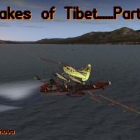
Chapter II surveys three Tibetan lake-area projects in the Roof of the World, authored by Gera Godoy Canova. It notes the Hung-Ku experimental station and Bukalam Airport, and provides a navigation…
An adjustment fixes a July 1995 flight plan location on the Barton leg toward Cardiff, and Andrew Webb provides all files in the main directory. Two variants exist to match England and Wales visual…
Roussillon Aero Simulation delivers a Maldives-based air race scenario using the Extra 300 and rated as medium difficulty. The Maldives locale, combined with the aircraft, highlights a measured pac…
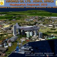
Kirongo Oil Ltd conducts a two-location trek using a default Cessna 208, though any STOL may operate. Thunderstorms form near a large lake while grass landing fields serve the company sites; a dire…
Two planes including pilots from the operator take part in the Mongolia adventure, and the operator activates the MONGO-TEMP.BGL file in the Addon Scenery/Scenery Directory. Temple Flight Instructi…
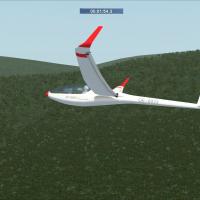
A 130 nm gliding race unfolds over Reunion Island in the Indian Ocean, by Mathieu O'Hare. Reunion Island anchors the route, and Mathieu O'Hare serves as the credited author, tying the course to a s…

Set near Pallasco in the central Honduran mountains, this Mayan Curse adventure centers on a pilot hired to fly an eminent professor and his two female assistants to the site, with an emergency str…

Set in September 1941, War Tide follows Joseph Cappirotti of Islands Airways as he scouts Indonesia–Malaya for two radar stations and a submarine base, written by Gera Godoy C. It includes .bgl fil…
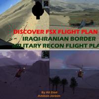
A squadron based at Kirkuk Air Force Base in northern Iraq conducts border patrols and reconnaissance along the Iraqi-Iranian frontier, while navigating valleys and ice-capped mountains at low alti…
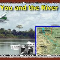
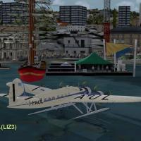
Dutch pilot Aafke Gruttzen flies along the Usumasinta River, a waterway marking the Mexico-Guatemala border, from Tenosique in Mexico toward a Guatemalan oil refinery deep in the river basin. EL-RI…