Page 6
Searches the whole library — filter by sim & category on the results page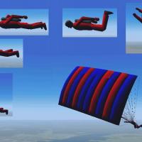 Base Model
A man maintains stable control from high altitudes, then switches to a Parafoil for landing, a transition implemented with FD and design adjustments by Tom Goodrick, as seen in the accompanying ima…
Version 2.1 of the autoland gauge provides hands-off autoland capability for all airliners, with a compact 198kB footprint. Martyn Becker adapts and amends the original XML programming by Nick Pike…
Nick Needham's gauge and effects system senses terrain contact or flight over diverse surfaces and adapts prop and rotor wash dust and water effects accordingly. It responds to dirt, dry mud or cla…
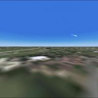
By Thomas Moger, multiple effects for aircraft appear in this file, and a graphic named Shootingstar.jpg is included to accompany the content. The author is identified as Thomas Moger, reinforcing …
 Base Model
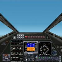
By Thomas B. Beard, the X-Wing Red 5 model tunes to the T-65AC4 specifications, with original aircraft copyright (c) 2001. The T-65 X-Wing Panel v.2.0 with gauges depicts the cockpit interface and …
 Base Model
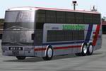
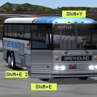
Mitsuya Hamaguchi crafts a bus model that includes a driving cabin and interior. The maker, Mitsuya Hamaguchi, is credited with these elements, establishing a concise, factual summary of the item.

Strobe lights on all aircraft flash together by default globally, a uniform behavior. By adjusting several default effects, this synchronization loosens and the lights flash randomly, yielding a ma…
 Base Model
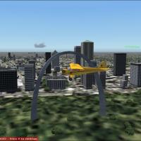
A comprehensive option provides 5000 flightplans of geese in V formations at various altitudes with worldwide coverage, operating as AI from invisible airports and avoiding disruption to airport op…

An edited halo.bmp light delivers sparkly illumination around airport lights. By Mark Poole, this adjustment alters the halo.bmp asset to refine its appearance, preserves the halo.bmp asset as the …
An in-flight kneeboard provides quick access to the Net during long flights, offering a simple way to stay connected while airborne. The image SchShts_002.jpg accompanies the kneeboard, with height…
 Base Model
Version 2 marks a two-seat alien fighter with a battle-scarred airframe and a virtual cockpit. It includes an air.file upgrade for smoother flights, an opening canopy, retracting transport rings, g…
The software reads default BGL, LWM, and VTP files and generates mesh data, land and water maps, and photo outputs, along with LWM masks, Flattens, VTP polygons and lines, Exclude Regions, Exclusio…
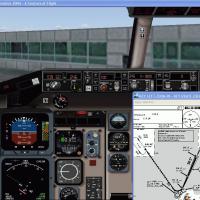
Version3.0 expands a stand-alone utility for flight simulators that stores airport charts and displays them on screen during flight. It creates new charts, prints all procedure charts, and supports…
By Timothy Metzinger, a version 2 guide for the B737NG outlines advanced operations under the PMDG label. The concise reference emphasizes practical procedures and system-level guidance for the air…
An aircraft editor lets users add or edit variants and Hangar management lets them handle add-ons off a live installation. LAN View enables virtual cockpits with multiple views, and a Logbook track…
63 variants by Michael Dohetry consolidate into one file, with Philip Wilson handling the compilation. An accompanying DDDA.jpg image provides a visual reference, linking the creators and the colle…
 Base Model
A fictitious half-scale single-seat research aircraft based on the Convair Model 49 VTOL concept presents a compact configuration for technical exploration. Its lineage ties to that Convair VTOL id…
 Base Model
The Greyhound bus model by Mitsuya Hamaguchi lets users drive the Greyhound MCI MC-12, a design rooted in an early Greyhound type. Greyhound Lines began service in 1914, linking intercity routes an…
The F-136B concept jet accelerates to Mach 4.57 and relies on hybrid engines that switch to rocket propulsion through a closing iris that forms a rocket bell. A second optional airfile is less powe…
 Base Model
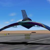
Four ID4 Destroyer ships hover over New York, London, Midway, and Prague, creating an aerial tableau. Each destroyer contains two airports, one on the tower roof and one inside the beehive, alignin…