Page 112
Searches the whole library — filter by sim & category on the results page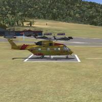
LFYS Sainte Leocadie in the Pyrenees hosts an aero club for GA alongside a military helicopter school with numerous landing pads. By Dominique M.L. Donzelot, it uses existing objects, stays small w…
 France
An ILS approach at El Yopal Airport, by Juan Carlos Cancelado R, sets a 110 9 frequency for SKYP's procedure. The addition notes incompatibility with Colombia Xtreme Sceneries, since the whole airp…
 Colombia
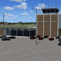
Jackson County-Reynolds Field (KJXN) in Michigan receives an update with a terminal, a tower, and revised taxiways and signs to mirror the prototype, while a fenced parking area with cars and light…
 United States of America
Anchorage, Alaska hosts 01EF, Elliott Field, a mountain-bound site that creates a demanding takeoff and landing. Two runways stay in use, featuring an asphalt strip while a water strip uses water p…
United States of America
Barbuda Upgrade fixes a fault in the sound effect for the Barbuda component, with BARBUDA.ZIP delivering the corrected audio. Creator Valladier Jean Louis labels this effort; a user unpacks Barbuda…
 Antigua and Barbuda
An airstrip on the Isle of Vella Lavella in the Solomon Islands, dating from 1943, is a work by Weygantt Kurt and honors VMF 214 of the Black Sheep Squadron. The airstrip is no longer in use.
 Solomon Islands
Andreas X9AN on the Isle of Man appears with core files Andreas X9AN.bgl, cvxAndreas.bgl, and a primary BGL. It documents RAF operations from 1941 to 1945 and notes reliance on Runway12 assets and …
 Isle of Man
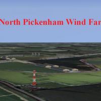
Neil Birch creates this wind-farm depiction for Neil's Microlights, located near Swaffham in Norfolk, United Kingdom. It emphasizes the rural wind-energy site and its link to Neil's Microlights in …
 United Kingdom
Bar-le-Duc at LFEU in France receives a patch that requires the LFEU_FSX.ZIP, fixes altitude discrepancies that occur with non-default meshes, and reduces wind turbine light sizes. It includes read…
France
Six airports in the Persian Gulf populate the roster, featuring Abumusa, Bandar Lengeh, Khark, Lavan, Sirri, and Jask among the sites, and parking fixed to improve layout, a credit attributed to Pe…
 Iran (Islamic Republic of)
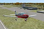
A refined layout at Barnstable Municipal Airport KHYA adds GA parking, replaces several buildings, and moves the tower while introducing static aircraft and vehicles as filler objects. Two files, A…
United States of America
Felix Fernandez de Castro presents an Asturias-focused realism kit for LEAS, adding three jetways and parking for GA and airliners. Three Cant_01, Cant_02, Cant_03 files revise Cantábrico Coast reg…
 Spain
SpainSamana Airport, also known as El Catey, sits in the Dominican Republic, and Kelvin Rafael Perez is listed as the author of this work in the present catalog. The designation anchors the location and…
 Dominican Republic
Richard Kittredege delivers HartfordCT.bgl, a focused urban enhancement with unique building placements and a detailed downtown grid that mirrors Hartford's real-world form. It covers significant l…
United States of AmericaRAF Bicester, located in Oxfordshire, UK, is modeled with hangars and a tower contributed by Ted Andrews, with Jon Davidson as the creator. A known ADE bug places the apron too deep in front of the…
United Kingdom
EHLE Lelystad Airport in Flevoland is modeled to integrate with NL2000 v4, featuring the main runway, taxiways, aprons, and surrounding structures faithfully placed. The modular design lets users s…
 Netherlands
Jaime Ortega delivers an SVPR airport enhancement featuring a redesigned terminal, a working control tower, a fire station, and dedicated heliports alongside the Caroní and Orinoco rivers. Jetways …
 Venezuela (Bolivarian Republic of)
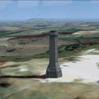
Hardy Monument rises as a 22-meter octagonal tower in Dorset, owned by the National Trust and staffed by volunteers from April through September, with AGL fixed to zero in the XML to sit atop any t…
United Kingdom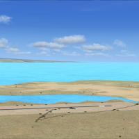
An airstrip designated FLKY sits near Nsumbu National Park on Lake Tanganyika in northern Zambia, created by Bashir Ismail and identified as variant v1. Its layout relies on the FLKY.bgl and FLKY_c…
 Zambia
A private seaplane facility near Jacksonville, Florida, identified as 0FL8, adds seaplane docks and a medium and a small marina and incorporates an ADF/NDB beacon (339.00, 40 NM range). ADE 1.50 po…
United States of America