Our selection of scenery enhancements and mods which include complete new airports, reworked airports based on the default, ground terrain, photoreal scenery, and fixes. Also included are reworked cities, towns, and buildings. This section seems to be the first to be expanded as the freeware developers are concentrating more on scenery at the moment as they are easier to work with the current SDK information available.

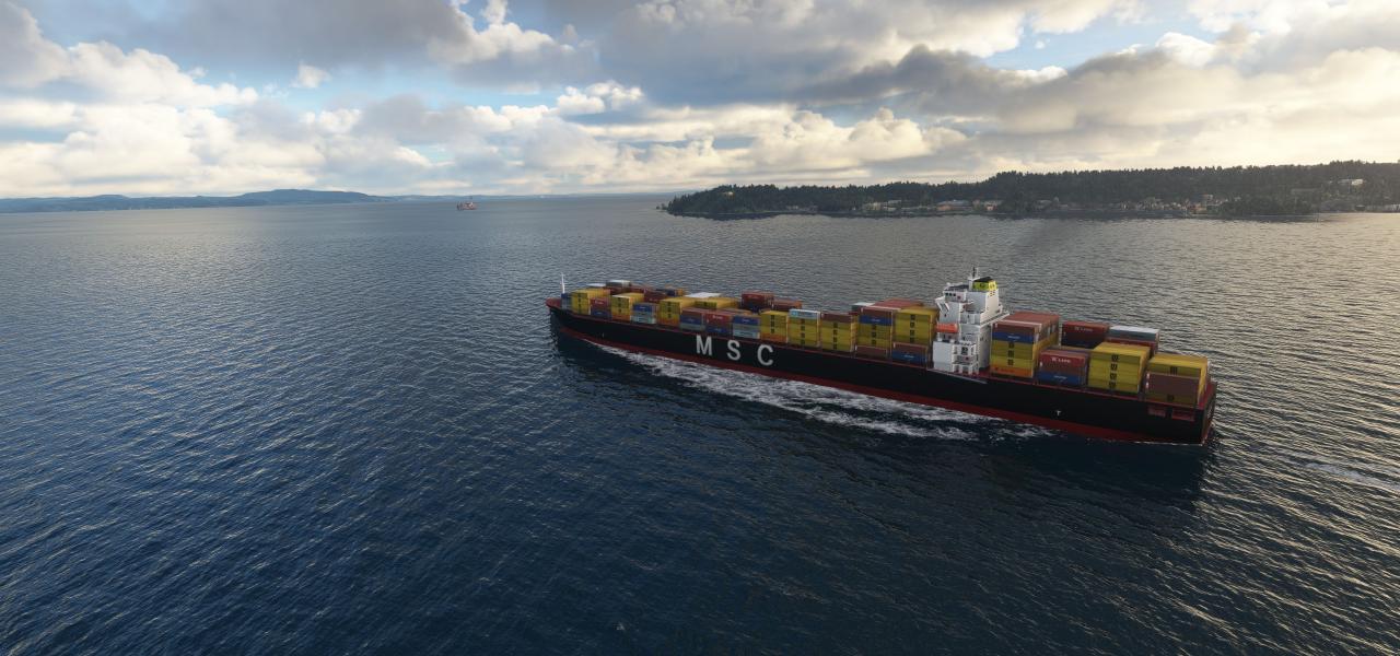
GAIST Ultra Version 6 broadens global maritime traffic with around 1,000 unique ship models and nearly 2,000 appearances, and expands routes to raise density across coastal and intercontinental lan…
 Global (World)
A faithful recreation captures the seven-building historic complex over Manhattan, with the Twin Towers and their plaza meticulously modeled. It uses COMP maps to control shine and reflectivity, de…
 United States of America
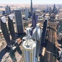
Risuali presents a freeware content enhancement that reworks Dubai and Jebel Ali Port, replacing more than 250 buildings and landmarks such as Burj Khalifa, Burj Al Arab, Dubai Frame, Stargate, and…
 United Arab Emirates
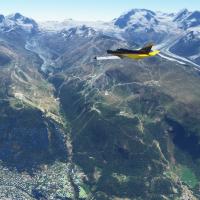
Haydn94 (Haydn Jones) delivers a Swiss-focused enhancement covering Bern, Geneva, Lausanne, Lucerne, Sion, and Zermatt, with new 3D building shapes and upgraded ground surfaces across these cities;…
 Switzerland
The 20-meter resolution DEM upgrade covers the entire country of Italy, including Sicily and Sardinia, with the ItalyDEM folder serving as the deployment container. Credits include DEM10 by TINITAL…
 Italy
Italy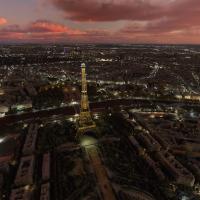
Thalixte includes five directories named thalixte-paris1 through thalixte-paris5, containing Paris area data from Google Maps and 3D elements credited to Google, generated via the Google Earth Deco…
 France
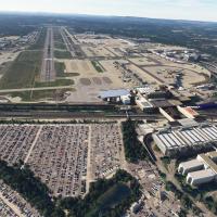
An add-on for flight simulation transforms Gatwick Airport (EGKK) by remodeling North and South Terminals and Pier 1, with high-resolution detailing and dynamic lighting, while adding enhanced grou…
 United Kingdom
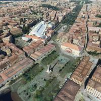
Camiba delivers a substantial enhancement of Lisbon and its surrounding districts, featuring landmarks such as Ponte 25 de Abril and Torre Vasco da Gama, plus terraforming, custom lighting, and AI-…
 Portugal
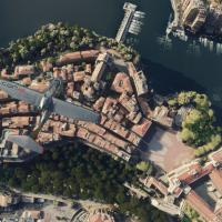
A Monaco photogrammetry project centers on a 2.1 square kilometer area, delivering highly accurate 3D representations of Monaco's urban cores and the Monte Carlo Casino. The archive thalixte-monaco…
 Monaco
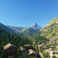
NikPrist delivers a complete overhaul of the Matterhorn Mountain, now at version 2.0, with four LOD levels and four modal areas to boost performance at distance and when viewed from certain angles.…
Switzerland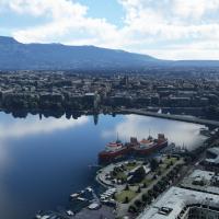
AdrianLscenery combines all parts of a Geneva area enhancement into a single archive, including the airport and Annemasse, plus northeast, southeast, and west sections. It uses photogrammetric grou…
Switzerland
Steveli recreates Prague’s entire urban area using newer photogrammetric data, with 3D building models and enhanced color corrections that raise detail to LOD20. A single download contains five par…
 Czechia
Expanded photogrammetry, via thalixte-larochelle, covers La Rochelle with updated colorimetry, including La Pallice harbor and Les Minimes marina, while improved road traffic, procedural lighting, …
France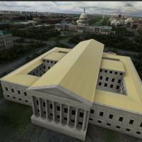
DC-area landmark compilation comprises more than 30 custom 3D landmarks, built with Blender and a Blender-based toolkit, using PBR shading for realistic rendering. Included sites span National Mall…
United States of America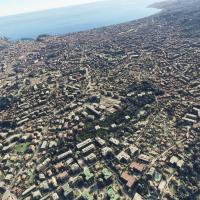
Thalixte delivers a rendition of Nice, France, using external map data and hand-finishing for precision, with enhanced 3D building models along the Promenade des Anglais and Monaco to the east not …
France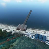
Keith Hackett and Kevin Base lead a hand-crafted, manually placed series of UK piers, created without AI or automation. Saltburn pier features animations and night lighting and overrides the ORBX G…
United Kingdom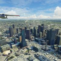
Thalixte implements an enhanced Dallas area upgrade, incorporating more autogen and a Globe Life Field 3D model near the AT&T Stadium, with 5m height maps for precision. The scope encompasses airpo…
United States of America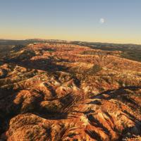
Jeppeson2001 delivers a Bryce Canyon area expansion, organized into three regions represented by folders BryceCanyon_FairylandPoint, BryceCanyon_InspirationPoint, and BryceCanyon_RainbowPoint. The …
United States of America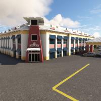
KFXE shows custom-modeled Administration Building, presenting a meticulous representation. Enhanced lighting around key structures and a freeware add-on using the latest SDK accompany the overall d…
United States of America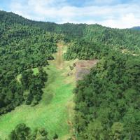
Gema Airstrip AYGM in Papua New Guinea, by Photosbykev, features a dirt runway with a long steep upslope and an ICAO code, complemented by custom objects and hand-placed buildings. The project cite…
 Papua New Guinea