Scenery Addons for Microsoft Flight Simulator 2004: A Century of Flight
Version 1.2 adds an ILS on Runway 9 at the airport on the Caribbean island of St-Maarten, using 110.10 MHz, though the real facility is not equipped with this instrument. It also adds a weather sta…
Version 7.0 of AEU7 broadens enhancements to default airports worldwide coverage, upgrading runway, taxiway, and tarmac surfaces along with airport buildings and lighting, and adds special reflecti…
Gmax 1.2 creates the jetway model, Arno Gerretsen's CAT program animates its operation, and Lucio Lepore assigns authorship for the jetway animation, while the same trio of tools and names appear a…
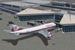
FS2004 rendition of the KMCO airport in Florida carries a 2008 date and credits Jaxan Prier and Jose Gutierrez of Mach-1 Design Group. The image named orland08.gif appears alongside the material fo…
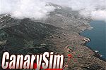
La Palma, El Hierro, La Gomera, Tenerife and Gran Canaria are covered with a 19-meter custom mesh and high-definition maps for all islands, by CanarySim. Full autogen coverage and night lighting cr…
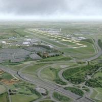
Version 7.0 presents a detailed rendition of a London-area airport, using a two-dimensional base image drawn from a composite aerial photograph produced by The Geoinformation Group Ltd. The layout …
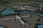
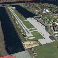
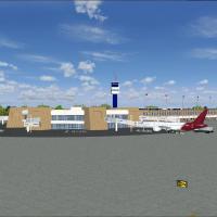
South Africa hosts a new international airport serving Johannesburg, identified as FAJS, featuring detailed hangars and buildings, photoreal ground visuals, and a corrected ILS alignment. The FAJS …
Terrain Mesh at 1-arc-second resolution uses data from the USGS NASA Shuttle Radar Topography Mission 1-Arc Second Dataset, resampled to 38.2 meters and interpolated x 20. It spans longitude W-70 t…

AI traffic cannot use ILS/LDA/IGS on runways with this setup; an ILS to VHHX 13/31 enables user aircraft to operate in low visibility, while ATC avoids the runway for AI traffic because the simulat…
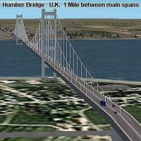
A Humber Bridge depiction for England appears as version 1.0, issued in August 2003, by Firstsim98, presenting this landmark in a straightforward layout. It includes night illumination and vehicles…
EGLC, in the United Kingdom, appears as a project by Frederik Mohrmann, basing the work on photos. Photos serve as the basis, and Frederik Mohrmann remains the author for the EGLC-focused layout to…
Autogen spans the globe with a three-dimensional effect and a broader range of surface finishes. AutoGen3D.JPG appears as the accompanying image by Valentin Casares, reinforcing the worldwide scope…
Version 2 by Bill Melichar marks the Tahiti adaptation, now aligned with the sim and removing prior palm and baggage carts scale issues. The terrain mesh for French Polynesia by Rolf Keibel and Joh…
Cancun Airport sits in Quintana Roo, Mexico, and the entry anchors its geographic context with a visual reference labeled mmun2005.jpg. The file name mmun2005.jpg provides a concrete link to the in…
Extending Chris Gilberts' KCVG work, Gary D. Jones delivers a revision that includes jetway macros by Shehryar Ansari and a modified file for compatibility with the sim. The revision centers on KCV…
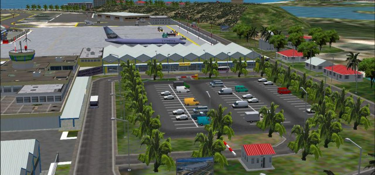
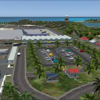
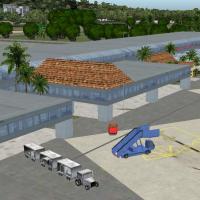
An international airport on the island of Guadeloupe in the French Caribbean presents high detail that demands a fast PC to render all elements. Christian Delblond authors the project, and Raizet_1…
Version two for Edmonton International Airport (CYEG) in Alberta, Canada, replaces the main terminal and cargo area, updates apron layouts, and adds a smaller cargo taxiway. Based on aerial and gro…
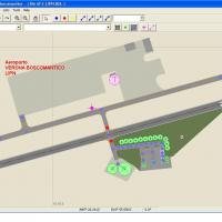
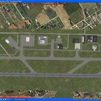
Carlo Bianchi delivers Verona Boscomantico (LIPN) addon focusing on a small Italian general aviation field near Verona in northern Italy, with runway configurations matched to real length and orien…
Master's Edition of the MX upgrade expands coverage to every global airport, from the largest hubs to the smallest, by night or by day. It adds special night lighting and seasonal techniques, and a…
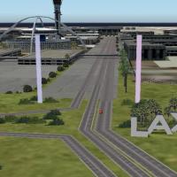
Powerful pylons at the perimeter illuminate in color in sync with the central tower and restaurant cluster, while a clearly visible LAX sign greets arrivals. Bill Melichar shortens the 405 Freeway …