Page 10
Searches the whole library — filter by sim & category on the results page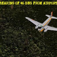
An expedition follows the discovery near Puerto Maldonado, in Peru's Matto Grosso, as Dr. Eulogio Belafontes teams with three other earth scientists, while sixteen additional researchers already es…
Mathieu O'Hare credits a flight task that uses the Augusto H101 to execute commands over the Pyrenees, establishing a mountain-region focus and naming the aeroplane model. The description concentra…
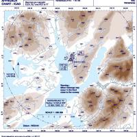
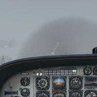
An airport hidden in a fjord tests pilots as persistent bad weather and winter closures shape operations at Narsarsuaq, with an approach from the southwest to runway 7. Two aircraft options are ava…
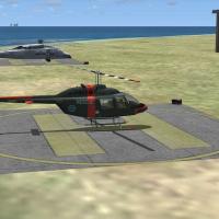
In Sette Cama, Gabon, rescuers aim to deposit an important passenger on an oil platform and return to base while avoiding rebel units. Two elements arrive: a Gabon folder and the SetteCama.RWD file…
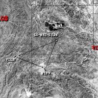
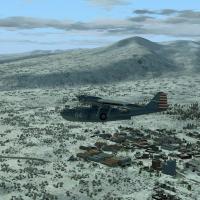
Air America assigns a Laos operation in 1964, where a beat-up gray Douglas C-47 stands ready for a calculated task, guided by an enclosed map.jpg for navigation along the route including Loi-Men-Ku…
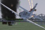
Located off the Coast of Haiphong at dusk, a carrier operation has Skyraider 3 leading a Navy Skyraider and an OH-6A to destroy two bridges using ybombs dropped in their centers. Acceleration is re…
Gera Godoy Canova presents a task that centers on four Catalina airframes equipped with cameras and long-range tanks assigned to Squadron 45B-38 to photograph the Mystery Corridor near Japan and do…
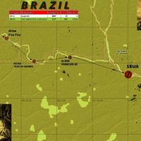
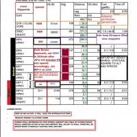
The DHC6-300 Twin Otter Amphibian serves as the aircraft for the leg and its three Indian villages, with the first segment covering 148.2 nautical miles from Iauarete (SBYA) to Sao Grabriel Da Coch…
Ali Zied creates a flight plan tracing a route from Queen Alia International Airport in Amman (OJAI) to Baghdad International (ORBI), using Amman’s Qatranah departure and a spiral approach into Bag…
Gera Godoy Canova anchors a four-part series with Episode I focusing on an Atlantis quest, inviting pilots to test challenging routes. An Atlantis directory exists and Plan-G is recommended for fli…
By Gera Godoy Canova, a Taranto-to-Tirana sequence unfolds with a full cabin, and the flight crosses the Adriatic before a late-afternoon cargo leg to Kukes. A multimedia instruction manual with in…
A flight file presents a foggy landing into KLPR, recreating the final 20 minutes of the flight linked to the inventor’s death, with author William Rayer contributing knowledge of the local airfiel…
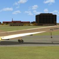
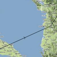
Concorde anchors a historical route to Princess Juliana International, pairing the jet with a 7,152-foot runway famed for its sea-level approach. Robbie Albers presents this scenario, based on an A…
Originating in Tapachula, Mexico, two Martin 404s transport freight to Las Palmas in Belize during the early 1950s, while today an ATR Turbo serves the passenger leg. By Gera Godoy Canova, this pie…
By Dave Feeger, this helicopter emergency scenario is built with the IMM tool and comes with an IMM file for adjustment and a volcanorescue.rwd file. Vocals use Microsoft Sam, and the author marks …

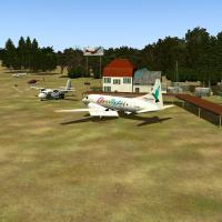
Cellular Madness, authored by Gera Godoy Canova for CelCab, involves delivering parts to four antenna sites across Chiriqui Province during the rainy season. The package comprises a PANAMA CHARTER …
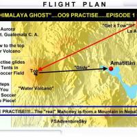
This hang glider session starts on the Top of the Water Volcano, just outside Guatemala City, and uses the AIR_C4.ZIP archive to glide toward a camp on the shore of Amatitlan Lake, featuring a peak…
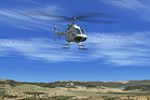
The operator tests a new autogyro using UAGYRO.ZIP while he photographs Africa’s plains, focusing on wildlife such as giraffes, zebras, and elephants. The itinerary includes a stop at Fukunga's Fri…
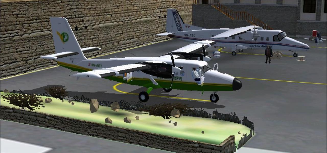
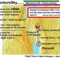
By Gera Godoy Canova, the scenario follows a Lukla-based supply flight to Tumlingtar, then Gutaba, where a helicopter carries spare parts, food, and purified water to archaeologists near a Buddhist…
By David Rogers, this polar operation centers on Antarctic logistics. A single main file supports the scenario, and the collection includes a distinct designation, emphasizing routes across latitud…