Page 99
Searches the whole library — filter by sim & category on the results page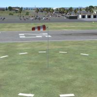
Eight major airports receive Revision #1 to CCCFSX.ZIP, dated 4/25/08, for the Central California coast area, with minor taxiway tweaks and windsock improvements. Windsocks at PRB, SBP, L52, SMX, L…
 United States of America
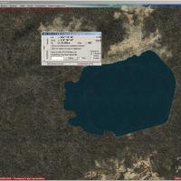
An enhancement around Sicily remaps lake shapes and waterclass using Earth imagery data, version 1.0, with KML tooling by Innova Software and attribution to Giovanni Miduri. It works with a compani…
 Italy
Italy
Bruno Brouillard documents Halifax Shearwater, a Canadian Forces base in Nova Scotia, Canada. The entry identifies the base's location and credits Brouillard as author, providing a concise, fact-ba…
 Canada
Four airstrips labeled EGP1–EGP4 appear across Pitcairn, Oeno, Henderson, and Ducie. EGP1 on Pitcairn Island uses a concrete 2350 ft runway, while EGP2–EGP4 on Oeno, Henderson, and Ducie rely on co…
 Pitcairn
St. Kilda in the Outer Hebrides covers most of the archipelago's islands, with custom sea stacks enhancing the landscape. A helipad at the village's east end offers a landing option, and a flight p…
 United Kingdom
The project reworks most Tanzania lakes from SRTM Water Body Data and altitude adjusts them to fit a mesh derived from SRTM, as a bgl-file. The work yields exact coastlines and elevations precisely…
 Tanzania, United Republic of
LSXR Haltikon functions as a heliport for Heli Gotthard and Heliswiss International, situated in Haltikon near Kussnacht am Rigi, SZ. The layout includes a square landing area, two hangars, residen…
 Switzerland
Jim Cook presents an enhanced KHGR, replacing most default buildings and relocating the control tower to the correct position. Allegiant Air uses designated gates, two files KHGR_AFX_JC.bgl and KHG…
United States of America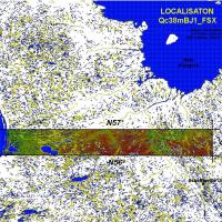
The project delivers a 38-meter mesh (LOD10) for the Quebec region, spanning latitudes N56–N57 and longitudes W66–W77, compiled by Gilles Gauthier. Related options include Qc38mBJ_FSX_1de2.zip and …
Canada
Vince Marrone delivers a Wallblake Airport (TQPF) upgrade that places static aircraft, vehicles, and a hangar, adds coastal features around Anguilla along the south and north coasts, and includes a…
 Anguilla
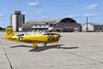
Jim Cook delivers a KNHZ enhancement for Naval Air Station Brunswick, adding Military_Cargo and Military_Combat parking for maritime patrol aircraft such as the P-3 Orion, with redesigned perimeter…
United States of America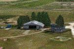
Modular Dutch landscape block for Ameland Island presents EHAL with a single 09/27 runway and detailed coastlines. The design integrates with NL2000 v4 and requires the v4.0.20 installer; it uses s…
 Netherlands
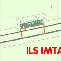
Alexander Garzon provides a new ILS for the Aeropuerto International Del Caribe General S. Marino in Venezuela, enhancing precision approaches at SVMG. The addition uses a single bgl file to implem…
 Venezuela (Bolivarian Republic of)
By Lukasz Kubacki and Michal Krawczyk, the Nowy Sacz airfield in Poland shows a grass runway sized 800 by 150 meters and uses 1 m per pixel photo imagery, and the ICAO code EPNL designation.
 Poland
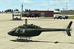
Fort Stewart hosts Hunter Army Air Field (KSVN) with an enhanced layout that adds parking and two fire stations and moves the control tower. Jim Cook supplies two new BGLs, AFX_KSVN_JC.bgl and KSVN…
United States of AmericaNear Scalea in southern Italy, this small airfield features an asphalt runway of midsize length suitable for light jets and remains unregistered as a standard airport without an ICAO code. Two BGL …
Italy
Originating in Argentina, the La Plata region extends the BsAs_X.3 area toward the south, adding Elizalde (ELZ), Tolosa (PTKL), and La Plata (SADL) aerodromes. It relies on libraries GSP_HANGARES2.…
 Argentina
Des Moines International Airport in Iowa (KDSM) corrects runway lengths and adds overruns, implements DME to ILS 13, and assigns airline codes to gates. The cargo area gains parking codes, cargo bo…
United States of America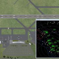
Revision 2 for the CCC area traffic introduces 99 AI flights across eight airports and fixes six airport layout files while updating visuals at SBP and SBA. It requires prior installations of the C…
United States of America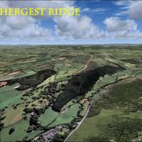
A photoreal landscape traces the England–Wales border between Kington in Herefordshire and Gladestry in Powys, with a highest point at 1397 feet. It aligns with UTX Europe and preserves a photoreal…
United Kingdom