Page 116
Searches the whole library — filter by sim & category on the results page
Harbor area near Mossel Bay, South Africa, is credited to Frits Beyer. A folder related to the locale exists to improve the local flying environment and to offer a focused reference for pilots oper…
 South Africa
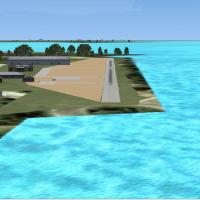
Alf B. Meier presents a modification lacking an ICAO code that still serves as Maya Island Air hub, with MZ55 assigned to the location. The note emphasizes the hub role for Maya Island Air while th…
 Belize
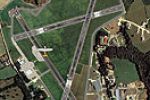
Designed to align with Horizon GenX Photo visuals and an included mesh, EGFE.bgl, cvxEGFEflatten.bgl, EGFEbuildings.bgl, EGFEwarehouses.bgl, and EGFETrees.bgl serve as core components. They also co…
 United Kingdom
Operating as part of the NL2000 v4 line, this Deelen airfield component requires the v4.0.20 installer and imports with other Dutch regions. It recreates EHDL with dedicated 3D buildings and precis…
 Netherlands
Metz X builds custom models with hand-drawn visuals for Metz airport (3CA7) near the Monterrey region in California, and relocates the runway to its correct position while refining the approach ter…
 United States of America
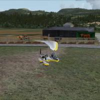
Near Crieff in the Scottish Highlands, Neil Birch authors East-Lochlane-Farm and ties it to Bryan Lockyear's Farm Strips and Private Airfields. The ELF folder contains two subfolders plus an ELF-TE…
United Kingdom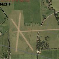
Created by Troy Chapman, three nearby airfields anchor this project: NZWL-West Melton, NZRT-Rangiora, and NZFF-Forest Field, all located in Christchurch/Canterbury near NZCH. The Canterbury Aero Cl…
 New Zealand
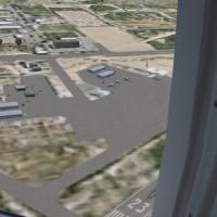
KCGZ in Arizona displays moving airport vehicles, parking areas, assorted objects, and lighting to populate the field. By Jimmy R. Martin, two aerial views reveal day and night perspectives of the …
United States of America
BlueLR01 presents a small grass strip with a single runway located south of SDF in Kentucky, and offers 1 meter per pixel photoreal terrain in the immediate area. The base uses LouX1MBB terrain, wi…
United States of America
Columbia-area public GA airfield in California, east of Stockton, operates as a base for CDF aerial firefighting during summers, identified by the code (022) and Unicom 123,050 MHz, with elevation …
United States of America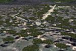
Located north of Gauteng in the Waterberg mountains of South Africa, this freeware airstrip attracts aviators from Gauteng as a fly-away destination. It includes wildlife and uses a photoreal base …
South Africa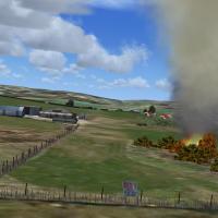
Neil Birch maps Oxenhope content for Neil's Microlights UK, places .bgls to drop in the main path and accompanying graphic files to Neil's Microlight directories. Credit sits with Neil Birch for Ne…
United Kingdom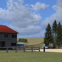
By Michael Allen-Andrews, Te Kuiti airport in New Zealand receives a basic photoreal upgrade drawn from fs-creations.org and calibrated for the VLC 20 meter mesh add-on, with the airport code NZTT.…
New Zealand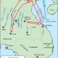
Two USAF routes and one Navy path form RP VI, with RP VI A from Korat using RPA1–3 and RPA4–7, RP VI B from NKP using RPB1–2 and RPB3–6, and the Navy leg from Yankee Station via RPN1–4. Original AF…
 Viet Nam
Anwar Gonzalez presents the ZUJZ airfield near Songpan, Sichuan, China, with airport buildings and working jetways, and autogen corrected to remove trees inside the airport limits. Elevation reache…
 China
China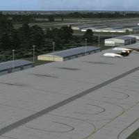
New details for KRDU refine gate and terminal positions to reflect a 2009-era layout, and realign taxiways around Runway 5L-23R to match recent diagrams. ADE v1.40 by Jon Masterson underpins the ap…
United States of America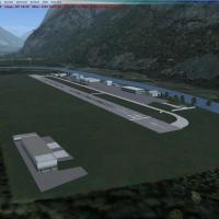
Lodrino LSLM, by Michael Bruttel, places a runway, taxiways and parking using Skyguide aerodrome chart and Google Maps, as part of the Lodrino Airport RUAG Maintenance effort. The layout uses gener…
 Switzerland
KJAN folder by Rob Touchtone adjusts gate and ramp layout at Jackson-Evers, with all jetways visible and operable via CNTRL-J and gates aligned for Delta, US Airways, Southwest, Continental, and Am…
United States of America
By JPS, this 1MA5 variant for Southborough adds taxiways, aprons, and nearby roads to better reflect the private field. It ships three BGL files—1MA5_ADEX_JPS.BGL, 1MA5_ADEX_JPS_CVX.bgl, and 1MA5_J…
United States of America
Pilots access a fictitious lookout site northeast of Tipella, British Columbia, with TLS as the airport code and a 124.325 MHz Unicom. The elevated, sloped grass runway sits 4 nautical miles east a…
 Canada