Page 128
Searches the whole library — filter by sim & category on the results page
NAURU_X.ZIP adds more baggage at the coolterminal for the Nauru X project. It requires the standard nauru_x.zip file and the preceding revision to take effect, and after loading the Nauru Intl area…
 Nauru
NauruOn Long Island, Southampton Heliport (87N) in New York serves as the town’s public helipad. It is the island’s only public helipad outside of an airport and shares a CTAF with Mattituck Airport (21…
 United States of America
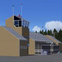
The Port-Menier facility on Anticosti Island in Quebec, bearing code CYPN, sits along Golfe Saint-Laurent, Quebec, Canada. Two original buildings stand amid default objects, and new fencing plus an…
 Canada
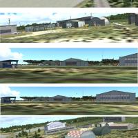
A fictitious float seaport in New York operates without fixed runways, featuring a ramp for amphibious aircraft and several short roads suitable for occasional landings. By Bob Smith, this freeware…
United States of America
Ren Scen offers a single .BGL file for Atibaia Airfield (SDTB) in Brazil. This offering is free of charge, and the author disclaims liability while restricting resale and distribution to domestic u…
 Brazil
This rendition shows Port Allen Airport on Kauai as a fictitious PAK, occupying 180 acres one mile southwest of Hanapepe. The work uses .bgl files and remains freeware, with frame rate friendly per…
United States of America
Located in Canada, this fictional airbase sits low between mountains to ease fighter climbs, with Runway 11 designated outbound for cargo and transport to avoid peak obstructions. It mixes stock mo…
Canada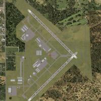
The airport near Jacksonville in Duval County, designated KCRG, receives refined taxi layouts, improved apron details, and enhanced hangar modeling, with surrounding landclass updates to reflect re…
United States of America
Two variants of a fictitious Air Force Base on Henderson Island provide a 7500 by 120 foot paved runway and a bay-side layout with hangars and barracks. Files labeled KTH Airport and KTH Airport Sa…
 Pitcairn
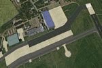
Valkenburg airfield EHVB presents accurate topography and faithful airfield assets reflecting its historic military layout near Katwijk and The Hague. It integrates with the NL2000 v4 ecosystem and…
 Netherlands
An add-on sits in southern Israel’s Arava region, 1 km from Yotvata Kibbutz and 40 km north of Eilat, and supports light civilian aviation while using ICAO code LL63 for flight planning. By Shoval …
 Israel
EBML2008 centers on the Maillen airfield near Namur, Belgium, a small field used predominantly by ULM aircraft. Jean-Philippe Pierard and Emmanuel Pierard contribute as creators, and static objects…
 Belgium
At Lewis University in Illinois (KLOT), the layout reproduces most campus buildings. Grady's Flight Service is added in memory, and an ILS is installed for RWY9 with checks on RWY27, while Rwy12 fi…
United States of AmericaPhase 2 expansion by Jason Morgan centers on a fictional Canadian airbase identified as CAN1. It features ILS on runway 29 at 110.75 and designates runway 11 as the only large-scale option for carg…
CanadaTrevor Hannant updates the Wattisham tower setup by relocating the tower at EGUW from the runway center to a position nearer its true site at Wattisham Army base in the United Kingdom. It uses the …
 United Kingdom
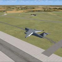
A USAF-operated facility in South Carolina supports C-17 training by the 437th and 315th Airlift Wings at Charleston AFB. Bare-base operations also occur at Shaw AFB and McEntire ANG Station with t…
United States of America
An air cargo hangar becomes part of the layout at KFMN in Farmington, NM, enhancing the local aviation footprint. The author designs a hangar and vehicles at KHOB Hobbs, NM, and plans air cargo cov…
United States of America
La Drang in Vietnam anchors this assembly, spanning four sites including Pie Me special forces camp, LZ Xray, LZ Falcon, and LZ Albany, with Alan Mccarthy credited as the author and the contributor…
 Viet Nam
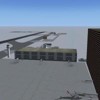
Kris Kringle Industries operates CYKK, located just 20 miles from the North Pole, as the base of operations for Santa Claus and his elves, reindeer, and helpers. It uses custom AI traffic, by Andy …
 Global (World)
Two saved flights accompany the training course, one for each supported version, by Andy Johnston, and it guides pilots through the twists and turns of a large pipe, designed for a flight simulator…
Global (World)