Page 127
Searches the whole library — filter by sim & category on the results page
Located in Quebec, Canada, Mascouche Airport (CSK3) gains a reworked ramp parking area, added land vehicles and hangars, revised taxiways and lighting, and an ILS now supports runways 11 and 29, cr…
 Canada
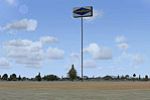
Derek Souza credits the Goodyear Sign placement at the blimp base in Carson, California, with design by Steve Ziegler. A Goodyear Sign BGL and other BGLs exist, with the main files in addon directo…
 United States of America
South of Adelaide, Noarlunga airfield receives a freeware rendering by Roger Leupold, part of his Aussie Scenery series. It uses Google Earth data to match runway geometry and surrounding landmarks…
 Australia
Ried/Kirchheim Airfield (LOLK) sits in Austria, uses the LOLK registration, serves sport flying, and features a runway measuring 743 m in length. Two bgl files accompany this release by Alex Grunwa…
 Austria
Four intermediate lighted airfields from the 1940 Cleveland Sectional Chart, in Pennsylvania, on the New York to Chicago Federal Lighted Airway, gain beacon towers on arrow-shaped concrete pads at …
United States of America
Two folders, credited to Jimmy R. Martin, add residents, campers, rental cottages, boats, and buildings to four islands and introduce runway lighting. This content widens the four-island layout and…
 Bahamas
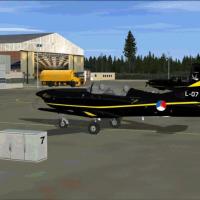
EHWO Woensdrecht Air Base module emphasizes updated approach paths, taxiways, and apron configurations, re-creating hangars and technical facilities with high-definition detail. It is compatible wi…
 Netherlands
ATIS and tower frequencies stay accurate, they identify as KXFL, the ground control frequency changes, and the old map designation X47 remains visible. Brighter runway lighting and enhanced approac…
United States of America
An enhancement of the Florida Marine Research facility on Lee Stocking Island in the Bahamas adds four light PAPI approaches and pole lighting for docks and ramps. By Jimmy R. Martin, it works with…
BahamasAt Wichita Mid-Continent Airport (KICT), this file, by Richie1935, replaces default hangars with Gmax-built structures for the Cessna Facility and adds animation to the Citation building doors only…
United States of AmericaBojnourd Airport sits in Iran’s North Hkorasan, anchoring the scene to a real-world locale. Shahin Najafi earns author attribution, and the site carries the code OIMN, providing a precise reference…
 Iran (Islamic Republic of)
EPSK, Slupsk Airport in Poland, receives a straightforward rework of the military airfield, adding real taxiways, parking positions, a helipad and a runway overrun on the main 27 runway, along with…
 Poland
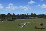
Hilversum Airport (EHHV) appears within the NL2000 v4 framework, runways reflect actual dimensions, grass airstrips mirror the real environment, and the design places hangars and clubhouse faciliti…
Netherlands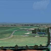
Weston-on-the-Green in Oxfordshire hosts autogen trees around the field and moving road traffic, with an AI jump aircraft in operation. Two extra files, WOTGextravegetation and WOTGextradetails, ad…
 United Kingdom
An authentic German GA airfield at EDGD, created by John Eriksson, features ILS runway 26, VOR/DME, and nearby helipads, plus an aircraft carrier and static aircraft. Buildings, taxi signs, windsoc…
 Germany
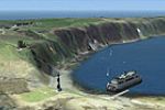
By Neil Birch, this flattening targets Horizon VFR Vol. 2 users and corrects the coastline around Lundy in the Bristol Channel, fixing the sea running uphill. It ships as a .bgl file optimized for …
United Kingdom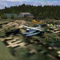
Fort Langley (CBQ2) in British Columbia presents a grass airfield enhanced with a few buildings, a farm area and a simple taxi network for light aircraft only. It includes a pair of parking spots p…
Canada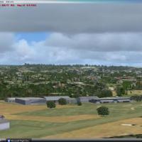
Jacques Botha delivers a freeware enhancement for the coastal location in KwaZulu-Natal, South Africa, assembled from default library content and not the real facility but close. A folder named FAP…
 South Africa
Empangeni airfield in Kwazulu Natal, South Africa is documented by Fritz Beyer and Jacques Botha. It uses custom objects and includes the FAEM_Empangeni folder with the AFX_FAEM_ALT.bgl, featuring …
South Africa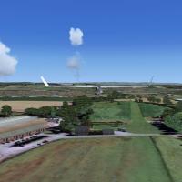
An Alcester Strip edition aligns with Horizon Generation X V2 and its mesh and remains untested with other environments. The strip lies near Kings Coughton, about half a mile north of Alcester, str…
United Kingdom