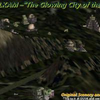
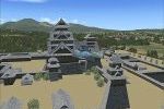
FSX Scenery

Page 132

Preview screenshot

Texture Update For Scenery EDHN_FSX

This freeware compatibility patch by Uwe Schweitzer refreshes the EDHN_FSX texture library, eliminating the washed-out or missing bitmaps that can appear after Microsoft Flight Simulator X Service Pack 2; tuned for DirectX 9 shaders and likely beneficial in the DX10 preview, it restores accurate ground polygons and building facades around Neumünster.

Country
Germany
File Size
329.17 KB
Total Downloads
82
No image available.

Victorian Airport Pack One

Compiled from current Airservices charts and Google Earth ortho-imagery, this FSX Victorian Airport Pack revises ten GA and regional strips—Boort (YBBT) to Avalon (YMAV)—with corrected AFCADs, realistic runway markings, updated navaids, refined taxi links, apron edge lighting and elevation fixes that smooth AI traffic flow across central and coastal Victoria.

Country
Australia
File Size
21.86 KB
Total Downloads
965
Star Rating
1/5
Preview screenshot

Monument Valley Beta

Monument Valley Beta for FSX introduces 5 m IFSAR mesh and 1 m ortho imagery, sharpening buttes, mesas and desert floor for precise canyon runs and VFR checkpoints; this public test build retains straight-edged coverage, lacks autogen and water masks, and seeks performance metrics ahead of wider terrain expansion.

Country
United States of America
File Size
385 MB
Total Downloads
682
Screenshots
2
Preview screenshot

Caye Chapel Airport

This low-key FSX add-on installs Caye Chapel Airport (IATA CYC, custom ICAO MZ58) featuring a notably wide 25 m, 100-yard runway, corrected elevation, exact geolocation and hand-placed golf-resort foliage that blends with default Belize scenery; lean BGLs preserve frame rates while supplying crisp ground polys and apron lighting for dusk VFR circuits.

Country
Belize
File Size
92.87 KB
Total Downloads
72
Screenshots
1
Preview screenshot

Dangriga Airport

This FSX scenery add-on brings Dangriga Airport, Belize (IATA DGA, custom ICAO MZ57) into Microsoft Flight Simulator X with accurate strip placement, compiled BGL scenery and updated AFCAD data so AI schedules and user flight plans recognize the two-airline regional field within the default Belize terrain.

Country
Belize
File Size
108.81 KB
Total Downloads
52
Screenshots
1
No image available.

Belize City Airport

Targeted scenery patch for Microsoft Flight Simulator X that replaces the accidental bridge object overlaying the dirt service road at Belize City Municipal Airport (TZA), delivering a cleaner ground vector, corrected landclass and precise geospatial alignment sourced from Google Earth and compiled into lightweight BGL files with SBuilderX and Airport Design Editor.

Country
Belize
File Size
4.04 KB
Total Downloads
167
Screenshots
1
Preview screenshot

Placencia Municipal Airport

Compact rendition of Placencia Municipal Airport (custom MZ56) brings Belize’s narrow 12-yard-wide, 500-yard runway, adjacent mangrove swamps and safety-dam, into FSX with accurate Google-Earth coordinates, hand-tuned in SBuilderX and Airport Design Editor for realistic approach vectors, corrected elevation data, and daily regional commuter traffic compatibility.

Country
Belize
File Size
122.23 KB
Total Downloads
104
Screenshots
1
Preview screenshot

Runway Fix For SKCG

Targeted at FSX pilots flying into SKCG Rafael Núñez, this runway patch refines threshold bars, touchdown-zone stripes and centerline paint, while inserting correctly spaced dual PAPI rows for accurate glide-slope cues—yielding a more regulation-compliant surface without altering other Cartagena scenery elements.

Country
Colombia
File Size
4.31 MB
Total Downloads
220
Screenshots
1
Preview screenshot

Caribbean Seaplane Tours Caribbe East

Covering twenty detailed airports and dock locations from Haiti down to Tobago, this FSX scenery add-on extends the Caribbean Seaplane Tours chain eastward, supplying accurate navaids, custom water runways, dedicated VOR/ILS frequencies and properly aligned AFCAD files, designed to mesh seamlessly with the earlier Florida, Bahamas and Caribbe West segments.

Country
Global (World)
File Size
58.39 MB
Total Downloads
1.3K
Screenshots
2
Preview screenshot

Belize City Municipal Airport

This FSX scenery rebuilds Belize City Municipal (custom ICAO MZ55) with ADE-compiled AFCAD, accurate Google Earth geo-referencing, corrected coastline and riverbed vectors for cleaner VFR paths, a new polygonal concrete terminal replacing the former huts, removal of threshold shrubs, preserved mangrove obstacle, detailed runway-end drainage ditches, and traffic logic matching Maya Island Air’s hub operations.

Country
Belize
File Size
117.63 KB
Total Downloads
205
Screenshots
1
No image available.

F.D. Roosevelt Aiport Demo

Tailored for the Microsoft Flight Simulator X demo, this freeware ADE/AFCAD v1.0 refreshes St Eustatius’ F.D. Roosevelt Airport (TNCE) by injecting accurately numbered gates, additional parking stands and apron positions, plus a complete taxiway network, enabling reliable AI traffic flow and cleaner ground routing for user-flown aircraft on the default scenery.

Country
Bonaire, Sint Eustatius and Saba
File Size
2.84 KB
Total Downloads
267
Screenshots
1
Preview screenshot

Extreme Westgreenland Terrain Mesh

Covering latitudes 65°N–68°N, Extreme Westgreenland Terrain Mesh injects a precise LOD11 high-resolution digital elevation model (DEM) into FSX / Microsoft Flight Simulator X, correcting default topography across 50,000 km²; re-engineered coastlines and lake polygons supply IFR/VFR flyers with accurate ridge lines, fjords and approach profiles missing from stock data.

Country
Greenland
File Size
44.95 MB
Total Downloads
679
Star Rating
1/5
Screenshots
1
Preview screenshot

Nellis Air Force Base

This Flight Simulator X scenery by Paul Strogen upgrades Nellis AFB (KLSV) with corrected elevation flattens, extra military ramp parking, and hand-placed static objects compiled via ADE, SBuilderX and the SP2 SDK, removing the stock “mesa” artefact and blending the field into 10-m Nevada terrain mesh.

Country
United States of America
File Size
855.94 KB
Total Downloads
2K
Star Rating
4/5
Screenshots
5
Preview screenshot

Tonopah Test Range Fix

Addresses missing vector roads around the Tonopah Test Range (TNX) in Nevada for Flight Simulator X, this Paul Strogen patch integrates accurate highway and service-road data into the existing TONO_TNX scenery, aligning traffic, landclass and terrain meshes so taxi, convoy and approach visuals now match sectional charts.

Country
United States of America
File Size
2.65 KB
Total Downloads
126
Screenshots
5
Preview screenshot

Salzgitter-Druette

Tailored for FSX and Aerosoft VFR Germany Vol 1, this freeware Salzgitter-Druette (EDVS) enhancement brings photoreal ground polys, precise runway geometry and geo-referenced exclusion zones assembled via SBuilderX and Google Earth, giving the compact Lower Saxony strip accurate coordinates, aligned taxiways and seamless seasonal blending once the redundant EDVS_Photo layer is removed.

Country
Germany
File Size
3.43 MB
Total Downloads
173
Star Rating
1/5
Screenshots
2
Preview screenshot

Tonopah Airport

Enhances the default FSX Tonopah Airport (KTPH) in Nevada with accurately placed GA ramp stands, varied static objects, asphalt-and-dirt road networks, and custom sloped-flatten terrain that removes the mesa elevation anomaly, blending cleanly with stock or USA 10 m mesh; authored via ADE, SBuilderX, and the FSX SDK for efficient realism.

Country
United States of America
File Size
812.99 KB
Total Downloads
159
Star Rating
1/5
Screenshots
2
Preview screenshot

Tonopah Test Range

FSX Tonopah Test Range revamps Nevada’s secretive desert field with custom BGLs authored through Airport Design Editor and SBuilderX, adding military ramp stands, geo-referenced access roads, corrected land-class and boundary exclusions; sloped flatten polygons suppress the stock mesh ‘mesa’, letting runway elevations blend smoothly into 10 m terrain or default mesh for stable approaches.

Country
United States of America
File Size
844.3 KB
Total Downloads
291
Screenshots
6
No image available.

Fix For MZBZ Goldson Airport

Addressing the familiar “runway full of trees” bug at MZBZ, this concise FSX scenery hotfix delivers cleaned-up BGL data that eliminates autogen vegetation intruding on Philip S. Goldson International Airport’s runways and taxiways, ensuring unobstructed approaches. Compiled with SBuilderX and Airport Design Editor, it slots neatly into any scenery library.

Country
Belize
File Size
5.31 KB
Total Downloads
996
Screenshots
6
Preview screenshot

Wake Island

Wake Island PWAK scenery rebuild refines the atoll’s shoreline geometry, replaces the default rainforest landclass with realistic coral terrain and waterclass mapping, and re-positions the military runway, taxiways and parking to Google Earth-accurate coordinates via AFX. Autogen-only structures retain performance while offering reliable VFR reference points for long Pacific hops.

Country
United States of America
File Size
35.46 KB
Total Downloads
1K
Star Rating
2/5
Screenshots
1
No image available.

Ippokratis Airport

Upgrades LGKO Kos Ippokratis in FSX with a revised AFCAD that corrects runway thresholds, redraws asphalt taxiways, adds properly coded parking stands, clear taxiway signage, turning bays, a functional windsock and on-field fuel truck, plus a PDF aerodrome chart for precise flight-planning.

Country
Greece
File Size
249.73 KB
Total Downloads
1K
Star Rating
1/5
Screenshots
1