Page 125
Searches the whole library — filter by sim & category on the results page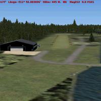
Falko Dienstbach creates Airfield Moosburg, registered as EDPI in Germany, near Moosburg auf der Kippe. Assets include a Hangar by Robert Waszkiewicz and a Church by Rafael Garcia Sanchez, while th…
 Germany
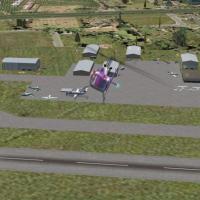
Freeware rendition of Williamson County airport (KMWA) near Marion, Illinois, by Jimmy R. Martin, presents improved primary and secondary runways with smoother surface transitions and enhanced apro…
 United States of America
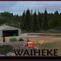
This Waiheke Island addon, by Robin Corn and Michael Allen-Andrews, is designed for SP1, SP2, and SDK and can pair with an Auckland project while functioning as standalone. It features a custom gra…
 New Zealand
Situated at Westfield-Barnes Airport (KBAF) in Massachusetts, by Dick Kittredge, the scene highlights the base as home to A-10s and the Air National Guard. Barnes Mun.bgl serves as the named file a…
United States of America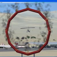
A Tonopah display near KTPH in Nevada features a Daredevil beside runway 33. The layout places the C_KTPH_airshow folder in C_AddonScenery01 and provides three files in C_Flights01 for the flight n…
United States of America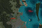
By Grant Clahsen, this small enhancement improves visuals for Samford, a town north of Brisbane, and for North Stradbroke Island near Brisbane International. It relies on a BrisParts asset and its …
 Australia
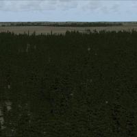
Gilles Gauthier delivers a 38m terrain mesh for the Baie James hydroelectric complex in Quebec, spanning latitudes N52° to N56° and longitudes W66° to W80°. The distribution comprises two archives …
 Canada
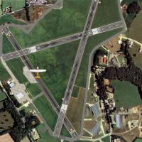
Haverfordwest airfield, licenced and operated by Pembrokeshire County Council, sits at N51 50.02, W004 57.63. This variant aligns topography with high‑resolution photo data, requires Horizon GenX P…
 United Kingdom
By Cesar Marinho, this correction fixes altitudes for lakes and a dam in Rio Grande do Sul, Brazil, notably in the region between Porto Alegre and Osorio City and the Passo Fundo area. It uses two …
 Brazil
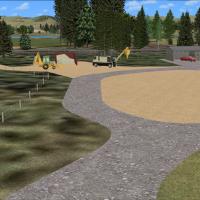
Wairoa Airport add-on in New Zealand’s NZWO region presents a complete rebuild of an earlier version, incorporating VLC Object Libraries and aligning with VLC payware. Credits flow to Lawrie Roache…
New ZealandGorlitz X (EGBX) in Germany operates as an enhancement for the town, delivering photorealistic visuals and crediting Dennis Weis alongside Georg Tomaschvili. Two BGL files, EDBX_ADEX_DA_CVX.bgl and…
GermanyPrinceton Airport (39N) in New Jersey sits on 100 acres as a public airstrip with five hangars accessible via DOCK parking, including north Docks 16–17, central Dock 20, and south Docks 18–19; fuel…
United States of America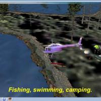
Middleton Field, KGZH near Evergreen, Alabama, by Jimmy R. Martin, includes lighting and activities such as campers, fishing, and boating across the landscape. The depiction is not photo-real, emph…
United States of America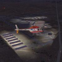
Marana Regional Airport (KAVQ) in Tucson, Arizona, receives a fixed-layout upgrade that adds moving airport activity, corrects parking spaces, ground vehicles, and lighting, and introduces ATIS. It…
United States of America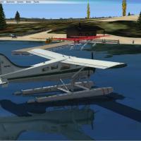
A small seaplane base centers on a water runway, identified by the SP12 designation. Install by placing all files into the addon folder; there are no parking spots because attempts to add them trig…
United States of America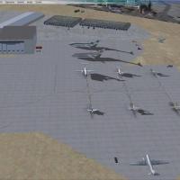
Vince Marrone documents Seattle-Tacoma International Airport (KSEA) in Washington, citing SEATAC.ZIP and the ksea_asb.zip file. The ksea_asb.zip corrects gate and jetway coordinate alignment, and M…
United States of America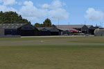
In Gelderland between Apeldoorn and Deventer, Teuge Airport (EHTE) sits within a modular, country-wide layout. It requires a v4.0.32 installer and has hand-placed buildings and control towers, high…
 Netherlands
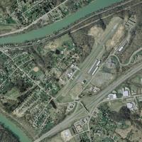
West Virginia's Fairmont field features the AC Express Flight School Hangar bay and adjacent hangars, a layout now displaying new runway numbers and taxiway placement. David Abreu oversees WV_FSX.Z…
United States of America
KEAU in Eau Claire, Wisconsin hosts a revised layout that fixes building placement and adds objects and people for realism. Notes indicate GAPLANE1.ZIP is required for some planes, while Jimmy R. M…
United States of America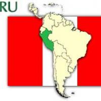
Collique Airport in Peru (SPOL) uses ADE9X v2 based on satellite maps and includes flying birds and other added objects. Credits go to Antoine Calleja for the environment and Jim Dhaenens for the l…
 Peru
Peru