Page 135
Searches the whole library — filter by sim & category on the results page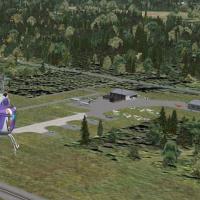
Jimmy R. Martin delivers a freeware rendition of KGRE Greenville Airport in Greenville, IL, located near farmland just east of St. Louis. It features enhanced runway and taxiway lighting, static ai…
 United States of America
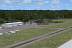
ChesterCT.bgl defines a small coastal airfield near Chester, Connecticut, created by Dick Kittredge. It relies on Flight1’s UT-FSX_Usa tool for proper object placement and remains viewable without …
United States of America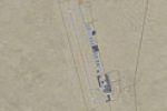
Tonopah area fix by Paul Strogen accompanies TONO_TNX.ZIP (TNX) in Nevada to add missing roads, expanding the prior TNX work. It provides the necessary file to integrate the new roads with earlier …
United States of America
Icebergs Ahoy, by Rob Sitter, marks two iceberg positions about 35 NM southeast of Stewart Island and 50 NM south of Dunedin, with a freeware asset named FNF_Ice.bgl. An RNZAF Orion report guides t…
 New Zealand
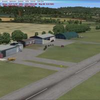
Schmidgaden airfield EDPQ in Bavaria, Germany sits east of Amberg in Upper Franconia, with the real runway asphalt despite the base layout showing a different alignment. Created by Uwe Schweitzer, …
 Germany
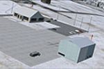
Two BGL files, 2G4_ADEX_MH and 2G4_ADEX_MH_CVX, pair with the Jim Dhaenens Objects folder for the western Maryland GA airport, using Jim Dhaenens T-hangars to depict runway upgrades that expand fro…
United States of America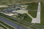
Den Helder module aligns with the NL2000 v4 framework, offering a photoreal ground layout and precise apron alignments for EHKD, reflecting both civilian and naval operations. It relies on the NL20…
 Netherlands
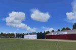
NL2000 v4 centers on EHSE Seppe Airport as a named variant within the NL2000 version 4 lineup, with credit to The Netherlands 2000 Design Team. The geographic reach encompasses the Netherlands and …
Netherlands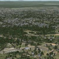
By Dick Kittredge, Easthampton Massachusetts presents a bgl file named EasthamptonMA.bgl focused on the city area near Northampton and just below Mt. Tom. The geographic scope centers on Easthampto…
United States of America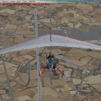
By Alan Mccarthy, Breighton AB near York, UK, this SP1-compatible project uses Airport Facilitator X and the SDK, relying on the default library only. It uses an auto-installer/uninstaller and reli…
 United Kingdom
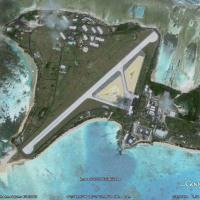
An enhancement for Dyess AAF in the Marshall Islands adds more buildings to the area around Dyess AAF. The modification expands the local footprint and enriches the site's appearance within the Dye…
 Marshall Islands
Five new airfields appear in lonely coastal towns, and daily flights head to Nav'Iret. Two subdirectories hold .BGL and .CL files in the first and .BMP files in the second, and an exclusion zone li…
 Russian Federation
KVIS in central California gains resized primary structures, expanded parking configurations, and a southern ramp modeled to real-world footprints guided by satellite data. Two BGL files, KVIS_ADE.…
United States of America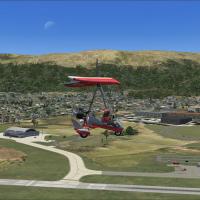
Israel-based creator Aviv Kerbel releases a Kiryat Shemona variant, v3, that includes static and dynamic vehicles, landclass data, and traffic on nearby roads. It relies on Israeli LandClass X and …
 Israel
Two turf strips sit on the Yorkshire moors, with 06/25 measuring 250 meters and 11/29 at 450 meters, perched over 1,100 feet in elevation. Neil Birch creates the layout, including the Ovenden Moor …
United Kingdom
Using ADE9X, this adaptation updates the field’s layout by adjusting building placement and adding an ILS to Runway 23 for the X35 site in Florida. It features two asphalt runways, 5/23 at 4,941 fe…
United States of AmericaWynoochee Lake WA hosts an airfield with airport ID BOB and a rugged dirt strip, lacking approach lights, which proves challenging at dawn or dusk. By Bob Caparoula, two .bgl files accompany a loca…
United States of America
For Neil's Microlights, Lower Upham is a small grass strip north of the Isle of Wight, centered on the final South-East variant to ensure all objects are visible, by Neil Birch. UK VFR coverage is …
United Kingdom
Two variants, HI-33 and HI-46, target Hawaii island and transform into a fly-in hospital with fire station and helipads, while HI-46 becomes a compact airport with helipads and parked planes. A dow…
United States of America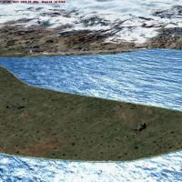
Salmon Point AKSP sits near Chenega, Alaska, with a 3500-foot gravel runway and two landable helipads, while navigational aids include an NDB at 309.0 with a 50 nm range and a VOR/DME at 115.60 wit…
United States of America