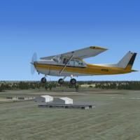
Using ADE9X, this adaptation updates the field’s layout by adjusting building placement and adding an ILS to Runway 23 for the X35 site in Florida. It features two asphalt runways, 5/23 at 4,941 fe…
 United States of America
Wynoochee Lake WA hosts an airfield with airport ID BOB and a rugged dirt strip, lacking approach lights, which proves challenging at dawn or dusk. By Bob Caparoula, two .bgl files accompany a loca…
United States of America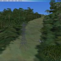
Two variants, HI-33 and HI-46, target Hawaii island and transform into a fly-in hospital with fire station and helipads, while HI-46 becomes a compact airport with helipads and parked planes. A dow…
United States of America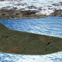
Salmon Point AKSP sits near Chenega, Alaska, with a 3500-foot gravel runway and two landable helipads, while navigational aids include an NDB at 309.0 with a 50 nm range and a VOR/DME at 115.60 wit…
United States of America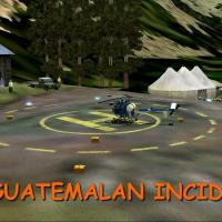
By Gera Godoy Canova, the release centers on a 1954 setting involving a forced landing in the Guatemalan mountains and occupants seized, with flight conducted in a period aircraft. Enclosed .BGL an…
 Guatemala
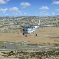
Located in California, Tracy Municipal Airport (KTCY) sits with two BGL files named KTCY_ADE.BGL and KTCY_ADE_CVX.BGL. Airport Design Editor designs and compiles them, while real satellite imagery …
United States of America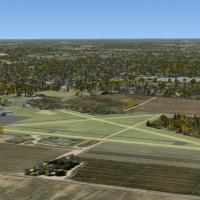
Martin Field lies about five miles northeast of Canton, Ohio, along Route 62, and serves the Canton area from the late 1930s to about 1997. Roy Poorman is the original owner/operator, and the archi…
United States of America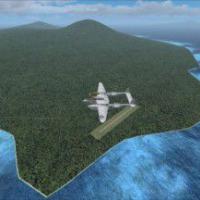
By Stephen Barstow, a boxed landarea spans Lea, Port Mos, Cape Clos, Rabual, and all islands in the slot, with a little extension beyond. It uses the default landclass data for the Pacific region c…
 Global (World)
Mbazwane-Sodwana carries the FAMX code, a dirt airstrip in KwaZulu-Natal, South Africa used by the forestry service. By Jacques Botha, the work shows an accurate version, with the Mbazwane-Sodwana_…
 South Africa
This EHSE Seppe Airport integration appears in the NL2000 v4.03 lineup, created by The Netherlands 2000 Scenery Design Team, and fits smoothly alongside other NL2000 v4 components. NL2000 v4.0.32 i…
 Netherlands
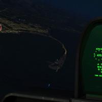
Fireworks light western Washington from Port Angeles to Tacoma, with displays across Mount Vernon, Port Townsend, Blaine, and the San Juan Islands. By Josef A. Kunzlar, a Mount Vernon image shows a…
United States of America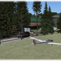
For Neil's Microlights, Lower Upham is a small grass strip north of the Isle of Wight, centered on the final South-East variant to ensure all objects are visible, by Neil Birch. UK VFR coverage is …
 United Kingdom
Maturin International Airport (SVMT) in Maturin, Venezeula gains taxiway designators and cargo and military parking, and the surrounding area is redone, with the effort credited to Shanard Letang; …
 Venezuela (Bolivarian Republic of)
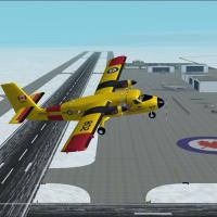
Version 4 presents a fictional Canadian arctic base with crosswind ILS runways, AI flights, and aurora effects, developed by Brian Sturton. CAF color schemes based on Greenwood and Comox aircraft, …
 Canada
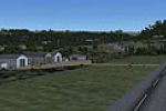
Jacques Botha documents a South African airfield identified as FALB, released as freeware. The project references a FALB_Ladybrand folder and highlights an approach into runway 7, while noting the …
South Africa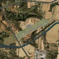
LETF, a Cadiz, Spain airfield with ICAO LETF, enters version 2 as Felix Fernandez de Castro fixes AI traffic taking off from Runway 24. Files LETF_aerodromo.bgl (AFD with GA parking), LETF_objetos.…
 Spain
Spain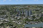
Dick Kittredge presents a Holyoke, Massachusetts view focused on the skyline along the Connecticut River. The package includes a file named HolyokeMA.bgl, designed to integrate with add-on resource…
United States of America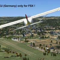
Ulrich Loehl offers a German airport identified by the code EDKU as freeware, anchoring the work to Germany and the EDKU designation as a distinct reference for pilots seeking a no-cost addition fo…
 Germany
By Zain Khan, an NFNM upgrade expands parking capacity and redefines runway markings for the base Matei airport layout. Two files, NFNM_ADEX_...ad2.bak and NFNM_ADEX_...bgl, reside in the addon pat…
 Fiji
Fiji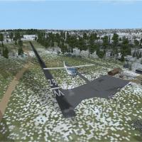
Located near West Kingston, Rhode Island, Richmond Airport (08R) is reworked from visits in March 2011 and satellite imagery, using stock objects with extras removed and key elements relocated. A B…
United States of America