Page 140
Searches the whole library — filter by sim & category on the results page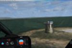
Enhancements provide new airfields, airstrips, lighthouses, and road plus AI traffic for the Gen X Orkney and Shetland area, including the Old Man of Hoy. The effort relies on accurately placed def…
 United Kingdom
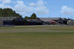
An edition aligns with NL2000 v4 framework and relies on the NL2000 v4 base that covers extensive areas of the Netherlands. Near Apeldoorn, EHTE Teuge Airport highlights the control tower, maintena…
 Netherlands
Second entry in a long-lost-era temple sequence by Gera Godoy Canova, this add-on provides enclosed .bgl files and BMP images, plus a route map to locate the temple and the nearby airfield. The wor…
 Global (World)
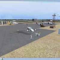
KMNF in Missouri gains life as Jimmy R. Martin adds airport objects and people to the field. Ramplights materials sit alongside two folders containing files, with the readme provided for reference,…
 United States of America
Anwar Gonzalez documents a high-altitude airport project in northwest Tibet, set to open in July 2010. Elevation reaches 13,995 ft and a 4,500 m asphalt runway oriented 09/27 sits at coordinates N3…
 China
China
East Hampton (KHTO) on Long Island receives a modification that adds GA parking, repositions and widens taxiways, and reconfigures the ramp to reflect current layouts using Google Earth, by Kyle Co…
United States of America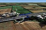
Near Kettering in Northamptonshire, this UK field expansion accompanies the A Day on the Farm series and covers 14 fields, including Crossland Moor and Rothwell, by Neil Birch. It relies on downloa…
United Kingdom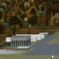
Springfield-Lebanon Airport in Kentucky, United States, identified by ICAO code 6I2, receives an upgrade that corrects aprons and adds taxiways and objects. A layout component is included to suppor…
United States of America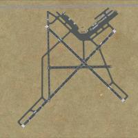
Joe Hassen adds an air cargo hangar to KHOB (Lea County Regional Airport), NM, a change described directly in relation to the field at Lea County and linked to KHOB’s code as the entry point for th…
United States of America
The KDAW airfield in Rochester, New Hampshire, adjusts aprons, roads and taxiways, replaces default buildings and adds new structures. Two BGL files, KDAW_AFX_JC.bgl and KDAW_JC.bgl, carry the chan…
United States of America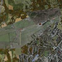
This freeware correction for Neumuenster Airport in Germany, by Uwe Schweitzer, adjusts autumn-season visuals by overwriting the EDHN.bgl file. Intended for use with EDHN_FSX.ZIP in Germany, the re…
 Germany
Two hangars on each of the A and B ramps gain opened interiors, while microwave towers are revised in version 7.1 by Brian Sturton. The patch moves five items into four folders, overwrites existing…
 Canada
Set near Kalispell City Airport, Montana, Katie's Lagoon sits east of S27 on the north shore of Flathead Lake, featuring a float plane landing strip coded MTKL and a GPS-visible water runway with s…
United States of America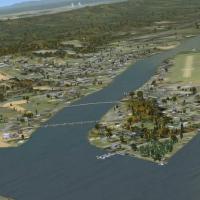
A complimentary add-on for the Selinsgrove, Pennsylvania area presents a waterside destination called Fantasy Island, where visitors meet friendly locals, pose for photos, and relax at the park whi…
United States of America
The project updates taxiways, runways, and parking at the airport at Red Wing, Minnesota (KRGK) using real satellite imagery from Google Earth, with detail drawn from default library objects. Phill…
United States of America
An add-on for Columbia Airport in Tuolumne County, California, adds static aircraft, vehicles, and hangars to the airport, aiming for a more accurate layout. Creator Vince Marrone credits the proje…
United States of America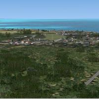
Belize’s Punta Gorda airstrip carries the self-designated code MZ62 and the IATA tag PND, with no official ICAO designation. Alf B. Meier authors the data, while an unpaved strip features two huts …
 Belize
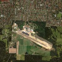
Manjimup, Western Australia, receives an add-on that requires autogen libraries beyond the stock library, including Rwy12, Ez, Orbx, and OzX, and Uwe Schweitzer author credits the file MANJMUP_LT.Z…
 Australia
The airfield with code KUWL sits in New Castle, Indiana, and serves as a straightforward add-on for the region, easily identified by its registration. By Jimmy R. Martin, the author emphasizes a si…
United States of America
Neil Birch presents a Redlands airfield adjustment for users in Neil’s Microlights North and Midlands areas, and it works with default VFR baselines, though the effect remains invisible there. Two …
United Kingdom