Page 24
Searches the whole library — filter by sim & category on the results page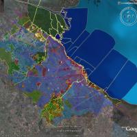
Buenos Aires 2008 by Pablo Contouris centers on the end of the Paraná delta and a coastal strip from Escobar to La Plata, balancing performance with a realistic land appearance. It references the B…
 Argentina
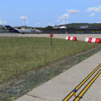
An LTBR airport add-on covers Bursa Yenisehir, serving civil and military use about 60 miles south of Istanbul, with 7 apron parking positions plus 2 military-side spaces and a helipad. The package…
 Turkey
At Port Columbus in Columbus, Ohio, KCMH, gates and parking are updated while jetways become visible and operable, with the ability to call a jet to the jetway using CNTRL-J. The layout serves carr…
 United States of America
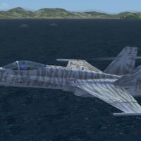
Javier Fernandez delivers a Version 2.0 USS Nimitz arrangement with FX by Sylvain Parouty, complemented by a compilation credit to Hani Michal. The Nimitz and four other battleships stand in static…
 Brazil
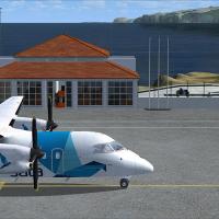
Lets Fly Association and Shigeru Tomino present Corvo Airport at LPCR in the Azores, Portugal as version two. Two image previews show the runway area, and attribution lists Lets Fly Association alo…
 Portugal
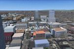
Harutoshi Nakagawa leads a two-year effort to model Japan's northern island, including Sapporo City on Hokkaido, using Gmax. A zip holds a file named sap_effect_fsx, containing a sap_effect folder …
 Japan
Japan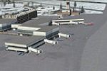
An updated configuration for Burlington International Airport (KBTV) adjusts aprons, taxiways, and roads, and assigns gates while adding Cargo, GA, and National Guard parking with static helicopter…
United States of America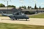
An enhancement of McGuire AFB (KWRI) near Wrightstown, New Jersey, adds extended parking with lighting, a fire station, and realigned aprons and taxiways that mirror reference diagrams and imagery,…
United States of America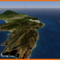
The St. Eustatius depiction centers on the FD Roosevelt airport TNCE in the Caribbean. It uses SbuilderX, Autogen Annotation, and Airport Design Editor 9x, and boat traffic may appear from source f…
 Bonaire, Sint Eustatius and Saba
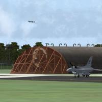
The 81st TFW RAF Bentwaters Woodbridge configuration recreates the two former United States Air Force bases as they stand prior to 1993, is built with input from the Bentwaters Cold War Museum, has…
 United Kingdom
This 10 m mesh relies on the Sardegna Region GIS terrain models, achieving LOD 12 and spanning the entire Sardinia region in Italy. Version 2 corrects sea water elevations, with attribution to Raim…
 Italy
Italy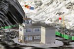
Axalp / Ebenfluh sits 2200m above sea level in the Swiss Mountains near Meiringen AB, drawing aviation enthusiasts each October for the annual event. Buildings, targets, navaids, a tower view and h…
 Switzerland
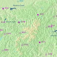
Tim Clayton presents the Dambusters project, detailing a representation of RAF Scampton as the takeoff base and the Moehne, Eder, and Sorpe dams. It includes a dambusters.htm file with guidance on …
 Global (World)
An updated v2 layout for the Detroit region airport activates all six runways and adds a dedicated cargo zone for UPS and FedEx. The project uses Airport Design Editor v1.30 and includes the KDTW_F…
United States of America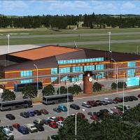
Shigeru Tomino of Lets Fly Association presents RJCB in Hokkaido, Japan, as a focused addition. An aerial view shows the airport and its surrounding area, anchoring the geographic layout and provid…
Japan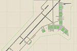
Jim Cook refines Luke AFB in Glendale, Arizona with added cargo and combat parking and refined taxiway alignment, broadening ground-vehicle activity. A new fire station with fire trucks and a helip…
United States of America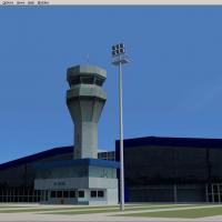
By Gustavo Luna, the add-on enhances the Rio Branco International Airport in Acre with detailed taxiway signage, grounded markings, and night lighting, while runways retain accurate dimensions and …
Brazil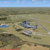
Schleswig-Jagel AB (ETNS) sits in northern Germany near Schleswig and the Baltic coast, hosting Naval Wing 1. It includes Kiel-Holtenau EDHK civil and ETMK military fields, and uses ADE X 1.50 with…
 Germany
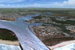
Anthony Lynch presents Ants Aussie Airports 14: Ballina, a two-part enhancement around Ballina region airport in New South Wales, Australia, delivering over 100 square kilometers of photoreal groun…
 Australia
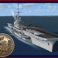
By Sylvain Parouty, a Clemenceau-era carrier model presents a moving ship with a functional catapult and arrestor wires for naval ops, though only the front catapult operates. The flight deck visua…
 France