Page 39
Searches the whole library — filter by sim & category on the results page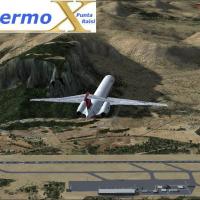
Palermo Punta Raisi Airport in Italy, version 2.0, sits 19 nautical miles west-northwest of Palermo on Sicily, and the newer terminal enhances realism. Crosswind landings join the lineup, and groun…
 Italy
Italy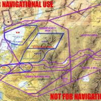
Naval Air Station Fallon in Nevada anchors coverage of B-16, B-17, B-19, and B-20 ranges with instrumented EW ranges and all MOAs Fallon manages. KNFL_FSXr serves as the core file, knflmoa.jpg char…
 United States of America
Victor Pinto creates a Panama-focused file. The item carries a Panama label and imagery references accompany it in the original materials, establishing the geographic scope and branding for this Pa…
 Panama
Ray Smith presents a Budapest LHBP modification designed with ADE v1.47 that updates the default airport layout, adds assigned parking, extra fuel trucks, and rebuilt roads with updated taxiways an…
 Hungary
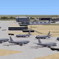
Altus AFB in Oklahoma hosts custom hangars for the 97th Air Mobility Wing, with parking for C-17s and KC-135s. It uses EZ library assets and Dan French Core Libraries Vol1_FSX or higher and PAI mod…
United States of America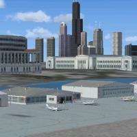
Merrill C. Meigs Field Airport carries IATA CGX and ICAO KCGX, and sits on Northerly Island in Chicago. The facility first opens in 1948 and rises to become the country’s busiest single-strip by 19…
United States of America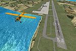
Denpasar airport in Bali receives a replacement whose runway portion extends into the ocean on an artificial peninsula. It uses ADE v1.37 and is by Er-Jin Jang, while aprons and parking areas recei…
 Indonesia
By Serdar Nuzhet, the Ercan LCEN project is built from scratch with 3ds Max and gmax to model North Cyprus' Ercan and nearby Gecitkale (LCGK) with working ILS and nav aids. It includes radar, flags…
 Cyprus
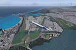
Gottfried Razek provides photo-based imagery for the eastern Puerto Rico region, offering a 4.7-meter-per-pixel resolution suitable for coastal terrain. Blueskyscenery.com appears as the source and…
 Puerto Rico
Alaska covers 147 airports and seaplane bases with Glacier Bay National Park, including six seaplane docks and a base camp for helicopters and ultralights. It delivers two aircraft variants and com…
United States of America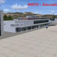
Beta release for Toncontin International in Tegucigalpa, code MHTG, arrives as version 0.6 and adds six Gmax-built structures, including the main terminal, control tower, cargo warehouse, fire-pavi…
 Honduras
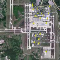
KCVG presents Terminals 1–3 with parking structures, skywalks, and annexes, along with the Delta hangar, DHL cargo facility, Comair headquarters, and a Doubletree hotel. It relies on ez_1.zip, rw12…
United States of America
Neil Birch presents a UK VFR Library, with permission from Alan Fidler. Unzipping yields three folders, including the UKVFR LIBRARY, with two others whose names are not specified, and the arrangeme…
 United Kingdom
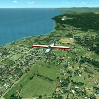
Ian Thatcher resizes and rewords all files to enable Autogen, now at 60% with a 6fps gain on the test computer. The changes apply to all included elements and improve its compatibility across confi…
 Global (World)
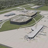
A Florida airport enhancement at KTPA adds a terminal replacement, parking areas, vehicles, and GA hangars, designed for a flight-simulation platform. It requires RWY12 Libraries, and distributes B…
United States of America
The EGBB enhancement replaces Runway 06-24 with taxiways L and T, updates markings and signs, moves E7, C1, and C2 for real-world alignment, and adds accurate terminal-area buildings behind the mai…
United Kingdom
KHOU in Texas receives a detailed ground layout featuring a new Y-shaped central concourse and the original 1940 terminal, with real gate assignments and runways aligned to satellite imagery. An op…
United States of America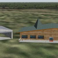
This version 2 release by Mahmoud Fadli and the VATSIM Jordanian FIR covers OJAI, OJAM, OJAQ, and OJMF with updated taxiway configurations and Amman, Aqaba, Mafraq landclasses, drawn from real-worl…
 Jordan
On a reclaimed island off Osaka Bay, the addition aligns terminals, aprons, and gates with real coordinates using satellite references. The RJBB_IanW folder anchors the project; the second runway a…
 Japan
JapanKEDW folder on Edwards AFB in California expands on-base capabilities with two refuel stations and static aircraft including KC-135, F-15C, A-10, Predator, and C-130 Hercules. Credits go to Guy Dio…
United States of America