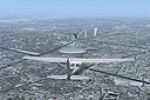
Canada

Page 3

Sort
Reset
Preview screenshot

CYVR

An updated AFCAD for Vancouver International Airport CYVR refines gate allocations and parking stands, aligns taxiway signage, extends Terminal D, inserts helipad starts, and offers optional cross-wind runway logic, giving FSX users a Canada-focused layout that improves AI routing, pushback sequencing, and ground service vehicle paths.

File Size
655.35 KB
Total Downloads
1.5K
Star Rating
4/5
Screenshots
3
Preview screenshot

McKenzie Valley Run

Covering Deline, Tulita, Norman Wells and Fort Good Hope in Canada’s Northwest Territories, this FSX scenery package rebuilds each gravel strip with custom 3-D structures and photoreal textures, aligns with Ultimate Terrain Canada, respects 5 m mesh, and shows best under Acceleration or SP2, giving bush pilots accurate VFR reference along the McKenzie River corridor.

File Size
2.9 MB
Total Downloads
1.1K
Screenshots
1
Preview screenshot

Hay River - Merlyn Carter Airport

Hay River’s Merlyn Carter Airport (CYHY) for FSX refines Northwest Territories bush-flying routes with realigned runways, corrected NAV-aids, GMax-built hangars, Buffalo Airways static fleet and a simplified yet accurate Hay River townsite, offering a practical Canadian freight-hub backdrop for VFR training, tanker ops and cold-weather cargo hauls.

File Size
40.22 MB
Total Downloads
1.1K
Star Rating
1/5
Preview screenshot

Montreal VFR

Covering urban Montreal in FSX, this VFR package by Sylvain Tremblay introduces custom Olympic pyramid models, the Mount Royal cross, St-Lambert lock structures and refined roadway vectors atop the mountain, combining photoreal textures with adjusted autogen to aid VFR navigation around Quebec’s busiest IFR/VFR transition airspace.

File Size
1.34 MB
Total Downloads
1.1K
Preview screenshot

Montreal Ponts de la Rive-Sud

Covering Montreal’s south-shore corridor, this FSX VFR add-on brings the Champlain and Honoré-Mercier spans, St-Lambert locks, Olympic Pyramid, and the Mount Royal beacon cross into sharp focus, aligned to Gilles Gauthier terrain mesh for accurate altitudes—ideal for GA pattern work and rotorcraft training along the St. Lawrence River skyline.

File Size
17.64 MB
Total Downloads
1K
Screenshots
5
Preview screenshot

Canadian Forces Station Alert

This Canada-category scenery mod overhauls Canadian Forces Station Alert (CYLT) for FSX, refining coordinates, gravel runway 05/31 profiles, NAVAIDs, and helipad spots while adding ice-station buildings, static Coast Guard cutters, naval assets, and drifting icebergs to support cold-weather VFR and IFR training in the high Arctic.

File Size
375.29 KB
Total Downloads
1K
Screenshots
10
Preview screenshot

Victoria Inner Harbor Airport

Detailed FSX scenery download re-creates Victoria Inner Harbor Water Airport (CYWH) on Canada’s Pacific coast, adding accurate floatplane docks, water runways, start points, static DHC-3/DHC-6 models, plus nearby Shoal Point Heliport (CBZ7). Crafted with Airport Facilitator X and Instant Scenery 2 from satellite data, the package tightens VFR coastal approach realism for seaplane pilots.

File Size
9.98 MB
Total Downloads
976
Star Rating
5/5
Screenshots
8
Preview screenshot

Sea Lion Air Service Scenery And Flights

Covering the rugged shoreline of Quebec’s Gaspé Peninsula, this FSX package recreates Sea Lion Air Service’s post-war routes from Sainte-Anne-des-Monts in a vintage C-47, adding bush strips, tide-level docks, seasonal photoreal terrain, custom flightplans and weather-aware VFR missions for short-haul cargo, mail and passenger hops along remote coastal settlements.

File Size
1.25 MB
Total Downloads
796
Star Rating
1/5
Screenshots
8
Preview screenshot

Canada Day Fireworks - 2012 Edition

Country-wide pyrotechnic scenery for FSX, the 2012 Canada Day Fireworks refresh introduces night-time particle bursts over Newmarket (CYNM area) and Langley (CYNJ), removes territorial-capital shows for cleaner frames, and ships as an Acceleration-SDK-compiled BGL set that layers above Orbx terrain; created in tribute to Canadian Armed Forces.

File Size
199.29 KB
Total Downloads
778
Screenshots
1
Preview screenshot

Ontario Landclass

Ontario Landclass for FSX delivers a province-wide terrain add-on, built from Ministry of Natural Resources GIS data, that swaps default tiles for accurate cropland grids, mixed forest bands and shoreline polys extending to U.S., Manitoba, Quebec and Nunavut boundaries—handy if you want a Canada VFR base layer before stacking photoreal downloads.

File Size
14.6 MB
Total Downloads
777
Star Rating
5/5
Preview screenshot

Banff Airport

High-altitude CYBA Banff Airport for FSX adds refined terrain mesh, updated AFCAD data, and purpose-built structures nestled between Mount Rundle and Sulphur Mountain, offering VFR flyers reliable reference points, a corrected short-field runway profile for STOL work, and seasonal textures that merge smoothly with default Canadian Rockies scenery.

File Size
385.6 KB
Total Downloads
727
Screenshots
2
Preview screenshot

HMCS True North Battlegroup

HMCS True North Battlegroup places a notional Royal Canadian Navy carrier task force—Ark Royal-standard light carrier HMCS True North, River-class DDG, Town-class patrol frigate, EH-101 utility helo and NH-90 plane-guard—into FSX Acceleration via AI Carriers, giving Canadian-theatre naval aviation a credible deck and escort setup for fixed-wing and rotorcraft ops.

File Size
8.59 MB
Total Downloads
693
Screenshots
4
Preview screenshot

BC PNW Whistler

Covering Whistler’s alpine valley in British Columbia, this FSX scenery add-on inserts CAE5 Green Lake Water Aerodrome, hospital heli pad CAW4 and municipal heliport CBE9 with handcrafted buildings, accurate geolocation, and 10 m mesh alignment for Orbx PNW users—ideal for bush pilots, floatplane sorties, medevac rotor work and scenic VFR hops across Canada’s Pacific Northwest.

File Size
3.3 MB
Total Downloads
633
Star Rating
1/5
Preview screenshot

Nova Scotia Landclass

Updating FSX’s default green blanket, this Nova Scotia landclass injects accurate coastal contours, urban footprints, agricultural patches and mixed-wood coverage from YHZ to Cape Breton, enabling sharper VFR checkpoints, realistic autogen placement and smoother transition between mesh and photoreal tiles across Canada’s Atlantic province; a pragmatic scenery enhancement for Microsoft Flight Simulator X users seeking regional fidelity.

File Size
19.18 KB
Total Downloads
608
Preview screenshot

CYVR Update

Targeted AFCAD refresh for Vancouver International Airport (CYVR), British Columbia, strips default autogen clutter along the coastal threshold of runways 08L/08R and the adjacent Swishwash Island, aligning approaches with real-world sightlines. Built in ADE for FSX default terrain, compatible with Ray Smith’s prior CYVR layout.

File Size
317.15 KB
Total Downloads
592
Screenshots
2
Preview screenshot

Sproat Lake Mars Water Bomber Base

Set on Vancouver Island’s Sproat Lake, this Flight Simulator X add-on installs the historic Martin JRM Mars water-bomber seaplane base, complete with mooring docks, service ramps, shoreline textures, wildfire effects and optional AI tanker traffic, supporting realistic low-level VFR circuits and firefighting operations across coastal British Columbia.

File Size
7.79 MB
Total Downloads
550
Star Rating
1/5
Screenshots
1
Preview screenshot

Banff National Park Airstrip

CYBA Banff National Park Airstrip for FSX repositions the alpine strip to accurate geo-coords, applies native slope data from the Canada19 mesh, and injects default FSX objects for contextual detail. Designed in ADEX9, compatible with SP2/Acceleration; no AI parking, just the helipad start, catering to bush flying and heli ops.

File Size
15.37 MB
Total Downloads
541
Star Rating
1/5
Preview screenshot

Nova Scotia

Quietly refreshing the Canadian Maritimes, this FSX terrain mesh for Nova Scotia by John Perkins refines coastal escarpments, granite headlands and glacial valleys using 38 m DEM data, yielding more precise VFR checkpoints over Halifax, Cape Breton and the Bay of Fundy while merging smoothly with stock landclass for stable frame-rates.

File Size
67.81 MB
Total Downloads
534
Screenshots
1
Preview screenshot

BC PNW Lighthouses

Covering eighteen staffed Canadian Coast Guard lightstations along British Columbia’s Pacific Northwest shoreline, this Microsoft Flight Simulator X scenery file supplies accurate lighthouse models with functional helipads, optional startup flights, and low-impact geometry. Useful waypoint markers for VFR bush routes and rotorcraft circuits, the package aligns with Orbx FTX NA Blue PNW and 10-metre terrain mesh.

File Size
4.52 MB
Total Downloads
523
Preview screenshot

Nunavut Landscape

LOD10 mesh, refined landclass, hydrography vectors and the newly added Mary River CMR2 strip reshape Nunavut’s Arctic expanse in FSX, aligning airport elevations and shorelines; low-level VFR sorties benefit from precise contours, glacier margins, rivers, lakes and ragged coastlines that support bush flying and polar navigation realism.

File Size
49.51 MB
Total Downloads
519
Star Rating
5/5
Screenshots
4

9 pages with 161 downloads.

previous123456789next