Page 57
Searches the whole library — filter by sim & category on the results page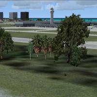
Version 1.2 adds major roads with moving traffic, power lines, and refined Land Class around San Juan, spanning TJSJ, TJBQ, and TJPS. Two af2x_tjsj.BGL files exist, one for Americal Airlines parkin…
 Puerto Rico
Mike Eppright presents a completely new rendition of KMKC in Missouri, as freeware. The creation relies on GMAX and ScenGenX, and notes that the runway and taxiway layout follows an older template,…
 United States of America
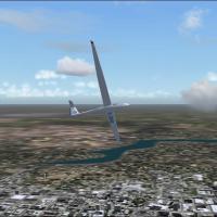
Thermals lifts enable glider flights across India, using atmospheric updrafts to sustain longer durations and broaden routing options for cross-country gliding. An image at /userimages/windia.jpg o…
 India
India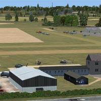
Stapleford_EGSG in the UK blends Google Earth aerials and the Pooleys UK Flight Guide, and the project uses the Object Placement Tool and Airport Design Editor v1.50 to create objects, plus Instant…
 United Kingdom
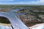
Anthony Lynch presents Ants Aussie Airports 14: Ballina, a two-part enhancement around Ballina region airport in New South Wales, Australia, delivering over 100 square kilometers of photoreal groun…
 Australia
Designed with ADE v1.47, the KAUS upgrade introduces assigned parking and a new control tower. KAUS_ADE_RS.BGL serves as the main file, KAUS_ADE_CVX.bgl removes Autogen and adds rear-terminal roads…
United States of America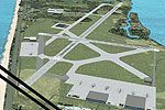
Two .bgl files, AFX_KCOF_JC.bgl and KCOF_JC.bgl, anchor a Patrick AFB revision by Jim Cook near Cocoa Beach, Florida, designed for flight simulation environments. Realigned taxiways reflect AirNav …
United States of America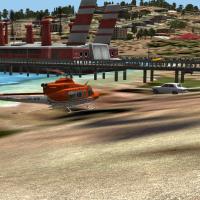
Coverage of two islands for Sao Tome and Principe introduces new landclass, airports, coastal towns, ports, and private airfields at sugar refineries, with maps showing towns and additional airfiel…
 Sao Tome and Principe
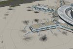
An update for the Duesseldorf EDDL layout arrives as version 1.01, covering Germany, addressing a parking-position collision when the frontwheel hits the jetway ground pattern. By Max Epperlein and…
 Germany
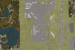
The KSFB facility in Florida undergoes an overhaul that replaces the default layout, with gates correctly assigned and a 6000-plus-foot extension to runway 9R-27L that includes an ILS, by Ryan Cobb…
United States of America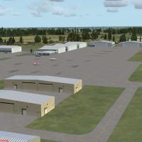
Authored by Art Poole, this Melbourne, Florida addon targets KMLB with updated taxiways and refined hangars. A new library file named Airport_Buildings_AP.bgl accompanies the work, and it remains c…
United States of America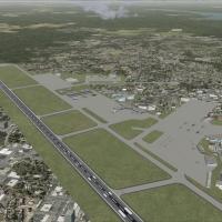
Lee Marrow crafts an addon for the Bangor area at KBGR in Maine, using only the default object library. An included parking file expands ramp positions and the cargo ramp carries assorted vehicles,…
United States of America
Hannes Steyn of Aeroworx delivers a refined land class refinement spanning Namibia, Botswana, Mozambique, and Zimbabwe, with focus from the Free State and Northern Cape to Lesotho towns and routes …
 Global (World)
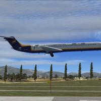
Antoine Calleja releases a VNKT fix for Khatmandu Tribhuvan Airport in Nepal, remedying missing trees and ground vehicles around the airfield. The adjustment aligns with the established setup for t…
 Nepal
Nepal
Four sites appear: Rio de Janeiro, Monument Valley, Istanbul and Budapest, tied to a Red Bull branded air race concept. The listing presents these locations as the core focus, highlighting geograph…
Global (World)
By Sylvain Parouty, a Clemenceau-era carrier model presents a moving ship with a functional catapult and arrestor wires for naval ops, though only the front catapult operates. The flight deck visua…
 France
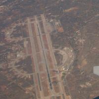
The LGSA designation on Crete, Greece marks a base enhancement near the airfield. A static F16 is included, credited to Guy Diotte with permission, while Alan Mccarthy handles development and Roger…
 Greece
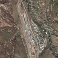
At Sardy Field in Colorado, registration KASE appears, and the runway heading shifts by 1.05 degrees to better align with the current layout, improving navigation for arrivals and departures. Repos…
United States of America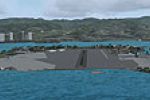
Distributed for Red Eye Guys Inc., by J. D. Starseed, this Hawaii-based facility on Ford Island adds combat ramps, static aircraft and ships, and an ILS approach to runway 4, while frame rates rema…
United States of America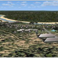
South Africa's Kruger area is recreated by Hannes Steyn and Martin du Preez for Aeroworx, detailing rest camps, picnic sites, roads, and waterholes. The work relies on Aeroworx mesh components FSXM…
 South Africa