Page 98
Searches the whole library — filter by sim & category on the results page
At Abilene, Texas airport (KABI), the update relocates the control tower, replaces nearly every default building, and adds aprons, parking, static aircraft, light poles, and extra structures, while…
 United States of America
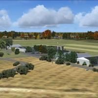
Located near Namur, Belgium, the airfield EBNM features grass runways, detailed hangars, and static aircraft. Three AI aircraft include PA28_180, C172, and Yak52 with unique markings, while Jean-Ph…
 Belgium
At KNBC in Beaufort, South Carolina, Jim Cook alters the base by adding Military_Cargo and Military_Combat parking, a fire station with trucks, additional buildings, static fork trucks, and parking…
United States of America
KGGB, by Derek Souza, sits near the San Francisco Bay area as a fictional field. Final approaches align with 27L water or 27R concrete, and the layout hosts 20+ gates and seaplane docks, with BGL f…
United States of America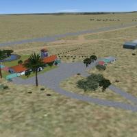
An upgrade of the airfield at Beaufort West in South Africa adds runway lights and reinforces its role as a stopover for small aircraft between Cape and the Northern Provinces. It integrates best w…
 South Africa
By The Netherlands 2000 Design, this enhancement refines the NL2000 v4 environment with updated foliage models and configurations for realistic regional plant life. It uses the NL2000 v4.0.20 insta…
 Netherlands
The file Gatewaycentre.bgl renders the Gateway Centre, with take-off options from Virginia Airport (FAVG), Durban International (FADN), and King Shaka (KSIA). The project is produced with Abacus FS…
South Africa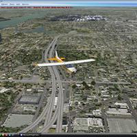
KBTR Beta v1.0 for Baton Rouge, Louisiana, brings city buildings and river traffic from KBTRv2 into the scene. By Joe DeGregorio, it highlights the Tall State Capitol Building, Cortana Mall, and Ex…
United States of America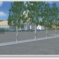
LPBG (Braganca) presents a 20 by 20 kilometer area developed with a custom terrain mesh and photoreal base imagery that faithfully renders the surrounding terrain. José Maia crafts the work, reflec…
 Portugal
Developers use ADE9x to model MDCY Samana airport (El Catey Intl) in the Dominican Republic. The included navdata targets the iFly747-400 and transfers to the iFly navdata folder, and the accompany…
 Dominican Republic
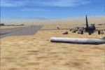
By Walker Grant, this Mojave Spaceport depiction targets Alphasim Rutan Long-EZ enthusiasts. It includes emergency vehicles, cranes, trucks, and buildings around vast boneyards and reclamation faci…
United States of America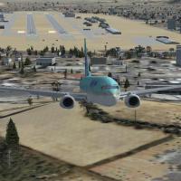
The Daegu airfield (RKTN) in South Korea gains a new taxiway, an apron, and a runway, along with several buildings. By Er-Jin Jang, built with ADE v 1.37, the file adds detailed aprons and parking.
 Korea, Republic of
Taiwan hosts a VOR/DME identified as TNN, with SIGANG 113.3, configured through a BGL shelf to restore its navigation aid. The file TNN_VOR_FSX.BGL, by Raphael, addresses its disappearance in the s…
 Taiwan, Province of China
An Unisa campus in South Africa features a custom designed building credited to designer Frits Beyer, illustrating a singular architectural element added to the site. Swartkops AFB is designated as…
South Africa
Tonopah facility in Nevada receives BGL files that add ramp parking for military aircraft and incorporate roads. The update replaces landclass to resemble satellite views and uses sloped flattening…
United States of America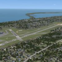
Extends the 2012 runway 6-24 extension at Erie International Airport (KERI) by about 1850 feet, bringing the runway length to 8350 feet. Two .bgl files, authored by Richard O. Finley, use stock bui…
United States of America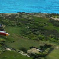
By Gera Godoy Canova, this add-on focuses on a Panama border town near Colombia, featuring a dirt airstrip about 1875 feet long and a printed route map for planning. It notes three weekly flights f…
 Panama
Alexandre Remy presents a freeware add-on for Longuyon-Villette airfield near the Belgian and Luxembourg frontiers in the 54th department, with GMAX-built buildings and autogen aligned to the under…
 France
P. Nigel Grant provides an adaptation of Mark Smith's facility at KPWT in Washington for a revised layout. The patch extends aprons, replaces fences via Airport Design Editor and uses SBuilderX to …
United States of America
Amundsen Paulatuk pays tribute to the Canadian Coast Guard vessel Amundsen and its shuttle near the village, with the ship landable and anchored at N69*23.45 W124*03.44 and the shuttle at N69*20.84…
 Canada