Page 133
Searches the whole library — filter by sim & category on the results page
Neil Birch presents an enhancement to the original farm scenario, refining terrain with field undulations and a visible mesh while adding road traffic and farm sounds at all strips. The package inc…
 Global (World)
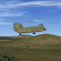
Gilze Rijen Air Base (EHGR) sits within the NL2000 v4 framework, enabling seamless interaction with the NL2000 v4 environment. The module updates runways and taxiways to align with current charts, …
 Netherlands
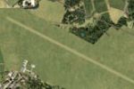
Located in Romania, Deva Aerodrome, registered LRDV, presents a grass-strip layout with accurate location but approximate extents and runway length and orientation, today hosting gliders and reflec…
 Romania
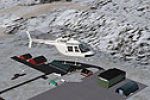
Geir Gronlien authors the ENBM edition, Bomoen 2007, v1.0, for the airfield in Norway. It relies on freeware tools including Gmax and KML, and BGL files such as cvxGRASSNOR.BGL and 210107Test6texai…
 Norway
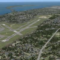
The work portrays the ongoing runway extension at Erie International Airport (Tom Ridge Field, KERI) and refines detail with a Google Earth overlay while using only stock buildings compatible with …
 United States of America
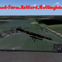
Forwood Farm sits in Nottinghamshire, England, offering a grass airstrip oriented 02/20 and measuring 500 by 27 meters, suitable for experienced microlight pilots. The work, by Neil Birch, serves N…
 United Kingdom
By The Netherlands 2000 Design Team, this edition centers on EHAL Ameland, delivering close-up coverage of the island airfield within the NL2000 v4 framework. It uses a modular installation requiri…
NetherlandsSaint-Florentin Aerodrome (LFGP) sits in France, and Simon Duval authors the work, establishing a geographic focus. The LFGP designation identifies the airfield, clearly linking the location to the…
 France
Near Quebec City, Canada, the Lauzon point hosts the Davie yard area along the St. Lawrence River, a notable VFR landmark, by Pierre Baillargeon. There are six .bgl files and a folder containing tw…
 Canada
South of Vancouver in British Columbia, the airfield operates as an uncontrolled aerodrome under registration CAK3 and hosts RAAC Chapter 85, Boundary Bay Flying Club, and COPA Flight 5. Redevelopm…
Canada
Jim Cook improves Anacortes Airport 74S in Skagit County with reconfigured aprons and road networks, plus replacements of generic buildings by more accurate hangar and terminal models and added sta…
United States of America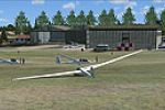
By Dirk Steinnagel, this EO28-focused addition centers on Iserlohn-Summern in Germany. It holds a Static Objects Library and a file named Sümmern.bgl, the two items live in the Addon area for EO28 …
 Germany
Frits Beyer and Jacques Botha credit Harrismith Airport (FAHR) in South Africa for this project, a general aviation facility linked to the FAHR designation. An accompanying AFX_FAHR_ALT.bgl file co…
 South Africa
South Africa hosts Mylstroom airfield, registered FANY, where Jacques Botha contributes custom buildings alongside default objects. The presentation highlights a blend of default library objects wi…
South Africa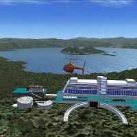
Harutoshi Nakagawa depicts the Windsor Hotel Toya area at Hokkaido Toya Lake, the fifth summit site in Japan, where leaders meet from July 7 to July 9, 2008. Two linked visuals accompany this recor…
 Japan
Japan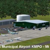
John B. Loney, Jr. provides a fix for KMPO in Pennsylvania, addressing missing signage at the Pocono area facility. The archive includes FILE_ID.DIZ, kmpo_fsx_1.jpg, and readme.txt, and an accompan…
United States of AmericaDesignation 26N sits two miles southwest of Ocean City, New Jersey on 60 acres with about 60 tiedown spots, and the main tarmac supports wingspans up to 40 feet while the west end accommodates larg…
United States of America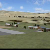
In South Africa, a field project uses custom-designed models and buildings under the FATN registration, with credits given to Jacques Botha and Frits Beyer. The FATN folder hosts the main models, a…
South AfricaStewart Haworth designs Orwell Bridge to operate with the default environment, spanning the river Orwell near Ipswich, Suffolk, UK. No usage restrictions apply, and it is for use with default visua…
United KingdomA private grass airstrip in the Pennines sits over 900 feet, near Bacup and Waterfoot with Ramsbottom to the southwest. By Neil Birch, an on-field NDB operates at 200.10 with a six-mile range, and …
United Kingdom