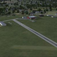
Registration N31 in Pennsylvania anchors this revival project as Kutztown Airport remains closed, drawing attention from enthusiasts and preserving a piece of regional aviation history. John 'Shark…
 United States of America
Merritt Field carries registration 4PN7 and sits in the Endless Mountains of Pennsylvania, while files named 4PN7_AFX_JC.bgl and 4PN7_JC.bgl accompany data from the site, forming a concise linkage …
United States of America
North Star facility gains overhead lighting for parking areas, increasing nighttime visibility. It includes raw macro files and three configuration options CYNS_NORTHSTAR_CONFIG_01, 02, and 03, wit…
 Canada
Designed for Neil's Microlights users, this addition introduces a tarmac runway at Cockerham Airfield (Patty's-Farm), replacing the default grass strip. It centers on Patty's-Farm-p.bgl and benefit…
 United Kingdom
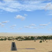
In the Jordan Valley near Masua, Israel, Jiptlik Airstrip serves emergency operations and very light LSA traffic, establishing a modest, operational facility for aviation activities in the region. …
 Israel
Phillip Coyle resizes and aligns the airport's runways, aprons, and taxiways to real-world coordinates in California, with two BGL files named KWLW_ADE.BGL and KWLW_ADE_CVX.BGL. He also integrates …
United States of America
Located near Lake Haupiri on New Zealand’s west coast, inland from Greymouth, the Gloriavale airstrip (NZHP) serves Air Westcoast and the Gloriavale Christian Community, and is not included in the …
 New Zealand
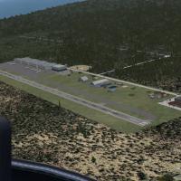
MYZ2 airport-focused change adjusts the runway northward, fixes the ILS, adds ATIS, and introduces pole lighting, remaining limited to the airfield area and not affecting any landclass. fc119sca.zi…
 Bahamas
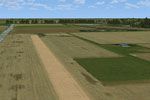
Developed for Noordoostpolder in the central Netherlands, this expansion delivers photoreal ground imagery, autogen enhancements, and refined landmarks across reclaimed landscapes. It fits within t…
 Netherlands
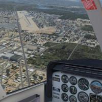
An airfield in Hardin, MT, identified as F02, gains runway lights and an ILS, along with helo pads, parking areas, and transport vehicles. Credit goes to Jimmy R Martin, using Airport Design Editor…
United States of America
LKSTX 1.1 revises LKSTX v1.0 to emphasize the LKST airport and Strakonice, with LKSR as a backup and including parts of Volyne and Pisek, by Pavel Krejci. The design uses simplified objects and adv…
 Czechia
The Dutch module recreates Drachten Aerodrome, ICAO EHDR, with accurately oriented runway and taxiway network. It integrates with the NL2000 v4 environment, requires the v4.0.20 installer, and the …
Netherlands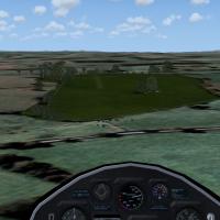
Near Plassay Caravan Park, the strip measures 325 by 8 meters with a 10/19 orientation and sits at 210 feet ASL near Wrexham, North Wales. By Neil Birch, and for users of Neil's Microlights, it is …
United Kingdom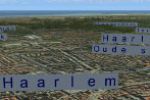
Edition for NL2000 V4.0 adds city and town names for educational purposes within the NL2000 v4 framework. The design is modular and free, and it requires the NL2000 v4 installer to enable use acros…
NetherlandsJoseph Penty creates a depiction of a regional airfield in Orrville, coded as KORA. A folder named KORA functions as the primary element users deploy to render the airfield in their project setups …
United States of America
Jimmy R. Martin creates Campbell Field at 1A3 in Copperhill, Tennessee. The setup leverages FS Genesis terrain mesh and Active Sky Advanced, with Ultimate Terrain X providing terrain enhancements a…
United States of America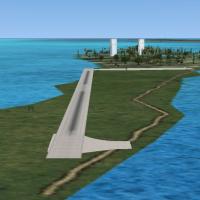
Belize's island airstrip serves the resort, designated MZ58 with no official ICAO code, while IATA uses CYC, by Alf B. Meier. The runway measures 100 yards in length and 25 meters in width, and the…
 Belize
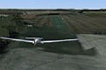
A revised file by Neil Birch for Neil's Microlights South-East addresses missing files and centers on a single .bgl element associated with Bennington-Strip. The creator, Neil Birch, is credited fo…
United Kingdom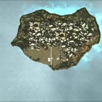
Orlandy Perez Intl Airport (MDOP) gains an ILS for runway 36, enabling precision approaches at the field. The AFX_MDOP.BGL file replaces the original in the main dataset to properly activate the pr…
 Dominican Republic
Paradyz, Poland hosts a fictional airfield designed by Paradyski for light aircraft, offering a compact layout suitable for small planes. Paradyski provides two BGL files, EPAR_ADEX_AW_CVX.bgl and …
 Poland